
Ranelagh Road in London Borough of Ealing
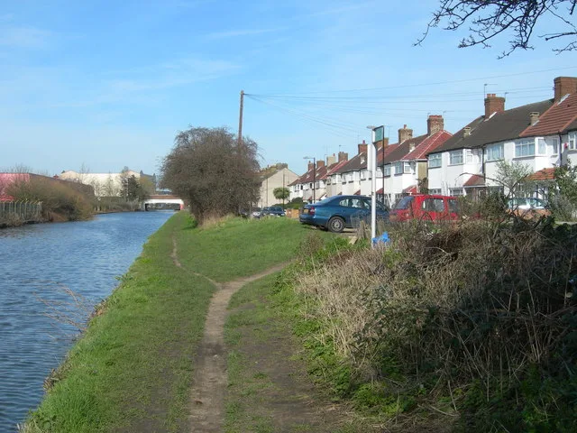
Ranelagh Road in London Borough of Ealing is a lit residential street. The road has sidewalks. It runs as a one-way street in a south-north direction starting from Beaconsfield Road and ends at The Broadway. In the vicinity, there is among other things a café. The nearest bus stop in the vicinity is Hayes Bridge (approx. 300 m away). Ranelagh Road also exists in City of Westminster, London Borough of Haringey, London Borough of Waltham Forest and London Borough of Brent.
- Road Type
- residential street
- Speed Limit
- 20 mph
- Route
- north-south
Image
Cafés
Roads nearby
Agape Way100 m
Beresford Road100 m
Trinity Roadself storage
150 m
Woodlands Road200 m
Cherry Avenue200 m
Bankside250 m
The BroadwayHayes Bridge
300 m
Ruskin Road300 m
Uxbridge RoadDelamere Road, GSF CAR PARTS, Coney Green, Hillingdon Hill, Hayes / The Grapes, Belmore Parade, Tesco Express, Hillingdon, Long Lane, The Prince of Wales, Hillingdon Primary School, Enterprise, Hillingdon Food Centre, Abbas's Trims and Fades, Uxbridge Tyres, Victory Plumbing and Heating, Home Tiles, Topps Tiles, Skyline Roofing Centre, Hayes By-Pass, JD Sports, H&M, Next, Springfield Road, West Drayton Road, Star Barbers, Hot House Pizza, Central Avenue, Church Road, Uxbridge County Court, Currys, Choice, Corner Convenience, Hillingdon Heath Post Office, Heath Road, Lodge Brothers, Dachels Hair & Cosmetics, House of Wardrobes, Fixura Interiors, Hillingdon News, KFC, Hewens Road, Hayes Police Station, Hayes End Library, Iceland, Morgans Lane, Rosedale Park, Hayes End, Hillingdon Heath / Lees Road, Rahul Food and Wine, ERS Exchange, Aurora Beauty n' Style, Sovereign Glass, Kassam Car Sales, Cafe Delight, Beef Belly, Electric Center, Papa'z Peri Peri and Pizza, Tops Pizza, Cakebox, Jey's Barber Shop, Hot Express Pizza, ITW Shipping, Gumba, Starbucks, Harlington Road, St John's Church, Craven Close, New Road, New Choice Carpets, Rahel's Afro/Euro Hair Studio, King Kebab, Tape City, Park Road, Brookside Road, Tennessee Express Chicken & Ribs, Londis
350 m
Stanley RoadSouth Acton Junction
400 m
Livingstone Road400 m
Alma Road450 m
Tollgate Drive500 m
Lowden Road550 m
Longford Gardens550 m
Delamere Road550 m
Through path600 m
Longford Close600 m
Cerne Close650 m
Ashford Avenue750 m
Shops nearby
Gold Bank250 m
Allotment gardens nearby
Hayes Bridge allotments300 m
Buildings nearby
Rock Electronics Ltd200 m
Hiltons Estates200 m
Keytons Estates200 m
Sriharans Solicitors200 m
Smile Estate Agents250 m
Rashid & Rashid Law Firm250 m
Butcher's nearby
Asian Meat & Poultry200 m
Car repair shops nearby
Empire Autos100 m
Chemist's nearby
Woodland Pharmacy200 m
Convenience stores nearby
Veer Food & Wine200 m
VVN & Sons250 m
Venus News and Booze250 m
Cosmetics shops nearby
CoLaz Advanced Aesthetics Clinic200 m
Drains nearby
Yeading Brook450 m
Electrical shops nearby
Amax Electrical Ltd250 m
Industrial areas nearby
B & L Scrap Metals250 m
Jeweller's nearby
Tamlini Jewellers300 m
Mobile phone shops nearby
FoneHouse200 m
Phone Arena250 m
Photography shops nearby
Click & Talk250 m
Places of worship nearby
Gurdwara Miri Piri Sahib200 m
Pubs nearby
Hambrough Tavern250 m
Restaurants nearby
Moonrise200 m
Abi Fast Food200 m
Warehouses nearby
DB Schenker Hayes350 m
Wholesale shops nearby
Quality Foods300 m
Wine shops nearby
Johal Wine Stores200 m
Public transport map London Borough of Ealing Legend
| Railway | |
| Bus | |
| Tram |
Cycling map London Borough of Ealing Legend
| Cycle path | |
| Cycle lane on road | |
| Cycling on bus lane | |
| Bicycle street | |
| Cyclists allowed | |
| Cyclists allowed, good surface | |
| No cycling | |
| Cobblestones |
| Long-distance cycle route | (depending on scale) | |
| Long-distance cycle route |
Walking map London Borough of Ealing Legend
| Path |
| Long-distance hiking trail | (depending on scale) | |
| Long-distance hiking trail | ||
| No pedestrians |