
Woodlands Road in London Borough of Ealing
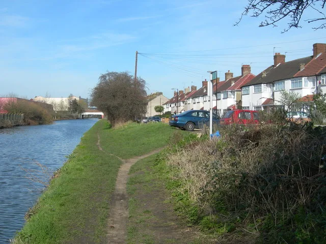
Woodlands Road in London Borough of Ealing is a lit residential street. The road has sidewalks. It runs as a one-way street in a south direction starting from The Broadway and ends at Beaconsfield Road. Woodlands Road also exists in London Borough of Enfield, London Borough of Bexley, Royal Borough of Kingston upon Thames, London Borough of Waltham Forest and London Borough of Redbridge.
- Road Type
- residential street
- Speed Limit
- 20 mph
- Route
- north-south
Image
Jewellers
Hostel
Houseware shops
Pharmacy
Bus stops
Furniture shops
Supermarkets
- Darbari Fancy Textiles (Darbari Fancy Textiles, opening hours: Mon–Sun 10:30–19:15) at The Broadway 59 (UB1 1JY). Fabric Store for your daily fashion accessorising, finding your own style. Wedding Fabrics designer fabrics. Make your own designs and wear your own style with us. Authentic Fabrics. – approx. 650 m.
Clothing shops
Fast food restaurants
Bookmakers
Bank
Confectioneries
Roads nearby
The BroadwaySouthall / Trinity Road, Ealing Broadway Station, Sainsbury's Local, Barclays, Toni & Guy, Caffè Nero, Holland & Barrett, The Body Shop, Blank Street Coffee, itsu, Three., Vision Express, Poundland, Game, Adorai, Choice, Foreign Exchange, Greggs, Fight For Sight, Headmaster, Rush Hair, Wenzel's, Moss, Sports Direct, The Works, Chocolate & Nails, Fix Station, Miabella, Thérapie Clinic, Deli Polonia, Frencheye, Lovisa, Lloyds Bank, Rawr Beauty, mobilebitz, Roxannes Pharmacy, Greenford Fish & Chips, Perfection Hair & Nail, Shan's News, Costa, Joe Blake's, Santander, Hafeez Jewellers, Ria Money Transfer, A&M Kasuri, Junaid Jamshed, EuroAsia Travel, AR Exchange Ltd, Kabras Jewellery, Punjab Textiles, Aahar, Greenford, William Hill, Paddy Power, Oldfield Lane South, Greenford Broadway, Iceland, Hayyi Food Centre, Halal Meat Centre, Greenford Hair & Beauty, Ladbrokes, Delight European Food Store, Boots Opticians, Halifax, Chaiiwala, Chicken Guys, NatWest, Laine Brewing Company, Ali's Berlin Doner, Ealing Broadway, The Phone Box, Vapers Box, WHSmith, Subway, Five Guys, M&S Food, Popeyes, McDonald's, Morrisons, TK Maxx, Abbotts Road, Northcote Avenue, Alexandra Avenue, Southall Broadway / St George's Avenue, Darbari Fancy Textiles, Madhan's Shopping Centre, Singh Sweets, Shagoon Jewellery Ltd, Dhamaka Fashion, Queens Pharmacy, J Halak Boutique, Gala Jewellers, Riwaaz UK, Lebas e Uroos, Momen Collections, The Jewellery Trunk, Omega, British Heart Foundation Home Store, Betfred, Hayes Bridge
50 m
Ruskin Road150 m
Livingstone Road200 m
Ranelagh RoadPaperback Coffee & Books, Felix & Spear, Fifty Shades Of Taupe
200 m
Trinity Roadself storage
200 m
Agape Way250 m
Beresford Road250 m
Stanley RoadSouth Acton Junction
250 m
Alma Road300 m
Tollgate Drive350 m
Bankside400 m
Lowden Road400 m
Cherry Avenue400 m
Through path450 m
Delamere Road450 m
Longford Gardens550 m
Bullsbrook RoadArgos
550 m
Ashford Avenue550 m
Longford Close600 m
Buildings nearby
Colt London 4550 m
Shops nearby
Gold Bank50 m
Allotment gardens nearby
Hayes Bridge allotments450 m
Buildings nearby
Rock Electronics Ltd50 m
Sriharans Solicitors50 m
Smile Estate Agents50 m
Rashid & Rashid Law Firm50 m
Keytons Estates100 m
Hiltons Estates100 m
Butcher's nearby
Asian Meat & Poultry50 m
Car repair shops nearby
Empire Autos300 m
Chemist's nearby
Woodland Pharmacy50 m
Convenience stores nearby
VVN & Sons50 m
Veer Food & Wine50 m
Venus News and Booze100 m
Cosmetics shops nearby
CoLaz Advanced Aesthetics Clinic100 m
Dry cleaner's nearby
New Merit Dry Cleaners150 m
Electrical shops nearby
Amax Electrical Ltd150 m
Industrial areas nearby
B & L Scrap Metals200 m
Jeweller's nearby
Tamlini Jewellers150 m
Mobile phone shops nearby
FoneHouse50 m
Phone Arena50 m
Photography shops nearby
Click & Talk50 m
Places of worship nearby
Gurdwara Miri Piri Sahib150 m
Pubs nearby
Hambrough Tavern250 m
Restaurants nearby
Abi Fast Food50 m
Moonrise100 m
Warehouses nearby
DB Schenker Hayes400 m
Wholesale shops nearby
Quality Foods300 m
Wine shops nearby
Johal Wine Stores100 m
Public transport map London Borough of Ealing Legend
| Railway | |
| Bus | |
| Tram |
Cycling map London Borough of Ealing Legend
| Cycle path | |
| Cycle lane on road | |
| Cycling on bus lane | |
| Bicycle street | |
| Cyclists allowed | |
| Cyclists allowed, good surface | |
| No cycling | |
| Cobblestones |
| Long-distance cycle route | (depending on scale) | |
| Long-distance cycle route |
Walking map London Borough of Ealing Legend
| Path |
| Long-distance hiking trail | (depending on scale) | |
| Long-distance hiking trail | ||
| No pedestrians |