
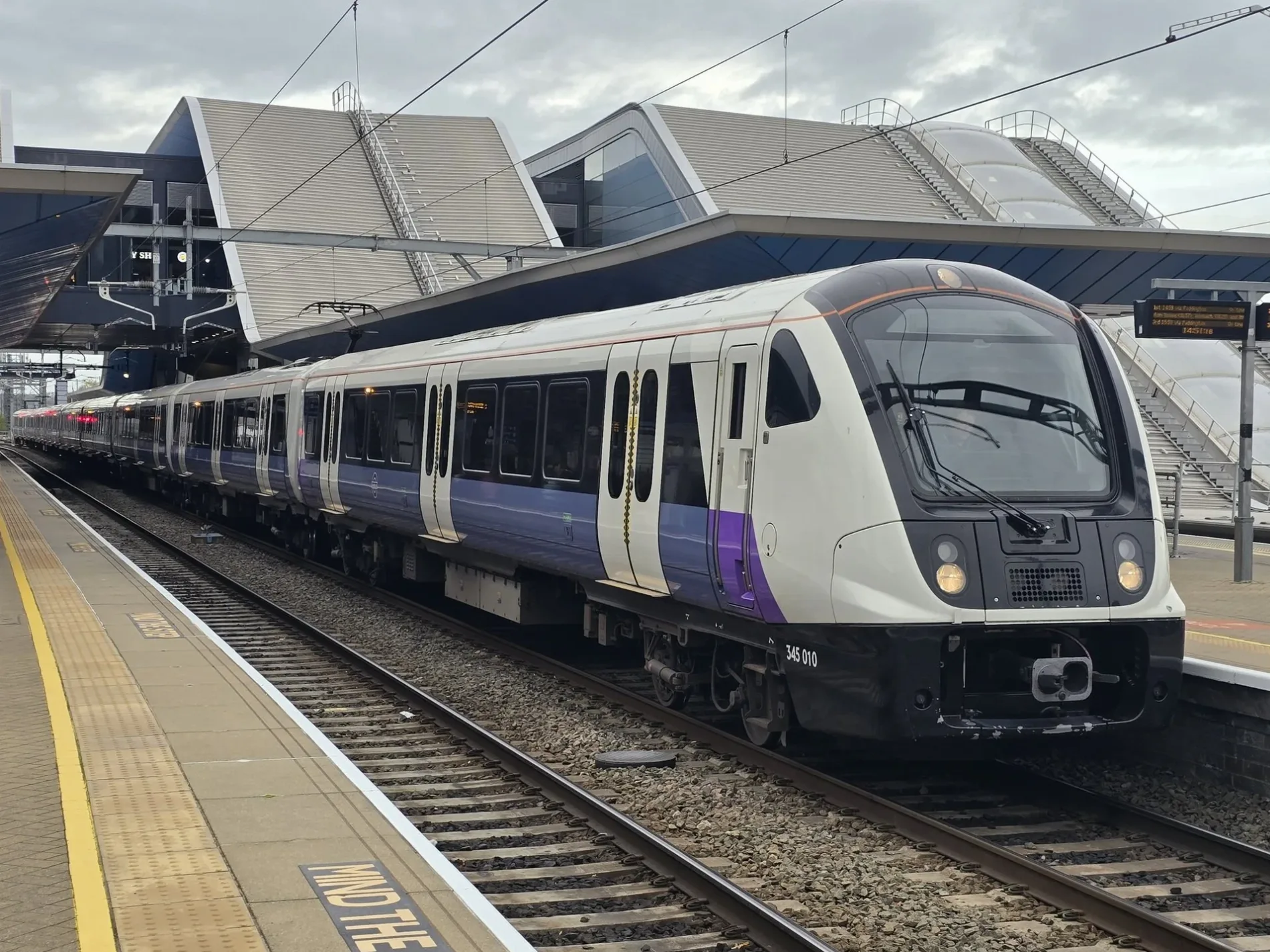
Elizabeth Line in London Borough of Havering
Elizabeth Line in London Borough of Havering is a railway line (Network Rail, line number LTN1, 1435 mm, overhead line, main line). The train route Elizabeth runs along this road. It crosses a bridge. Elizabeth Line is also known as Lizzie line. Elizabeth Line also exists in City of Westminster, Royal Borough of Kensington and Chelsea, City of London, London Borough of Tower Hamlets and London Borough of Islington. Ⓦ.
- Speed Limit
- 70 mph
- Operator
- Network Rail
Bus stops
Recycling centres
Frozen food shops
Roads nearby
Bridport Avenue100 m
Jutsums Lane150 m
Crowlands Avenue150 m
Jutsums Avenue150 m
Eddy Close200 m
Ainsley Avenue250 m
Kimberley Avenue250 m
Burlington Avenue300 m
Maldon Road350 m
Bracken Mews350 m
Astor Avenue350 m
Derby Avenue350 m
Crow LaneHail & Ride Beechfield Gardens, Hail & Ride Jutsums Lane, Crow Metals, Hail & Ride Seabrook Gardens, Tipples
350 m
Weald Way350 m
Fernden Way350 m
Bear Close350 m
Stanford Close350 m
Danes Road400 m
Lonsdale Avenue400 m
Southern Way400 m
Lessington Avenue450 m
Bernard Road450 m
Lowland Gardens500 m
Esher Avenue500 m
Raven Close500 m
London RoadJutsums Lane, Romford Stadium, Richards Avenue, St Edward's School, Iceland, Budgens, Knightsbridge Gardens, Cotleigh Road
550 m
Beechfield Gardens550 m
Vignoles Road550 m
Cromer Road600 m
Spring Gardens600 m
Marina Gardens600 m
Seabrook Gardens600 m
Jubilee Close600 m
Goldsmith Avenue600 m
Braithwaite Avenue650 m
Sheringham Avenue650 m
Norfolk Road650 m
Jubilee Avenue700 m
Alan Gardens750 m
Allotment gardens nearby
Romford Smallholders Society750 m
Buildings nearby
Romford Electrical Control Room250 m
Disused railways nearby
Romford Centre Siding450 m
Farmyards nearby
Crown Farm750 m
Military areas nearby
Romford TA Centre550 m
Parks nearby
Jutsums Park200 m
Railway lines nearby
Overhead Line Maintenance Depot300 m
Great Eastern Main Line600 m
Recreation grounds nearby
Westlands Playing Field650 m
Stadiums nearby
Romford Greyhound Stadium550 m
| Named after | Elizabeth II |
|---|---|
| Opening | 2022 |
| Country | United Kingdom |
| Transport network | Elizabeth line network |
| Website | https://tfl.gov.uk/modes/elizabeth-line/ |
| Significant event | Crossrail |
| Has part | Elizabeth line: Reading - Abbey Wood, Elizabeth line: Maidenhead - Abbey Wood, Elizabeth line: Heathrow Airport - Abbey Wood, Elizabeth line: Heathrow Airport - Shenfield, Elizabeth line: Paddington - Shenfield |
| Part of | TfL |
Public transport map London Borough of Havering Legend
| Railway | |
| Bus | |
| Tram |
Cycling map London Borough of Havering Legend
| Cycle path | |
| Cycle lane on road | |
| Cycling on bus lane | |
| Bicycle street | |
| Cyclists allowed | |
| Cyclists allowed, good surface | |
| No cycling | |
| Cobblestones |
| Long-distance cycle route | (depending on scale) | |
| Long-distance cycle route |
Walking map London Borough of Havering Legend
| Path |
| Long-distance hiking trail | (depending on scale) | |
| Long-distance hiking trail | ||
| No pedestrians |