
Watersplash Lane in London Borough of Hillingdon
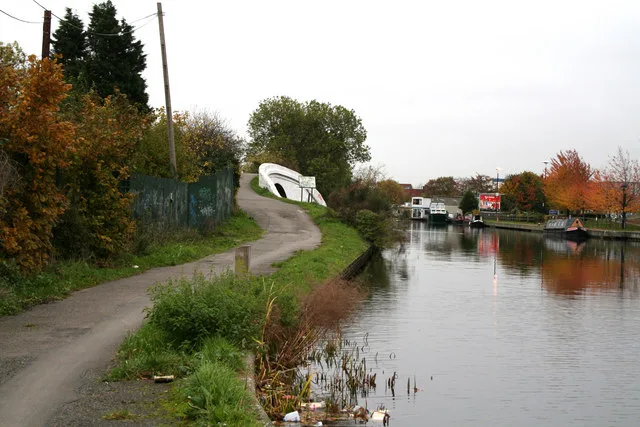
Watersplash Lane in London Borough of Hillingdon is a minor road and it runs in a southeast-northwest direction starting from North Hyde Road and ends in a cul-de-sac. This road is part of the foot routes Hillingdon Trail and London LOOP (Section 10).
- Road Type
- minor road
- Route
- southeast-northwest
Image
Restaurants
Tourist information offices
Car hires
Bus stops
Roads nearby
Roseville RoadHail & Ride Coronation Road, North Hyde Road, Hail & Ride Roseville Road
100 m
Sutherland Avenue150 m
Blair Close150 m
Gordon Crescent250 m
Wyre Grove250 m
Westlands Close300 m
Laburnum Road300 m
The Parkway350 m
North Hyde Gardens350 m
Coronation RoadHail & Ride Coronation Road
400 m
Cranford Park Road400 m
Harold Avenue450 m
Hayes RoadSubway, Hayes Road / Tesco, Bulls Bridge Tesco
450 m
Bulls Bridge RoadBulls Bridge
450 m
Crane Gardens450 m
Granville RoadGranville Road, Greggs
450 m
Newhaven Close500 m
Dallas Terrace500 m
Nestle's AvenueSpaceships Campervan Rentals, Access Self Storage, Family Tanks
500 m
Christopher Road500 m
North Hyde RoadHarold Avenue, Old Station Road, Roseville Road, Pizza Delicacia, Drinks Direct, North Hyde Road, London Hayes
550 m
Cranton AvenueHayes & Harlington
600 m
Silverdale Road700 m
Pump Lane750 m
Apartment buildings nearby
Truscon House450 m
Rasina Court600 m
Catimor House600 m
Canals nearby
Grand Union Canal450 m
Grand Union Canal (Paddington Branch)450 m
Car dealerships nearby
Volvo Truck and Bus450 m
Commercial areas nearby
Segro Park Hayes350 m
Convenience stores nearby
Londis450 m
Docks nearby
Bulls Bridge Wet & Dry Docks550 m
Door shops nearby
Altus Shop Fronts & Shutter Repairs450 m
Industrial areas nearby
FM Conway500 m
Tarmac Hayes600 m
Industrial buildings nearby
Argent Trade Park700 m
Parks nearby
Cranford Country Park300 m
Platforms nearby
3650 m
2650 m
5650 m
Railway lines nearby
Great Western Main Line600 m
Elizabeth Line650 m
Residential areas nearby
Hayes Village600 m
Rivers nearby
River Crane400 m
Streams nearby
Yeading Brook650 m
Supermarkets nearby
Tesco Extra400 m
Lidl550 m
Other nearby
North Hyde Substation50 m
Public transport map London Borough of Hillingdon Legend
| Railway | |
| Bus | |
| Tram |
Cycling map London Borough of Hillingdon Legend
| Cycle path | |
| Cycle lane on road | |
| Cycling on bus lane | |
| Bicycle street | |
| Cyclists allowed | |
| Cyclists allowed, good surface | |
| No cycling | |
| Cobblestones |
| Long-distance cycle route | (depending on scale) | |
| Long-distance cycle route |
Walking map London Borough of Hillingdon Legend
| Path |
| Long-distance hiking trail | (depending on scale) | |
| Long-distance hiking trail | ||
| No pedestrians |