
Elizabeth Line in London Borough of Redbridge
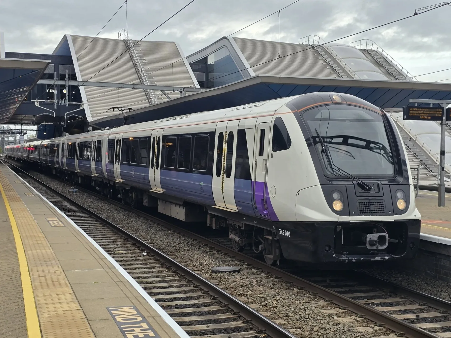
Elizabeth Line in London Borough of Redbridge is a railway line (Network Rail, line number LTN1, 1435 mm, overhead line, main line). The train route Elizabeth runs along this road. Elizabeth Line is also known as Lizzie line. Elizabeth Line also exists in City of Westminster, Royal Borough of Kensington and Chelsea, City of London, London Borough of Tower Hamlets and London Borough of Islington. Ⓦ.
- Speed Limit
- 70 mph
- Operator
- Network Rail
Cafés
Clothing shops
Newsagent's
Bus stops
Greengrocers
Bag shops
Pubs
Pharmacy
Bank
Bookshops
Charity shops
Pawnbrokers
Bookmakers
Fast food restaurants
Post offices
Shoe shops
Mobile phone shops
Patisseries
Tobacconist's
Chemist's
Roads nearby
Havelock Street50 m
Balfour Road150 m
Chadwick Road150 m
Balfour ApproachPerky Blenders, Phone Doctors
150 m
High RoadIlford Broadway, Ilford, Boots, The Co-operative Bank, Halifax, TSB, Savers, Fashion 4 Less, Paddy Power, Nationwide, Iceland, Star Fruit & Veg, Ushan's Fruit & Veg, Popeyes, Chingford Lane, Seven Kings Station, Connaught Road, Ilford Police Station, Argos, Boots Opticians, Starbucks, Shoe Zone, Primark, The Works, Greggs, Hainault Street, Churchfields, The Eva Hart, 14/122, New Road, Seven Kings, Finance & Leasing, Sam99p, Coral, Yorkshire Building Society, Grove Hill, BGR London, bar bar.co, Martin Lock & Safe, Spencer Munson, Chicken Cottage, BB, High Road / George Lane, William Webb News, International Supermarket, McDonald's, The Salvation Army, Flavours of Punjab, Costcutter, Lakehouse Hungarian, Vadi, Bijou Salon, Nando's, Chadwell Heath Lane, Goodmayes Retail Park, B&M Bargains, Masala Bazaar, Goodmayes Tesco, Gales Cameras, Dynasty, Artisan, Oxfam, Hair Male, Queen Mary Practice, The Elmhurst Practice, funkymojoe, Southend Road, Woody Food & Wine, The Canteen Cafe, Homes & Co, Zantel, Family Kebab, Barclays, Roman Catholic Church of St Cedd, Goodmayes Road / Goodmayes Station, Grove Road, Seven Kings Post Office, Chester Road, Aldi, Barley Lane / Goodmayes Station, St Peter & St Paul Church, Ilford County Court, Ilford Fire Station, Dreams, Aldborough Road South, Pharmaram, Montpelier Gardens, Belfairs Drive, NK News, Essence Peri Peri Grill, Screwfix, Chadwell Heath Muslim Centre, Wangey Road, Farmfoods
150 m
Station RoadBoots, B.J. Cars
150 m
Postway Mews150 m
Oakfield RoadSantander
250 m
Janice MewsShuropody
250 m
Kenneth More Road250 m
Clements LaneGolden Curry
250 m
Handforth Road300 m
Shops nearby
Regent250 m
Banks nearby
Lloyds Bank150 m
Metro Bank150 m
HSBC UK200 m
NatWest250 m
Bars nearby
Champ's300 m
Bookmakers nearby
Betfred250 m
Buildings nearby
4 Medical Clinical Solutions150 m
Ilford Central Telephone Exchange200 m
Malachi Place200 m
SPACE250 m
Albert Road Children's Centre400 m
Regal Law Solicitors450 m
Cafés nearby
Bubbles Cafe250 m
Pasha Cafe250 m
Charity shops nearby
Saint Francis Hospice100 m
Chemist's nearby
Superdrug200 m
Clothing shops nearby
Imperiale Ilford100 m
Zee & Co150 m
Colleges nearby
Empire College London250 m
Electronics shops nearby
CeX150 m
Gift shops nearby
Card Factory150 m
Houseware shops nearby
Home Savers100 m
Marketplaces nearby
Mercato Metropolitano Ilford200 m
Opticians nearby
Specsavers150 m
Places of worship nearby
Salvation Army250 m
City Gates Church300 m
The Church of Jesus Christ of Latter-day Saints400 m
Post depots nearby
Ilford Delivery Office200 m
Pubs nearby
O'Neill's Ilford150 m
Railway stations nearby
Ilford Railway Station150 m
Retail buildings nearby
Foot Locker150 m
Sabina Hair & Cosmetic & Salon150 m
A&A Electronics250 m
Shoe shops nearby
Clarks150 m
Shopping malls nearby
Exchange Ilford150 m
Town halls nearby
Redbridge Town Hall200 m
| Named after | Elizabeth II |
|---|---|
| Opening | 2022 |
| Country | United Kingdom |
| Transport network | Elizabeth line network |
| Website | https://tfl.gov.uk/modes/elizabeth-line/ |
| Significant event | Crossrail |
| Has part | Elizabeth line: Reading - Abbey Wood, Elizabeth line: Maidenhead - Abbey Wood, Elizabeth line: Heathrow Airport - Abbey Wood, Elizabeth line: Heathrow Airport - Shenfield, Elizabeth line: Paddington - Shenfield |
| Part of | TfL |
Public transport map London Borough of Redbridge Legend
| Railway | |
| Bus | |
| Tram |
Cycling map London Borough of Redbridge Legend
| Cycle path | |
| Cycle lane on road | |
| Cycling on bus lane | |
| Bicycle street | |
| Cyclists allowed | |
| Cyclists allowed, good surface | |
| No cycling | |
| Cobblestones |
| Long-distance cycle route | (depending on scale) | |
| Long-distance cycle route |
Walking map London Borough of Redbridge Legend
| Path |
| Long-distance hiking trail | (depending on scale) | |
| Long-distance hiking trail | ||
| No pedestrians |