
Glastonbury Road in London Borough of Sutton
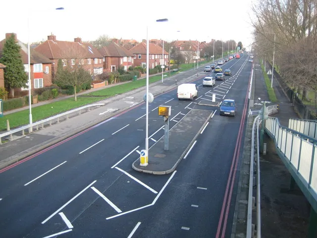
Glastonbury Road in London Borough of Sutton is a residential street. It runs in a southeast-northwest direction starting from Love Lane and crosses Forest Road, Hartland Road, Hexham Road and Hunston Road and ends at Reigate Avenue. Glastonbury Road also exists in London Borough of Enfield and London Borough of Merton.
- Road Type
- residential street
- Route
- southeast-northwest
Image
DIY stores
Fast food restaurants
Pharmacy
Bus stops
Convenience stores
Restaurants
Kindergarten
Post offices
Roads nearby
Kirksted Road100 m
Reigate Avenue150 m
Hunston Road150 m
Keynsham Road150 m
Keynsham Walk200 m
Hexham Road200 m
Iona Close250 m
Glenthorne Close300 m
Halesowen Road300 m
Holycross Close350 m
Damask Court350 m
Hartland Road400 m
Wheatcroft Court450 m
Cleeve Way450 m
Garendon Road500 m
Glastonbury Road500 m
Hove Gardens500 m
Love LaneHail & Ride Love Lane
550 m
Hyde Walk550 m
Green LaneHail & Ride Lincoln Road, Hail & Ride Hazlemere Gardens, Dorchester Road, Onslow Motors
550 m
Wrythe LaneMPS Pharmacy, Shell, Muschamp Road, Poulton Avenue, Welbeck Road, Dolphin Fish Bar, St. Helier Food & Wine, Salmina Pharmacy, Wrythe Convenience Store, N & J Barbers, Autocare Carshalton, Wrythe Lane / Rose Hill Roundabout, Superdrug, Londis, Hair Location, Rose Hill Pharmacy, Seecta Fruits, Two Napkin Burger, Rosehill Post Office, Papa John's, Favorite Chicken & Ribs, Fish R Us, Millers, St Helier Cafe, Star Express, Wrythe Green, Wrythe Recreation Ground, Kebab World, Kamsons Pharmacy, Chysab, New World, St Helier Hospital
550 m
Flaxley Road550 m
Gloucester Gardens600 m
Goodson House600 m
Rosehill Roundabout600 m
Rose HillRosehill Park West, Crescent Hire, 1st Hire, M&J Healey, Merton Timber, The Tool Centre, Rose Hill / Rose Hill Roundabout, KFC, Premiere, Best-one, Rosehill
600 m
Garendon Gardens600 m
Rosehill Court ParadeSt Helier Avenue / Rose Hill Roundabout, Cleanerwash, Harlequin Motors
650 m
Haines Walk650 m
St. Helier Avenue650 m
Bishopsford RoadGreen Wrythe Lane, Middleton Road, Netley Road, Bishopsford Road / Rose Hill Roundabout
650 m
Rose Hill Park West650 m
Stavordale Road700 m
Rosehill Avenue700 m
Pilgrim Close750 m
Dore Gardens750 m
Newhouse Walk750 m
Dorchester Road800 m
Arcades nearby
Mecca Bingo750 m
Buildings nearby
St Helier DC Traction Substation200 m
Cheshire House500 m
Community centres nearby
Chaucer Centre750 m
Parks nearby
Rosehill Park500 m
Places of worship nearby
St Helier Methodist Church650 m
Railway lines nearby
Sutton Loop Line400 m
Recreation grounds nearby
The Daisy Field - Reigate Avenue Playing Fields250 m
Thomas Wall Park450 m
Sports halls nearby
Indoor Tennis Courts450 m
Streams nearby
East Pyl Brook500 m
Supermarkets nearby
Lidl600 m
Public transport map London Borough of Sutton Legend
| Railway | |
| Bus | |
| Tram |
Cycling map London Borough of Sutton Legend
| Cycle path | |
| Cycle lane on road | |
| Cycling on bus lane | |
| Bicycle street | |
| Cyclists allowed | |
| Cyclists allowed, good surface | |
| No cycling | |
| Cobblestones |
| Long-distance cycle route | (depending on scale) | |
| Long-distance cycle route |
Walking map London Borough of Sutton Legend
| Path |
| Long-distance hiking trail | (depending on scale) | |
| Long-distance hiking trail | ||
| No pedestrians |