
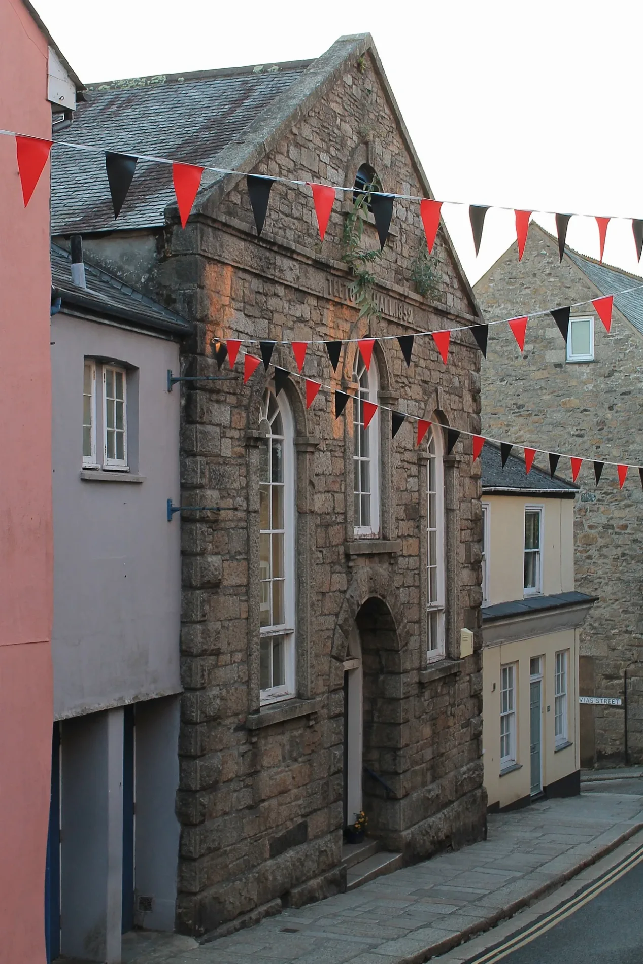
Temperance Hall in Penryn, Cornwall
Temperance Hall in Kernow / Cornwall, Penryn is a community centre (Penryn Town Council), Lower Market Street (TR10 8BH).
- Amenity
- community centre
- Street
- Lower Market Street
- Operator
- Penryn Town Council
- Postal Code
- TR10 8BH
- Building Type
- building
Image
Cafés
Jewellers
Copy shops
Post offices
Car parts shops
Hairdressers
Fast food restaurants
Bakeries
Bicycle hires
Bus stops
Museum
- Penryn Museum (opening hours: Mon–Thu 10–15:30; Fri 10–13, free, web) at Higher Market Street (TR10 8LT) – approx. 50 m.
Library
Clothing shops
Charity shops
Pharmacy
Roads nearby
St Gluvias Street50 m
Higher Market StreetPenryn Museum, Cornwall Poetry Library, Hannah Batstone, Penryn Barbers, Reeves Barbershop, The Printing Chambers
50 m
Lower Market StreetPenryn, Stargazy, Three of Cups, MJ Hair, Seven Stars, Penryn Post Office, Choy Hung House, Red Chilli Indian Takeaway, Sassi Hairdressing, Costcutter Bus Stop, Lower Market Street, Rowe's, Pips Cafe, Tanya's Courage Trust
150 m
New Street150 m
Saracen Place150 m
Permarin Road150 m
Chapel Lane150 m
Saracen WayHendras@Penryn Limited
200 m
College Ope200 m
Church Hill250 m
Truro Lane250 m
Broad StreetOpp Kings Arms, Insight
250 m
Saracen Crescent250 m
College Hill250 m
Church RoadTexaco, Penryn & Falmouth Foodbank
250 m
Dunstan Close300 m
Brook Place300 m
Parc Briwer300 m
Glasney Place350 m
Bohelland Road350 m
South View350 m
Chalacombe Gardens350 m
College Green350 m
Calver Close400 m
St Gluvias Parc450 m
Bohelland Way450 m
Old Well Gardens450 m
Buildings nearby
Penryn Snooker Club150 m
Penryn Telephone Exchange150 m
Charity shops nearby
Sasha Would've Loved It350 m
Commercial buildings nearby
SKB Sails250 m
Community centres nearby
Highway House Community Centre250 m
St Gluvias Community Hall350 m
Convenience stores nearby
Spar100 m
Londis200 m
Doctor's practice nearby
Penryn Surgery150 m
Fast food restaurants nearby
Mariner's fish and chips100 m
Grass nearby
Glasney College300 m
Libraries nearby
Penryn Library and Information Service150 m
Pharmacies nearby
Hendras@Penryn Limited100 m
Places of worship nearby
Penryn Methodist Church100 m
Playgrounds nearby
Perharin Park150 m
Pubs nearby
Seven Stars150 m
Kings Arms150 m
The Thirsty Scholar250 m
Famous Barrel300 m
Restaurants nearby
Bango Kitchen200 m
Scuba diving shops nearby
Seaways Diving200 m
Town halls nearby
Penryn Town Hall50 m
| Located in | Penryn |
|---|---|
| Country | United Kingdom |
Public transport map Penryn Legend
| Railway | |
| Bus | |
| Tram |
Cycling map Penryn Legend
| Cycle path | |
| Cycle lane on road | |
| Cycling on bus lane | |
| Bicycle street | |
| Cyclists allowed | |
| Cyclists allowed, good surface | |
| No cycling | |
| Cobblestones |
| Long-distance cycle route | (depending on scale) | |
| Long-distance cycle route |
Walking map Penryn Legend
| Path |
| Long-distance hiking trail | (depending on scale) | |
| Long-distance hiking trail | ||
| No pedestrians |