
Barkby Holt Lane
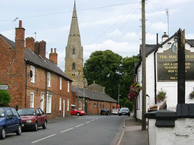
Barkby Holt Lane in Barkby in Charnwood is an asphalted residential street. The road has partly a sidewalk (asphalt). It runs in an east-west direction starting from Beeby Road and crosses Vicarage Lane. It ends in a cul-de-sac.
- Road Type
- residential street
- Route
- east-west
Image
Pubs
Bus stops
Roads nearby
School Lane150 m
Beeby RoadBarkby, Barkby Hall, The Pochin School
200 m
Main Street250 m
Vicarage Lane250 m
BrooksideThe Brookside
300 m
Thorpe Lane300 m
Barkby Thorpe Lane450 m
King StreetThe Parlour, Barkby Thorpe, Roots Farm Shop, The Hatch
500 m
Queen StreetManor Farm
600 m
Queniborough RoadMalt Shovel PH, Forge
650 m
J13750 m
Barkby Lane800 m
Somerville Close1,1 km
Wadham Close1,2 km
Hertford Close1,2 km
Wolfson Close1,2 km
Blackfriars Road1,2 km
Linacre Crescent1,3 km
Magdalen Close1,3 km
St Hildas Close1,3 km
Exeter Close1,3 km
Whissendine Way1,3 km
Barkby RoadGurkha Embassy, Lime Close, Syston Road, College Road, Barkby Road Cemetery, Syston Cemetery, Syston Mangal, Mace, Ridgemere
1,3 km
Manton Way1,3 km
Saxby Drive1,3 km
Lime Drive1,4 km
Empingham Drive1,4 km
St Annes Close1,4 km
Cherry Drive1,4 km
Buildings nearby
Barkby Hall250 m
Summer house350 m
Community centres nearby
Barkby Village Hall200 m
Farmyards nearby
Dairy Farm200 m
Thorpe Farm450 m
Merton Farm500 m
Gardens nearby
Japanese garden250 m
Long walk250 m
White garden300 m
Heather bed350 m
Shrub Rose Garden350 m
Summer house border350 m
Wild flower garden350 m
Places of worship nearby
St Mary's250 m
Pubs nearby
The Malt Shovel300 m
Recreation grounds nearby
Barkby United Cricket Club50 m
Retail areas nearby
Church View Garden Centre450 m
School buildings nearby
The Pochin School150 m
Streams nearby
Barkby Brook450 m
Woodlands nearby
Abbot's Spinney850 m
 Public transport map Barkby Legend
| Railway | |
| Bus | |
| Tram |
 Cycling map Barkby Legend
| Cycle path | |
| Cycle lane on road | |
| Cycling on bus lane | |
| Bicycle street | |
| Cyclists allowed | |
| Cyclists allowed, good surface | |
| No cycling | |
| Cobblestones |
| Long-distance cycle route | (depending on scale) | |
| Long-distance cycle route |
 Walking map Barkby Legend
| Path |
| Long-distance hiking trail | (depending on scale) | |
| Long-distance hiking trail | ||
| No pedestrians |