
Queniborough Road in Barkby
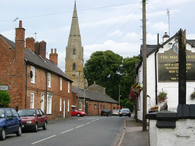
Queniborough Road in Barkby in Charnwood is a tertiary road. It runs in a north-south direction and ends at Main Street, while the other end is a cul-de-sac. The nearest stops are Malt Shovel PH and Forge.
- Road Type
- tertiary road
- Route
- north-south
Image
Bus stops
Roads nearby
Main Street550 m
Somerville Close550 m
Beeby RoadBarkby, Barkby Hall, The Pochin School
550 m
Barkby Holt Lane600 m
Wadham Close600 m
Hertford Close600 m
Vicarage Lane600 m
Wolfson Close650 m
Blackfriars Road650 m
School Lane650 m
Barkby Lane650 m
Linacre Crescent700 m
Magdalen Close700 m
BrooksideThe Brookside
700 m
Exeter Close750 m
St Hildas Close750 m
Manton Way800 m
Whissendine Way800 m
Exton CloseRidgemere
800 m
Thorpe Lane800 m
St Annes Close850 m
Barkby RoadRidgemere, Gurkha Embassy, Lime Close, Syston Road, College Road, Barkby Road Cemetery, Syston Cemetery, Syston Mangal, Mace
850 m
Empingham Drive850 m
Ruskin Avenue850 m
Saxby Drive850 m
Lincoln Drive850 m
Langham Close900 m
Greetham Way900 m
Pembroke Avenue950 m
John Frear Drive950 m
Balliol Avenue950 m
Eatough Close950 m
Buildings nearby
Summer house300 m
Barkby Hall400 m
Farmyards nearby
Merton Farm500 m
Dairy Farm600 m
Gardens nearby
Wild flower garden300 m
Summer house border300 m
Heather bed350 m
Shrub Rose Garden350 m
White garden350 m
Long walk400 m
Japanese garden400 m
Parks nearby
Deville Park950 m
Places of worship nearby
St Mary's400 m
Pubs nearby
The Malt Shovel450 m
Recreation grounds nearby
Barkby United Cricket Club650 m
Retail areas nearby
Church View Garden Centre300 m
School buildings nearby
The Pochin School750 m
 Public transport map Barkby Legend
| Railway | |
| Bus | |
| Tram |
 Cycling map Barkby Legend
| Cycle path | |
| Cycle lane on road | |
| Cycling on bus lane | |
| Bicycle street | |
| Cyclists allowed | |
| Cyclists allowed, good surface | |
| No cycling | |
| Cobblestones |
| Long-distance cycle route | (depending on scale) | |
| Long-distance cycle route |
 Walking map Barkby Legend
| Path |
| Long-distance hiking trail | (depending on scale) | |
| Long-distance hiking trail | ||
| No pedestrians |