
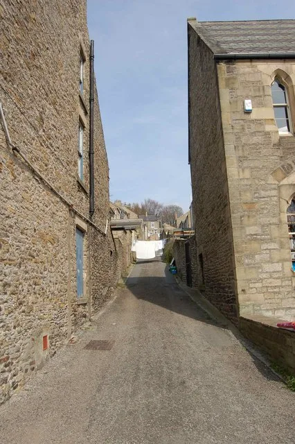
Dales Street in Stanhope, County Durham
Dales Street in County Durham, Stanhope is a residential street and runs in an east-west direction starting from Union Lane and ends at Front Street.
- Road Type
- residential street
- Speed Limit
- 30 mph
- Route
- east-west
Image
Cafés
Interior decorators
Convenience stores
Greengrocers
Hairdressers
Charity shops
Hardware shops
Kitchen showrooms
Travel agencies
Fast food restaurants
Bus stops
Pubs
Pharmacy
Post offices
Butcher's
Artwork
Roads nearby
Union LaneNew 2 You
100 m
Martin StreetWE & J Rowell
100 m
High StreetCobalt Ceramics, Dales Floral Art, Durham Dales Crafts, Old Stone Vets, Woolmouse
150 m
Graham StreetHomefront, Helen's Hair Design
150 m
Coronation Avenue250 m
Church LaneThe Bonny Moorhen
300 m
Railway Terrace300 m
The Market PlaceMarket Place, Pizza Barn
350 m
The ButtsChristine's Hair and Beauty
350 m
Bondisle WayStanhope, Railway Station, Weardale Railway, Fifteas Vintage Tea Room, Welcome to Stanhope
350 m
Willard Grove350 m
Front StreetStanhope, Fondant & Apron Strings, Fossil Tree, Rookhope, Village, Rookhope Newsagent, Durham Dales Centre, Durham Dales Centre Tea Room, Red Lodge, Welcome to Stanhope, Regenerare, Fire Station, The Grey Bull, Front Street-Former Queens Head, Bakers Loaf and Tea Shop, Woodhalls Greengrocers, Castle Bank Butchers, Stanhope Post Office, The Paper Shop, Dales and Moor Kitchens, Stanhope Pharmacy, Sports & Social Club, Ford, The Barber's of Stanhope, Woollyback, Stanhope Travel, Everyday Cafe, Roots of India
350 m
Park View350 m
East EndWeardale Bus Depot, Bridge
450 m
Castle GardensAccess Land in the North Pennines, Welcome to the Durham Dales Centre
450 m
Woodcroft Gardens450 m
Garden Close500 m
East LaneHill Crest
500 m
Centenary Close550 m
Chapel Street550 m
Dunsfield Farm Estate550 m
Cross StreetStanhope Fish & Chips
600 m
Cross Hill650 m
Grosvenor Close700 m
Barrington Court750 m
Union Street750 m
Eastcroft800 m
Land Use nearby
Weardale Motor Services500 m
Art galleries nearby
Alex Clark @ Lime Tree250 m
Buildings nearby
Stanhope Castle350 m
North Lodge450 m
Stanhope Silver band600 m
(Former) Town Hall600 m
Caravan site nearby
Stanhope Caravan Park300 m
Chalet nearby
Fairfield House200 m
Community centres nearby
Stanhope Community Centre650 m
Disused railways nearby
Weardale Railway400 m
Farmyards nearby
Unthank Mill550 m
Funeral directors nearby
Charlotte Fleming Funeral Services350 m
Industrial areas nearby
William Cook Cast Products (Astrum)500 m
Places of worship nearby
St Thomas the Apostle350 m
Stanhope Methodist Church450 m
Pubs nearby
Pack Horse Inn300 m
Quarries nearby
Ashes Quarry (East)550 m
Residential areas nearby
High Shittlehope700 m
Retail buildings nearby
Durham Dales Retail Centre400 m
Sports pitches nearby
Stanhope Cricket Club500 m
Supermarkets nearby
Lakes & Dales Co-operative250 m
Woodlands nearby
Clint's Wood750 m
Public transport map Stanhope Legend
| Railway | |
| Bus | |
| Tram |
Cycling map Stanhope Legend
| Cycle path | |
| Cycle lane on road | |
| Cycling on bus lane | |
| Bicycle street | |
| Cyclists allowed | |
| Cyclists allowed, good surface | |
| No cycling | |
| Cobblestones |
| Long-distance cycle route | (depending on scale) | |
| Long-distance cycle route |
Walking map Stanhope Legend
| Path |
| Long-distance hiking trail | (depending on scale) | |
| Long-distance hiking trail | ||
| No pedestrians |