
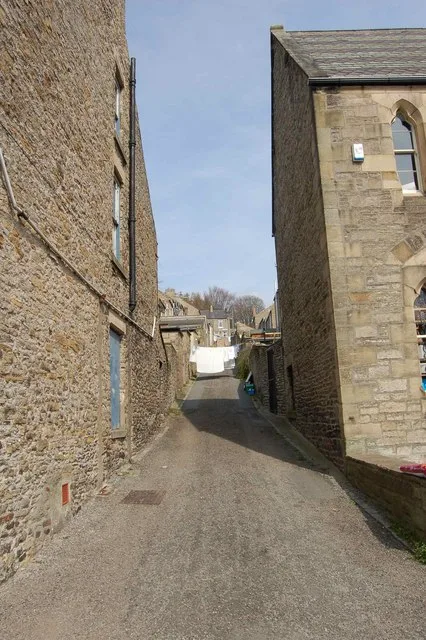
The Market Place in Stanhope, County Durham
The Market Place in County Durham, Stanhope is a cobblestone, lit residential street and it runs in a north-south direction starting from Front Street and ends at The Butts. In the vicinity, there is among other things a fast food restaurant. The nearest bus stop in the vicinity is Fire Station (approx. 150 m away).
- Road Type
- residential street
- Route
- north-south
Image
Roads nearby
Front StreetStanhope, Fondant & Apron Strings, Fossil Tree, Rookhope, Village, Rookhope Newsagent, Durham Dales Centre, Durham Dales Centre Tea Room, Red Lodge, Welcome to Stanhope, Regenerare, Fire Station, The Grey Bull, Front Street-Former Queens Head, Bakers Loaf and Tea Shop, Woodhalls Greengrocers, Castle Bank Butchers, Stanhope Post Office, The Paper Shop, Dales and Moor Kitchens, Stanhope Pharmacy, Sports & Social Club, Ford, The Barber's of Stanhope, Woollyback, Stanhope Travel, Everyday Cafe, Roots of India
100 m
Church LaneThe Bonny Moorhen
100 m
The ButtsChristine's Hair and Beauty
150 m
Park View150 m
Castle GardensAccess Land in the North Pennines, Welcome to the Durham Dales Centre
200 m
Graham StreetHomefront, Helen's Hair Design
200 m
Garden Close200 m
Martin StreetWE & J Rowell
250 m
High StreetCobalt Ceramics, Dales Floral Art, Durham Dales Crafts, Old Stone Vets, Woolmouse
250 m
Union LaneNew 2 You
250 m
Chapel Street300 m
Cross StreetStanhope Fish & Chips
300 m
Dunsfield Farm Estate300 m
Dales Street350 m
East LaneHill Crest
350 m
Cross Hill350 m
Grosvenor Close450 m
Union Street450 m
Barrington Court500 m
Eastcroft500 m
Cowgarth Hill550 m
Westcroft550 m
Paragon Street550 m
Ashcroft550 m
Bondisle WayStanhope, Railway Station, Weardale Railway, Fifteas Vintage Tea Room, Welcome to Stanhope
550 m
Crawleyside BankWest Terrace, Crawleyside Bank (Ashers Ho.), Crawleyside, Lane Head
550 m
Waterside CourtNewtown House, Memorial Fountain
600 m
Allerton BridgeBurnside Brae Guest House
700 m
Unthank BankUnthank
800 m
Art galleries nearby
Alex Clark @ Lime Tree100 m
Buildings nearby
Stanhope Castle50 m
North Lodge150 m
Stanhope Silver band300 m
(Former) Town Hall300 m
Caravan site nearby
Stanhope Caravan Park150 m
Chalet nearby
Fairfield House300 m
Community centres nearby
Stanhope Community Centre350 m
Disused railways nearby
Weardale Railway750 m
Farmyards nearby
Unthank Mill300 m
Funeral directors nearby
Charlotte Fleming Funeral Services50 m
Hospital nearby
Weardale Community Hospital750 m
Places of worship nearby
St Thomas the Apostle100 m
Stanhope Methodist Church200 m
Pubs nearby
Pack Horse Inn50 m
Quarries nearby
Ashes Quarry (East)400 m
Retail buildings nearby
Durham Dales Retail Centre150 m
Sports centres nearby
Weardale Open Air Pool500 m
Sports pitches nearby
Stanhope Cricket Club250 m
Supermarkets nearby
Lakes & Dales Co-operative100 m
Public transport map Stanhope Legend
| Railway | |
| Bus | |
| Tram |
Cycling map Stanhope Legend
| Cycle path | |
| Cycle lane on road | |
| Cycling on bus lane | |
| Bicycle street | |
| Cyclists allowed | |
| Cyclists allowed, good surface | |
| No cycling | |
| Cobblestones |
| Long-distance cycle route | (depending on scale) | |
| Long-distance cycle route |
Walking map Stanhope Legend
| Path |
| Long-distance hiking trail | (depending on scale) | |
| Long-distance hiking trail | ||
| No pedestrians |