
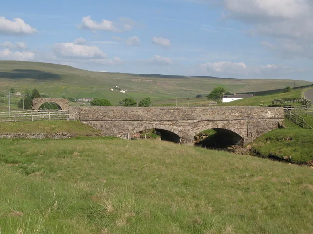
Lintzgarth Bridge in Stanhope, County Durham
Lintzgarth Bridge in County Durham, Stanhope is an unlit tertiary road. It runs in a north-south direction and ends in a cul-de-sac.
- Road Type
- tertiary road
- Speed Limit
- 60 mph
- Route
- north-south
Image
Hofläden
Campsite
Tourist information offices
Viewpoint
Roads nearby
Front StreetRookhope, Village, Rookhope Newsagent, Stanhope, Fondant & Apron Strings, Fossil Tree, Durham Dales Centre, Durham Dales Centre Tea Room, Red Lodge, Welcome to Stanhope, Regenerare, Fire Station, The Grey Bull, Front Street-Former Queens Head, Bakers Loaf and Tea Shop, Woodhalls Greengrocers, Castle Bank Butchers, Stanhope Post Office, The Paper Shop, Dales and Moor Kitchens, Stanhope Pharmacy, Sports & Social Club, Ford, The Barber's of Stanhope, Woollyback, Stanhope Travel, Everyday Cafe, Roots of India
1,6 km
Boltsburn Crescent1,6 km
Churchgarth Lane1,9 km
Stotfield BurnThe Vicarage, Bog
2,1 km
Redway Cut2,3 km
Red Road2,3 km
Body of waters nearby
Peg's Hole Reservoir1,2 km
Buildings nearby
Low Lintzgarth Cottage400 m
Prydale House1000 m
Boltslaw Cottages2,8 km
High Brandon2,9 km
Churches nearby
St. John the Evangelist2,1 km
Commercial areas nearby
Rookhope Business Centre1,3 km
Community centres nearby
Rookhope Village Hall1,4 km
Farmyards nearby
Wolf Cleugh2,1 km
Smailsburn2,2 km
Forests nearby
Lintzgarth Plantation800 m
Hostel nearby
Barrington Bunkhouse1,5 km
Houses nearby
High Bishopseat2,8 km
Pubs nearby
Rookhope Inn1,5 km
Rookhope Workingmens Club1,7 km
Quarries nearby
Hawksike Quarry1,2 km
Greenhill Quarry2,1 km
Boundarycleugh Quarry2,5 km
Residential buildings nearby
Bank Foot500 m
Hogarth Terrace1,7 km
Ridges nearby
Dry Rigg2,3 km
Rivers nearby
Rookhope Burn1,5 km
Ruins nearby
Winding Engine House2,9 km
Screes nearby
Tips2,7 km
Streams nearby
Red Burn350 m
Lintzgarth Cleugh400 m
Rispey Sike850 m
Rushy Sike1,1 km
Hawk Sike1,3 km
Stogel Cleugh1,7 km
Long Well Sike1,7 km
Bolt's Burn1,8 km
East Stogel Cleugh2,0 km
Whimsey Cleugh2,2 km
Scar Sike2,7 km
Crow's Cleugh2,7 km
Smithy Cleugh2,9 km
Broken Bank Sike2,9 km
Terraced houses nearby
Hylton Terrace1,6 km
Other nearby
Rookhope Chimney550 m
Rispey sheepfold800 m
Wolfcleugh Sheepfold2,3 km
Wolfcleugh Folds2,5 km
| Heritage designation | Grade II listed building |
|---|---|
| Located in | Stanhope |
| Country | United Kingdom |
 Public transport map Stanhope Legend
| Railway | |
| Bus | |
| Tram |
 Cycling map Stanhope Legend
| Cycle path | |
| Cycle lane on road | |
| Cycling on bus lane | |
| Bicycle street | |
| Cyclists allowed | |
| Cyclists allowed, good surface | |
| No cycling | |
| Cobblestones |
| Long-distance cycle route | (depending on scale) | |
| Long-distance cycle route |
 Walking map Stanhope Legend
| Path |
| Long-distance hiking trail | (depending on scale) | |
| Long-distance hiking trail | ||
| No pedestrians |