
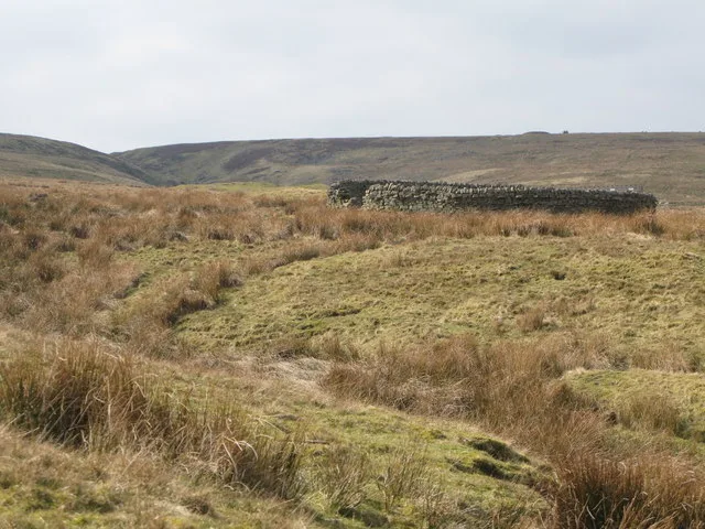
Wolfcleugh Sheepfold in Stanhope, County Durham
Wolfcleugh Sheepfold in County Durham, Stanhope ist eine Anlage. Wolfcleugh Sheepfold is near Seeingsike Road.
Image
Bus stops
Viewpoint
Tourist information offices
Post offices
Roads nearby
Lintzgarth Bridge2,3 km
Red Road2,8 km
Seeingsike Road2,9 km
Rookhope and Middlehope RailwayMiddlehope Shield Mine and washing floor, Middlehope Shield Plants that live on lead, Middlehope Shield Geology of the area
3,5 km
Buildings nearby
Low Lintzgarth Cottage2,6 km
Prydale House3,2 km
Farmyards nearby
Wolf Cleugh600 m
Forests nearby
Lintzgarth Plantation2,0 km
Houses nearby
Midhope Lodge2,5 km
Industrial buildings nearby
Groove Rake Mine Lodging Shop1,2 km
Quarries nearby
Grove Rake Quarry1,2 km
Boundarycleugh Quarry1,3 km
Hawksike Quarry1,5 km
Residential buildings nearby
Bank Foot2,5 km
Ridges nearby
Dry Rigg2,0 km
Knoutberry Rigg3,1 km
Streams nearby
Whimsey Cleugh200 m
Rookhope Burn650 m
Long Well Sike900 m
Brecken Sike900 m
Rushy Sike1,3 km
Rispey Sike1,4 km
Hawk Sike1,6 km
Greencleugh Sike1,9 km
Saugh Cluegh2,2 km
Middlehope Burn2,3 km
Lintzgarth Cleugh2,5 km
Yearn Cleugh2,5 km
Red Burn2,6 km
South Grain2,6 km
Broken Bank Sike2,7 km
Scar Sike2,7 km
Old Middlehope Sike2,7 km
Long Sike2,9 km
South Foul Sike2,9 km
North Grain3,0 km
Great Espy Sike3,0 km
Bleaklaws Sike3,1 km
Shorngate Sike3,1 km
Little Espy Sike3,2 km
Black Sike3,4 km
Grindstone Cleugh3,5 km
Seeing Sike3,6 km
Valleies nearby
Great Espy Cleugh3,1 km
Middle Hope3,4 km
Other nearby
Wolfcleugh Folds450 m
Rispey sheepfold1,5 km
Rookhope Chimney1,8 km
Middlehope Fold2,2 km
| Heritage designation | Grade II listed building |
|---|---|
| Located in | Stanhope |
| Country | United Kingdom |
 Public transport map Stanhope Legend
| Railway | |
| Bus | |
| Tram |
 Cycling map Stanhope Legend
| Cycle path | |
| Cycle lane on road | |
| Cycling on bus lane | |
| Bicycle street | |
| Cyclists allowed | |
| Cyclists allowed, good surface | |
| No cycling | |
| Cobblestones |
| Long-distance cycle route | (depending on scale) | |
| Long-distance cycle route |
 Walking map Stanhope Legend
| Path |
| Long-distance hiking trail | (depending on scale) | |
| Long-distance hiking trail | ||
| No pedestrians |