
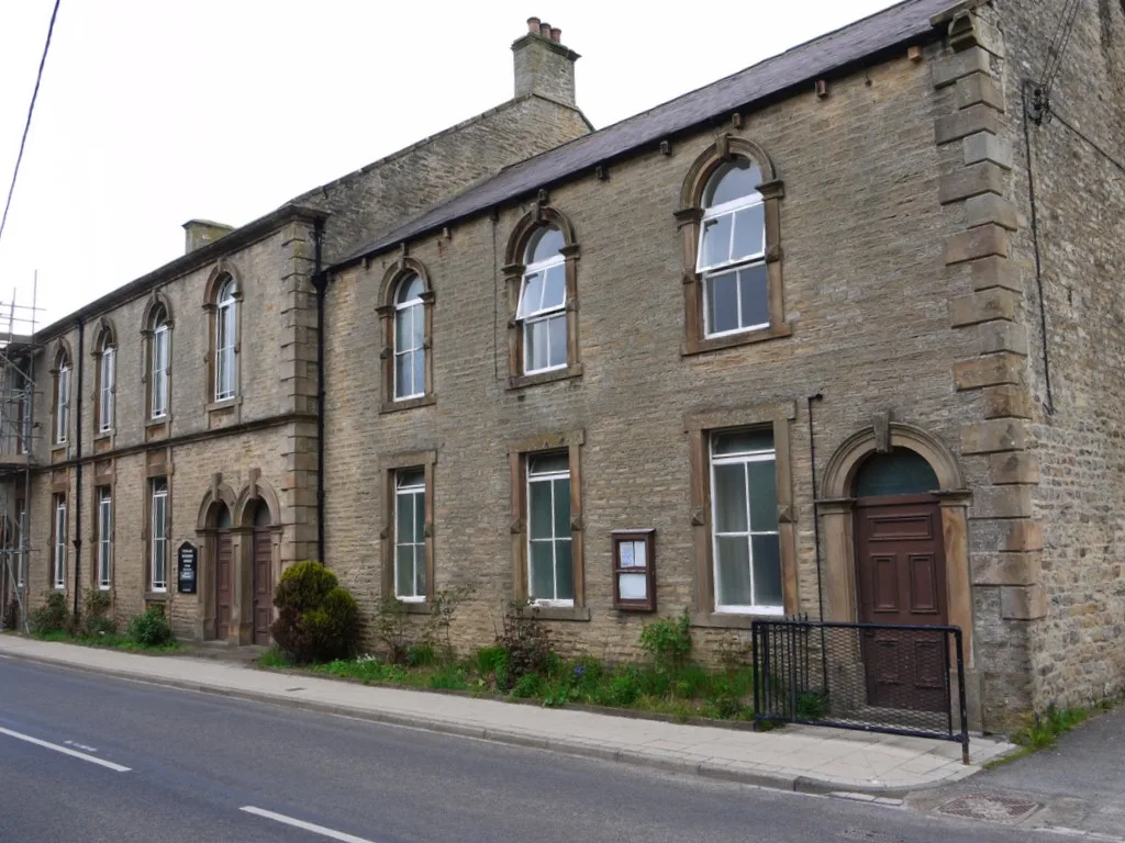
Westgate Methodist Chapel in Stanhope, County Durham
Westgate Methodist Chapel in County Durham, Stanhope is a chapel. Westgate Methodist Chapel is also known as Westgate Primitive Methodist Chapel. Westgate Methodist Chapel is near Crosslet Lane. Ⓦ.
- Building Type
- chapel
- Operator
- Historic Chapels Trust
- Website
- https://www.hct.org.uk/chapels/westgate-methodist-chapel
Image
Bus stops
Hofläden
Tourist information offices
Roads nearby
BullfieldWestgate
250 m
Crosslet Lane250 m
St Andrew's PlaceSt. Andrews Place
500 m
Scutterthill Bank700 m
FP 1310000021 Stanhope Parish Westgate Ward850 m
Side Lane900 m
FP 1310000018 Stanhope Westgate Parish Ward950 m
FP 1310000016 Stanhope Parish Westgate WardWarden Hill
1,1 km
Seeingsike Road1,3 km
Abandoned railways nearby
Rookhope and Middlehope RailwayMiddlehope Shield Mine and washing floor, Middlehope Shield Plants that live on lead, Middlehope Shield Geology of the area
1000 m
Body of waters nearby
Low Slitt Mine Pond1,2 km
Buildings nearby
Wooden Close400 m
Brownrigg Side800 m
Dale Head850 m
High Margery Dale900 m
Plantation House1,3 km
Rigg Side1,9 km
Caravan site nearby
Westgate Caravan Park and Camping Site250 m
Swinhopeburn Caravan Site650 m
Community centres nearby
Westgate Village Hall300 m
Farmyards nearby
Weeds Farm200 m
Council Farm1000 m
New Meadows1,2 km
Forests nearby
Middle Windyside Plantation800 m
Low Windyside Plantation900 m
Swinhopeburn Wood1,0 km
Guest house nearby
Lands Farm750 m
Hotels nearby
Westgate Manor300 m
Industrial areas nearby
Burnfoot Rural Workshops1,9 km
Places of worship nearby
St Andrew's Church400 m
Pubs nearby
Hare & Hounds300 m
Quarries nearby
West Rigg Mine and Opencut1,3 km
Razed railways nearby
Scutterhill Incline900 m
Residential areas nearby
Weardale Holiday Home Park150 m
East Haswicks600 m
Field Stile Caravan Park800 m
Ruins nearby
Bouse teams1,1 km
Streams nearby
Rawshaw Well600 m
Middlehope Burn650 m
Crooked Well850 m
Daddryshield Burn1,2 km
Barrasdale Sike1,4 km
Swinhope Burn1,4 km
West End Well1,6 km
Seeing Sike1,6 km
Park Burn1,7 km
Drygill Sike1,9 km
Valleies nearby
Middle Hope1,7 km
Swin Hope1,8 km
| Inception | 1871 |
|---|---|
| Heritage designation | Grade II* listed building |
| Located in | Stanhope |
| Country | United Kingdom |
| Location | Westgate |
 Public transport map Stanhope Legend
| Railway | |
| Bus | |
| Tram |
 Cycling map Stanhope Legend
| Cycle path | |
| Cycle lane on road | |
| Cycling on bus lane | |
| Bicycle street | |
| Cyclists allowed | |
| Cyclists allowed, good surface | |
| No cycling | |
| Cobblestones |
| Long-distance cycle route | (depending on scale) | |
| Long-distance cycle route |
 Walking map Stanhope Legend
| Path |
| Long-distance hiking trail | (depending on scale) | |
| Long-distance hiking trail | ||
| No pedestrians |