
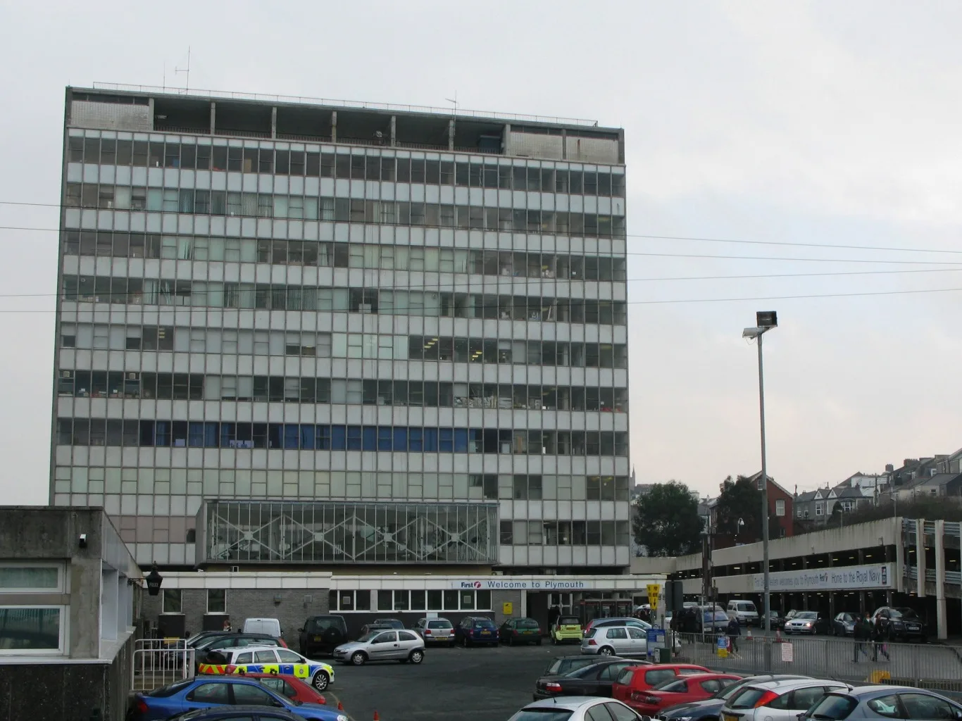
InterCity Place in Plymouth
InterCity Place in Plymouth is a university building. InterCity Place is near Claremont Street. Ⓦ.
- Building Type
- university building
Image
Stations
Fast food restaurants
Post offices
Bus stops
Roads nearby
Caprera Place100 m
Saltash RoadHMS Drake, Day Lewis Pharmacy, The Royal Navy Arms, Fleet Street, Ocean Street, Wombwell Crescent, North Cross Park & Ride, Railway Station, British Transport Police, St Levan Gate, Goschen Centre, Saltash Road, Johnstone Terrace
150 m
North Road West150 m
Pennycomequick HillPennycomequick
200 m
Boon's Place250 m
Gloucester Place250 m
Eton Avenue300 m
Holdsworth Street300 m
Russell Place300 m
Claremont Street300 m
Central Park AvenueIsambard Kingdom Brunel
300 m
Eton Place300 m
Eton Street300 m
Wake Street300 m
Bayswater Road350 m
Staddon Terrace Lane350 m
Oxford Place350 m
Stuart RoadPennycomequick, Stuart Road, Babybond Ultrasound Direct, Moor, St Barnabas Court
350 m
Alma RoadMilehouse Central Park, Milehouse Alma Road, Milehouse Bus Depot, Pilgrim Mews, De La Hey Avenue, Earl's Acre, Alma Road, Cuffe Road
400 m
Sydney Street400 m
Ilbert Street400 m
Oxford Street400 m
Cambridge Lane West450 m
Penrose Street450 m
Tracey Court500 m
Patna Place500 m
Hastings Terrace500 m
Penrose Street West500 m
Hastings Street550 m
Railways nearby
Plymouth Signal Box150 m
Shops nearby
Speedy Hire Centre300 m
Apartment buildings nearby
Aspire House (Student Flats)550 m
Morley Court550 m
Buildings nearby
Caprera Terrace Substation100 m
The Railway Club350 m
Stuart Social Club400 m
Cafés nearby
Café Local100 m
Car parks nearby
Armada Centre350 m
Convenience stores nearby
Tremain News400 m
PVS Pennycomequick Stores400 m
Doctor's practice nearby
North Road West Medical Centre300 m
Armada Surgery350 m
Guest house nearby
Caprera Guest House100 m
Kitchen showrooms nearby
Armada Kitchens and Bathrooms400 m
Playgrounds nearby
Patna Play Park550 m
Pubs nearby
The Newmarket Tavern600 m
Railway lines nearby
South Devon Main Line250 m
Shopping malls nearby
Armada Shopping Centre450 m
Supermarkets nearby
Sainsbury's400 m
University buildings nearby
Emdeck / MDEC Building200 m
| Inception | 1962 |
|---|---|
| Owner | Network Rail |
| Country | United Kingdom |
 Public transport map Plymouth Legend
| Railway | |
| Bus | |
| Tram |
 Cycling map Plymouth Legend
| Cycle path | |
| Cycle lane on road | |
| Cycling on bus lane | |
| Bicycle street | |
| Cyclists allowed | |
| Cyclists allowed, good surface | |
| No cycling | |
| Cobblestones |
| Long-distance cycle route | (depending on scale) | |
| Long-distance cycle route |
 Walking map Plymouth Legend
| Path |
| Long-distance hiking trail | (depending on scale) | |
| Long-distance hiking trail | ||
| No pedestrians |