
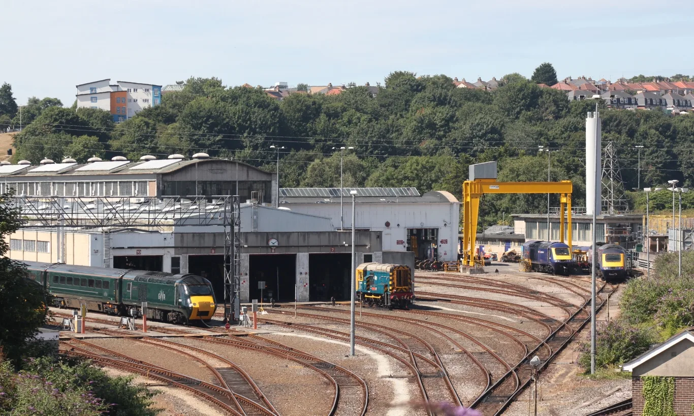
Laira Diesel Depot in Plymouth
Laira Diesel Depot in Plymouth ist ein Gebäude. Laira Diesel Depot is near Finch Close. Ⓦ.
- Building Type
- military depot
Image
Hairdressers
Theatres
Doctor's office
Bus stops
Roads nearby
Mullet Close300 m
Mount Gould RoadMount Gould Hospital, Farringdon Road, Channel View Terrace, Lipson Terrace, Ladysmith Road, Archway Avenue, Crossway Avenue, Mount Gould Primary Care Centre, Mount Gould Local Care Centre, Outpatients, Plym Neuro Rehab Unit
350 m
Mullet Avenue350 m
Curlew Mews350 m
Mullet Road350 m
Brandon Road350 m
Finch Close350 m
Laira Avenue400 m
Dartmoor View400 m
Beaumont RoadHeathfield Road, The Venton Centre, Astor Drive, Mount Gould, Carmarthen Road, Beaumont Villa Surgery, St Judes Church, Gasking Street, Friary Mill, Friary Surgery, Durham Avenue, Jephson Road
450 m
Laira Gardens450 m
Jubilee Place450 m
Old Laira RoadLaira Junction, Laira Library, Bramley Road, Wycliffe Road, Riga Terrace, Lipson Junction, Studio 28, Old Laira Road, Old Laira Road Shops, Well Pharmacy, Laira, Efford Lane
450 m
Astor Drive450 m
Bramley Road450 m
Huntley Place450 m
Federation Road450 m
Mirador Place450 m
Beverley Road500 m
The RideChelson Meadow
500 m
Riga Terrace500 m
Norfolk Road550 m
Pike RoadPike Road (bottom), Pike Road, Pike Road Horseshoe, Wandle Place, Manifold Gardens, Pike Road Footpath, Pike Road Post Office, Co-operative Food, Pike Road Shops
550 m
Brockley Road550 m
Fox Field Close550 m
Norfolk Close550 m
Kiel Place Lane600 m
Plymouth RoadCrabtree, Crabtree Close, Crabtree Riversleigh, St Mary's Court, Marsh Mills Superstore, Larkham Lane, Laira Flyover, McDonald's, Woodford Avenue, Great Woodford Drive, Cot Hill, Skewbridge, Dingle Road, Marsh Mills East, Plympton Vinyl Centre, Esso, Amazon, Londis, Military Road
600 m
Embankment RoadLaira Flyover, Higher Stert Terrace, Lanhydrock Road, Embankment Road Post Office, Mini-Deli Polskie Delikatesy, Prince Rock Primary School, Astor Playing Field, Cattedown Roundabout, Rowing Club, Mount Gould Junction
600 m
Kiel Place600 m
Lanhydrock Road650 m
Manor Lane650 m
Amenities nearby
Achievers Day Nursery450 m
Abandoned railways nearby
Plymouth Loop No. 2650 m
Hospitals nearby
Avon House400 m
Erme House450 m
River View450 m
Revive500 m
Wards 5,6,7,8 (standing empty)500 m
Terraces500 m
Nature reserves nearby
Blagdon's Meadow350 m
Pet groomings nearby
Cooper's Dog Grooming400 m
Places of worship nearby
St Mary the Virgin500 m
Railway lines nearby
Sutton Harbour Branch150 m
South Devon Main Line300 m
Plymouth Loop No. 1400 m
Retail buildings nearby
Spar400 m
Social facilities nearby
Age UK400 m
Sports centres nearby
Plymouth Amateur Rowing Club250 m
| Country | United Kingdom |
|---|
 Public transport map Plymouth Legend
| Railway | |
| Bus | |
| Tram |
 Cycling map Plymouth Legend
| Cycle path | |
| Cycle lane on road | |
| Cycling on bus lane | |
| Bicycle street | |
| Cyclists allowed | |
| Cyclists allowed, good surface | |
| No cycling | |
| Cobblestones |
| Long-distance cycle route | (depending on scale) | |
| Long-distance cycle route |
 Walking map Plymouth Legend
| Path |
| Long-distance hiking trail | (depending on scale) | |
| Long-distance hiking trail | ||
| No pedestrians |