
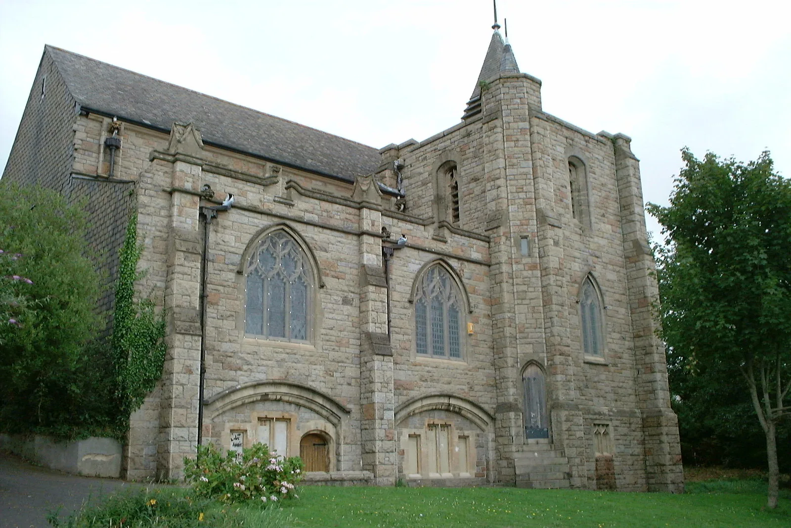
St Mary the Virgin in Plymouth
St Mary the Virgin in Plymouth is a Anglicana church. It is near Huntley Place and belongs to the Diocese of Exeter. The church is dedicated to Mary and is a listed building. St Mary the Virgin also exists in Somerset, Thurrock and Brighton and Hove.
- Amenity
- place of worship
- Building Type
- church
Image
Bus stops
Roads nearby
Old Laira RoadLaira Junction, Laira Library, Bramley Road, Wycliffe Road, Riga Terrace, Lipson Junction, Studio 28, Old Laira Road, Old Laira Road Shops, Well Pharmacy, Laira, Efford Lane
100 m
Laira Gardens100 m
Fox Field Close100 m
Norfolk Close100 m
Jubilee Place150 m
Federation Road150 m
Huntley Place150 m
Mullet Road150 m
Curlew Mews150 m
Mullet Avenue150 m
Arun Close200 m
Mullet Close200 m
Finch Close200 m
Bramley Road200 m
Severn Place200 m
Norfolk Road200 m
Laira Avenue250 m
Erme Gardens250 m
Beverley Road250 m
Derwent Avenue250 m
Brandon Road300 m
Brockley Road300 m
Kiel Place350 m
Creedy Road350 m
Riga Terrace350 m
Kiel Place Lane350 m
Pike RoadPike Road Horseshoe, Wandle Place, Manifold Gardens, Pike Road Footpath, Pike Road (bottom), Pike Road, Pike Road Post Office, Co-operative Food, Pike Road Shops
400 m
Manor Lane450 m
Torridge WaySt Paul's Church, Torridge Way
450 m
Plymouth RoadCrabtree, Crabtree Close, Crabtree Riversleigh, St Mary's Court, Marsh Mills Superstore, Larkham Lane, Laira Flyover, McDonald's, Woodford Avenue, Great Woodford Drive, Cot Hill, Skewbridge, Dingle Road, Marsh Mills East, Plympton Vinyl Centre, Esso, Amazon, Londis, Military Road
450 m
Embankment RoadLaira Flyover, Higher Stert Terrace, Lanhydrock Road, Embankment Road Post Office, Mini-Deli Polskie Delikatesy, Prince Rock Primary School, Astor Playing Field, Cattedown Roundabout, Rowing Club, Mount Gould Junction
450 m
Highfield Close500 m
Wandle Place500 m
Blandford RoadCommunity Centre, Blandford Road, Blandford Road Community Centre, Highfield Close, Torridge Way Post Office, Fish and Chips, Efford Road, Yeo Close, Higher Efford Road, Teign Road, Lower Compton, Compton Vale, Byland Road, Blandford Road East, Thames Gardens, Plym View Primary School, Douglas Road, Spire Court, Carlton Close
550 m
Dunclair Park550 m
Manifold Gardens600 m
Fairview Avenue600 m
Stott Close600 m
Darwin Crescent600 m
Amenities nearby
Achievers Day Nursery200 m
Buildings nearby
Laira Diesel Depot500 m
Buildings nearby
Laira Surgery400 m
Parks nearby
Efford Valley Wildlife park350 m
Pet groomings nearby
Cooper's Dog Grooming200 m
Places of worship nearby
St Paul's Church400 m
Railway lines nearby
South Devon Main Line250 m
Sutton Harbour Branch350 m
Plymouth Loop No. 1400 m
Retail buildings nearby
Spar150 m
| Dedicated to | Mary |
|---|---|
| Diocese | Diocese of Exeter |
| Heritage designation | Grade II listed building |
| Located in | City of Plymouth |
| Country | United Kingdom |
 Public transport map Plymouth Legend
| Railway | |
| Bus | |
| Tram |
 Cycling map Plymouth Legend
| Cycle path | |
| Cycle lane on road | |
| Cycling on bus lane | |
| Bicycle street | |
| Cyclists allowed | |
| Cyclists allowed, good surface | |
| No cycling | |
| Cobblestones |
| Long-distance cycle route | (depending on scale) | |
| Long-distance cycle route |
 Walking map Plymouth Legend
| Path |
| Long-distance hiking trail | (depending on scale) | |
| Long-distance hiking trail | ||
| No pedestrians |