
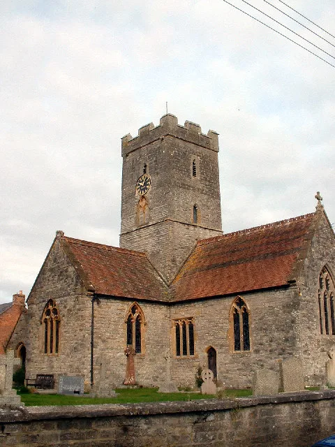
St Michael & All Angels in Bawdrip
St Michael & All Angels in Somerset, Bawdrip is a Anglicana church. It is near New Road and is also known as Church of St Michael and All Angels, Bawdrip. The church belongs to the Anglican Diocese of Bath and Wells and is dedicated to Michael. It is a listed building. St Michael & All Angels also exists in Pitminster, Greinton, Wayford, Yeovil and St Cuthbert Out. Ⓦ.
- Amenity
- place of worship
- Building Type
- church
Image
Roads nearby
Church RoadBawdrip
50 m
Church Walk100 m
Church Farm100 m
St Michaels Court100 m
Greenfield Lane150 m
South View150 m
Shaws Orchard150 m
Stone Drove150 m
Eastside Lane200 m
Bawdrip Lane250 m
New Road350 m
Little Wall Lane400 m
Bradney BridgeBradney Bridge
400 m
Bradney LaneBradney
450 m
Field Lane500 m
Brook Lane800 m
Northmoor Drove850 m
Woolavington Hill950 m
Crancombe Lane1,0 km
Bath RoadKnowle, Horsey, Bradney Lane, Horsey Lane, Chedzoy Lane
1,2 km
Sedgemoor Road1,2 km
Windmill CrescentWindmill Convenience Store, Think Fish, Woolavington Pharmacy
1,2 km
Sedgemoor Way1,3 km
Knowle End1,3 km
Polden Walk1,3 km
Southfield Close1,3 km
Old Mill Road1,4 km
Orchard Way1,4 km
Martland Close1,4 km
Darkfield Way1,4 km
Highcroft1,5 km
Hillsboro1,5 km
Tor View1,5 km
Mount View1,6 km
Horton Way1,6 km
Puriton Hill1,6 km
Abandoned railways nearby
Old Route of Somerset & Dorset Railway150 m
Bridgwater Branch900 m
Buildings nearby
The Knowle Inn750 m
Caravan site nearby
Fairways Holiday Park900 m
Convenience stores nearby
Co-op Food1,5 km
Drains nearby
Chedzoy Rhyne1,1 km
Bath Road Rhyne1,6 km
Petrol stations nearby
Murco800 m
Residential areas nearby
Bawdrip450 m
Knowle850 m
Rivers nearby
King's Sedgemoor Drain1,6 km
Woodlands nearby
Three Corner Batch1,0 km
Eleven Acre Covert1,3 km
| Dedicated to | Michael |
|---|---|
| Diocese | Anglican Diocese of Bath and Wells |
| Heritage designation | Grade II* listed building |
| Located in | Bawdrip |
| Country | United Kingdom |
 Public transport map Bawdrip Legend
| Railway | |
| Bus | |
| Tram |
 Cycling map Bawdrip Legend
| Cycle path | |
| Cycle lane on road | |
| Cycling on bus lane | |
| Bicycle street | |
| Cyclists allowed | |
| Cyclists allowed, good surface | |
| No cycling | |
| Cobblestones |
| Long-distance cycle route | (depending on scale) | |
| Long-distance cycle route |
 Walking map Bawdrip Legend
| Path |
| Long-distance hiking trail | (depending on scale) | |
| Long-distance hiking trail | ||
| No pedestrians |