
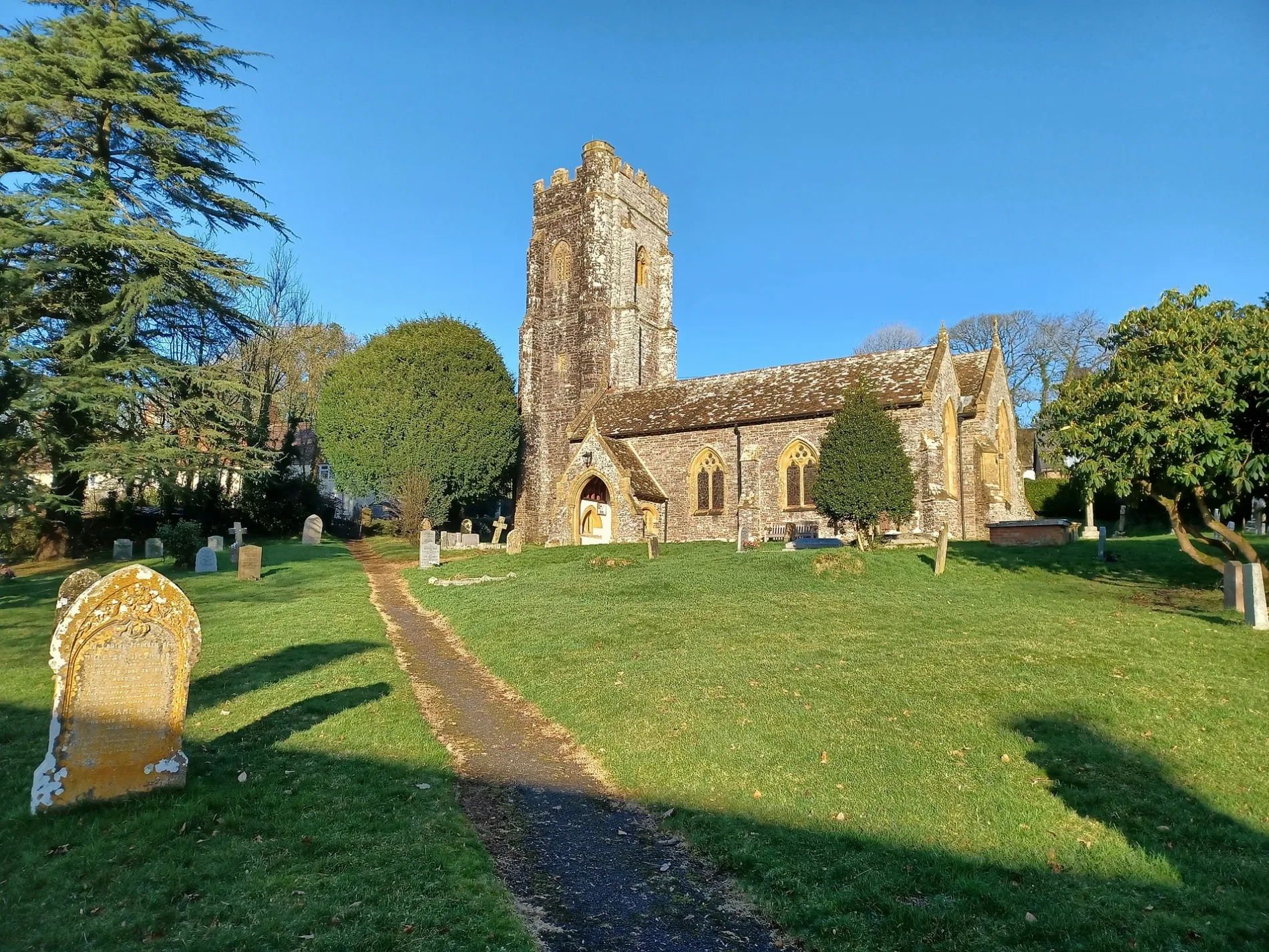
Church of All Saints in Chipstable
Church of All Saints in Somerset, Chipstable is a Anglicana church. It is near Newhouse Lane and is also known as All Saints Church, Chipstable. The church belongs to the Anglican Diocese of Bath and Wells and is dedicated to All Saints' Day. It was built in 1201 and is a listed building. Church of All Saints also exists in Monksilver, Langport and East Pennard. Ⓦ.
- Amenity
- place of worship
- Building Type
- church
Image
Tourist information offices
Post boxes
Roads nearby
Newhouse LaneChipstable
150 m
Old WayChubworthy Cross
700 m
Little Wilscombe Lane850 m
Stoneridge Lane1,1 km
Pitt Lane1,3 km
Trowell Lane1,4 km
Dulverton Lane1,5 km
Hawkin's Lane1,6 km
Huish Cleeve1,6 km
Challick Lane1,7 km
Tanners HillHuish Champflower
1,7 km
Hart's Lane1,8 km
Common Lane1,9 km
Bibors Hill1,9 km
New Road2,0 km
Hill Lane2,1 km
Spears Lane2,2 km
The Barton2,2 km
Churchill LaneRaddington Bottom
2,2 km
West Coombe Lane2,4 km
Scott's Hill2,5 km
Shute Lane2,5 km
Summer Cleeve Lane2,6 km
Jews Lane2,6 km
Holland's Lane2,7 km
Pyncombe Lane2,8 km
Bicking's Close Lane2,8 km
Maundown Road2,9 km
Waysdown Lane3,1 km
Abandoned railways nearby
Venn Cross Tunnel2,6 km
Barnstaple Branch2,8 km
Bathealton Tunnel3,1 km
Buildings nearby
The Rock Inn1,9 km
North Rodden Barn2,7 km
Community centres nearby
Huish Champflower Village Hall2,1 km
Forests nearby
Young Oaks Wood700 m
Middle Hill Plantation950 m
Maundown Plantation1,5 km
Houses nearby
Hillside Cottage1,6 km
Cleeve Cottage1,6 km
The Barn1,6 km
Rose Cottage1,7 km
Places of worship nearby
St Peter2,2 km
St Michael2,5 km
Rivers nearby
River Tone1,4 km
Woodlands nearby
Huish Cleeve Plantations1,8 km
Batscombe Copse1,9 km
Lee Moor Plantation2,8 km
Glass's Copse3,4 km
| Inception | 1201 |
|---|---|
| Dedicated to | All Saints' Day |
| Diocese | Anglican Diocese of Bath and Wells |
| Heritage designation | Grade II* listed building |
| Located in | Chipstable |
| Country | United Kingdom |
| Website | http://www.wiveychurches.org.uk/ |
 Public transport map Chipstable Legend
| Railway | |
| Bus | |
| Tram |
 Cycling map Chipstable Legend
| Cycle path | |
| Cycle lane on road | |
| Cycling on bus lane | |
| Bicycle street | |
| Cyclists allowed | |
| Cyclists allowed, good surface | |
| No cycling | |
| Cobblestones |
| Long-distance cycle route | (depending on scale) | |
| Long-distance cycle route |
 Walking map Chipstable Legend
| Path |
| Long-distance hiking trail | (depending on scale) | |
| Long-distance hiking trail | ||
| No pedestrians |