
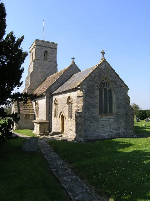
St Thomas A Becket in Lovington, Somerset
St Thomas A Becket in Somerset, Lovington is a Anglicana church. It is near Goes Lane and is also known as Church of St Thomas of Canterbury, Lovington. The church belongs to the Anglican Diocese of Bath and Wells and is dedicated to Thomas Becket. It is a listed building. St Thomas A Becket also exists in South Cadbury and Sutton Montis and Pylle. Ⓦ.
- Amenity
- place of worship
- Building Type
- church
Image
Roads nearby
Goes Lane250 m
Mulberry Lane1,0 km
Brue Farm1,1 km
Pilgrims WayThe Pilgrims Restaurant
1,2 km
Marsh Farm1,2 km
Higher Farm Lane1,3 km
Old Approach1,9 km
Eastfield Lane1,9 km
Perry Hill2,1 km
Cary Moor Drove2,3 km
Pyle Well LaneUphill Farm, Higher Foddington
2,3 km
Church LaneEast Lydford
2,3 km
Thornymarsh Lane2,4 km
Rubbery Lane2,5 km
Dimmer Lane2,5 km
Castle Cary Road2,5 km
West Lane2,5 km
Musmoor Lane2,8 km
Foster's LaneSouth Barrow
2,8 km
Easton Town LaneHornblotton Green
2,8 km
Fair Place2,9 km
Foss WayLydford Services, Budgens, Lydford-on-Fosse
3,0 km
Nightingale Lane3,0 km
Chapel Lane3,0 km
Hearn Lane3,1 km
Clanville Manor3,2 km
Pound Lane3,2 km
Dimmer Bridge3,2 km
Blackworthy Road3,4 km
Caravan site nearby
The Cross Keys Inn Caravan and Motorhome Park3,0 km
Commercial areas nearby
Lydford Business Park2,4 km
Community centres nearby
North Barrow Village Hall1,7 km
Farmyards nearby
Manor Farm3,0 km
Easton Town Farm3,1 km
Lower Farm3,4 km
Golf courses nearby
Wheathill Golf Club1,4 km
Landfills nearby
Dimmer Landfill1,4 km
Places of worship nearby
St Nicholas1,8 km
All Saints1,9 km
St Mary2,4 km
St Peter3,4 km
Pubs nearby
Cross Keys Inn3,0 km
Railway lines nearby
Reading to Taunton line1,3 km
Heart of Wessex Line2,9 km
Rivers nearby
River Brue1,2 km
River Cary2,0 km
River Alham2,6 km
Streams nearby
Back Brook500 m
Dry Brook2,3 km
| Dedicated to | Thomas Becket |
|---|---|
| Diocese | Anglican Diocese of Bath and Wells |
| Heritage designation | Grade II* listed building |
| Located in | Lovington |
| Country | United Kingdom |
 Public transport map Lovington Legend
| Railway | |
| Bus | |
| Tram |
 Cycling map Lovington Legend
| Cycle path | |
| Cycle lane on road | |
| Cycling on bus lane | |
| Bicycle street | |
| Cyclists allowed | |
| Cyclists allowed, good surface | |
| No cycling | |
| Cobblestones |
| Long-distance cycle route | (depending on scale) | |
| Long-distance cycle route |
 Walking map Lovington Legend
| Path |
| Long-distance hiking trail | (depending on scale) | |
| Long-distance hiking trail | ||
| No pedestrians |