
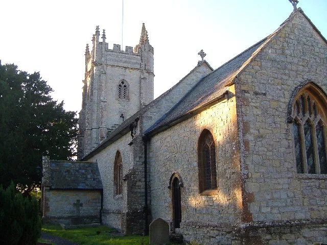
St Andrew's Church in West Hatch
St Andrew's Church in Somerset, West Hatch is a Anglicana church, West Hatch Lane (TA3 5RJ). It is also known as St Andrew's Church, West Hatch and belongs to the Anglican Diocese of Bath and Wells. The church is a listed building. St Andrew's Church also exists in Stringston, Otterhampton and Mells.
- Postal Code
- TA3 5RJ
- Street
- West Hatch Lane
- Amenity
- place of worship
- Building Type
- church
Image
Roads nearby
Church Lane500 m
Griffin Road750 m
West Hatch LaneWest Hatch
850 m
Huish Woods Lane900 m
Griffin Lane1,2 km
Burnt House Copse Lane1,2 km
Meare Green LaneMeare Green
1,2 km
Bickenhall Lane1,4 km
Higher West Hatch Lane1,5 km
Prey Lane1,5 km
Ash Bridge1,6 km
Mattock's Tree HillAsh Cross, Nags Head, Garage
1,6 km
Ash Road1,6 km
Village RoadVillage Road Post Office, Hatch Beauchamp Road, Hatch Green, Hatch Beauchamp
1,7 km
Grughay Lane1,8 km
Slough HillSlough Green
1,8 km
Frost Street1,9 km
Cold Road1,9 km
Buildings nearby
RSPCA West Hatch Animal Centre1,5 km
Campsite nearby
Huish Woods850 m
Ashe Farm Camp Site1,6 km
Caravan site nearby
Slough Green Park1,1 km
Commercial areas nearby
The Railway Cutting1,4 km
Commercial buildings nearby
Nightingale Farm1000 m
Community centres nearby
West Hatch Village Hall50 m
Farmyards nearby
Vincents Farm600 m
Philpotts Farm650 m
Park Farm750 m
Swallow Barn Farm750 m
East Haddons Farm800 m
Meades Farm850 m
Yarde Farm950 m
Three Elms Farm1,0 km
Boons Farm1,0 km
Haddons Farm1,0 km
Ashe Farm1,3 km
Strouds Farm1,3 km
Bickenhall Farm1,7 km
Sparks Farm1,8 km
Forests nearby
Thurlbear Wood1,7 km
Sturm's Hill Plantation1,8 km
Great Boles1,9 km
Grass nearby
Beacon Field650 m
Hotels nearby
Farthings1,6 km
Pubs nearby
The Farmers Arms1,7 km
Woodlands nearby
Wright's Copse750 m
Five Acre Copse800 m
Bickenhall Wood1,1 km
Ben's Copse1,4 km
| Diocese | Anglican Diocese of Bath and Wells |
|---|---|
| Heritage designation | Grade II listed building |
| Located in | West Hatch |
| Country | United Kingdom |
 Public transport map West Hatch Legend
| Railway | |
| Bus | |
| Tram |
 Cycling map West Hatch Legend
| Cycle path | |
| Cycle lane on road | |
| Cycling on bus lane | |
| Bicycle street | |
| Cyclists allowed | |
| Cyclists allowed, good surface | |
| No cycling | |
| Cobblestones |
| Long-distance cycle route | (depending on scale) | |
| Long-distance cycle route |
 Walking map West Hatch Legend
| Path |
| Long-distance hiking trail | (depending on scale) | |
| Long-distance hiking trail | ||
| No pedestrians |