
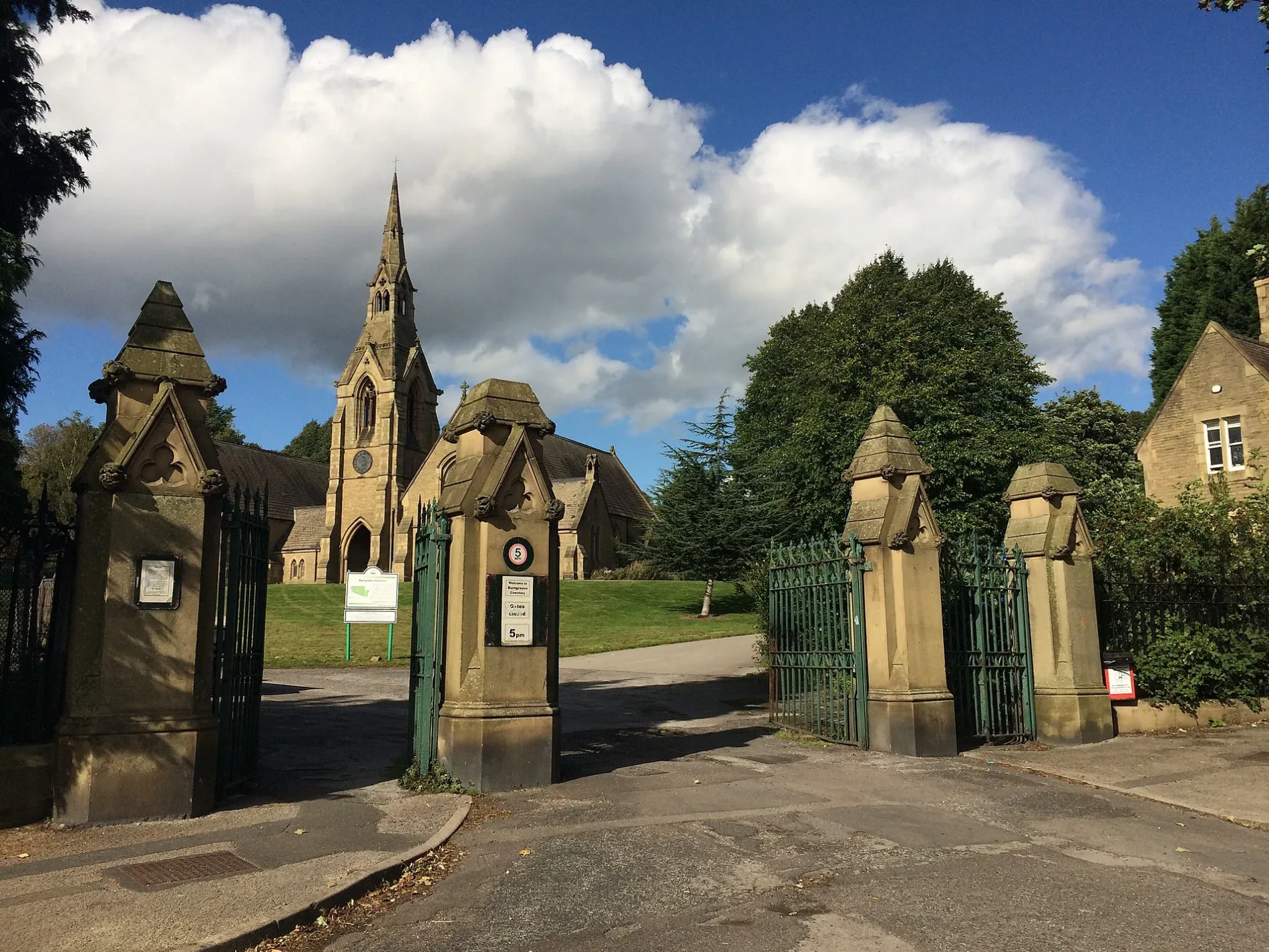
Burngreave Cemetery in Sheffield
Burngreave Cemetery in Sheffield is a wall. Burngreave Cemetery is also known as Sheffield (Burngreave) Cemetery. Burngreave Cemetery is near Melrose Road.
- Land Use
- cemetery
Image
Roads nearby
Burngreave Street100 m
Melrose Road150 m
Coupe Road150 m
Burngreave Bank250 m
Cranworth Place250 m
Cranworth Road300 m
Brotherton Street300 m
Rock StreetRock Street/Pye Bank Road, Rock Street/Marcus Drive, Rock Street/Andover Street, Rock Street/Nottingham Street, The Rock Store
300 m
Holtwood Road300 m
Catherine StreetSteers Convenience Store, Dayar E Madina
300 m
Bressingham Road350 m
Burngreave RoadBurngreave Road/Pitsmoor Road, Burngreave Road/Minna Road, Burngreave Road/Toll Bar, Burngreave Pharmacy, Burngreave Road/Melrose Road, Burngreave Road/Andover Street, Somaliland Community Social Club, Burngreave Road/Cranworth Road, Burngreave Road/Burngreave Street, Melrose Surgery
350 m
Brackley Street350 m
Christ Church RoadPitsmoor Methodist Church
350 m
Abbeyfield RoadThe Glastonbury Guest House
350 m
Rising Street350 m
Nottingham StreetNottingham Street/Pilgrim Street, Nottingham Street/Rock Street, Nottingham Street/Fox Street
400 m
Pilgrim Street400 m
Burngrove Place400 m
Minna RoadMinna Road/Pitsmoor Road, Pitsmoor Dental Health Centre, The Heavenly Nights Guest House
400 m
Somerset Road400 m
Somerset Street400 m
Pitsmoor RoadPitsmoor Road/Minna Road, Pitsmoor Road/Rutland Road, Pitsmoor Road/Swinton Street, Pitsmoor Road/Pye Bank Rd/Mobility Only, Food Plus, Pitsmoor Road/Pinfold Lane, Pitsmoor Off Licence, Sales, Repairs and Spares, The PitStop, Church of God, Pitsmoor
400 m
Kilton Hill450 m
Richmond Street450 m
Brandon Street450 m
Firshill Road450 m
Lopham Street450 m
Andover StreetMy Dentist, Star
500 m
Barnsley RoadBarnsley Road/Orphanage Road, Barnsley Road/Firshill Close, Sara Hand Car Wash, Nile Market, Marshall News, Palace Express, Sweetie Desserts, Barnsley Road/Kinnaird Avenue, Barnsley Road/Turning Circle, Osgathorpe, Barnsley Road/Devon Road, Barnsley Road/Longley Lane, Barnsley Rd/Northern General Hospital NG6, Barnsley Road/Norwood Road, Barnsley Rd/Northern General Hospital NG5, Barnsley Road/Idsworth Road, Barnsley Road/Mortlake Road, Barnsley Road/Hereward Road, Barnsley Road/Horninglow Road, Barnsley Road/Hatfield House Lane, Barnsley Road/Homestead Road, Numark, Greggs Outlet, Steers Beers, Barnsley Road/Crabtree Close, Barnsley Road/Osgathorpe Road, Barnsley Road/Herries Road/Hospital NG8, Barnsley Road/Hartley Brook Road
500 m
Shirley Road500 m
Firshill Close550 m
Car repair shops nearby
Pit Stop450 m
Car washes nearby
Diamond Hand Car Wash350 m
Civic buildings nearby
Abbeyfield Park House450 m
Doctor's practice nearby
Pitsmoor Surgery350 m
Fast food restaurants nearby
Pizza Palace450 m
Hairdresser's nearby
Andreas Hair Design450 m
Kindergartens nearby
Watoto Pre-School250 m
Parks nearby
Somerset Park300 m
Abbeyfield Park500 m
Places of worship nearby
St Catherine's Catholic Church200 m
Christ Church Pitsmoor400 m
Seventh Day Adventist Church450 m
Playgrounds nearby
Pitsmoor Adventure Playground100 m
Pubs nearby
The Pitsmoor500 m
Bay Horse Inn500 m
Schools nearby
Byron Wood Primary Academy200 m
Sports pitches nearby
Wards Pitmoor/Abbeyfield Park Crown Green Bowls Club500 m
| Inception | 1861 |
|---|---|
| Opening | 1861 |
| Area | 14.8 ha |
| Heritage designation | Grade II listed park and garden |
| Located in | Sheffield |
| Country | United Kingdom |
| Has part | War Memorial 400 Metres North East of Chapel at Burngreave Cemetery |
 Public transport map Sheffield Legend
| Railway | |
| Bus | |
| Tram |
 Cycling map Sheffield Legend
| Cycle path | |
| Cycle lane on road | |
| Cycling on bus lane | |
| Bicycle street | |
| Cyclists allowed | |
| Cyclists allowed, good surface | |
| No cycling | |
| Cobblestones |
| Long-distance cycle route | (depending on scale) | |
| Long-distance cycle route |
 Walking map Sheffield Legend
| Path |
| Long-distance hiking trail | (depending on scale) | |
| Long-distance hiking trail | ||
| No pedestrians |