
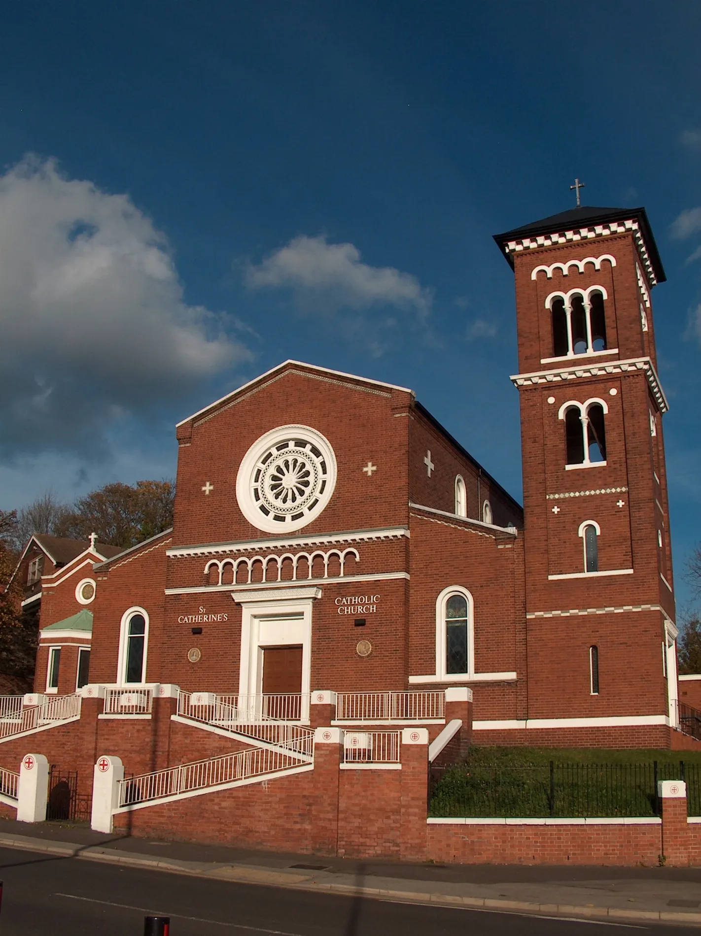
St Catherine's Catholic Church in Sheffield
St Catherine's Catholic Church in Sheffield is a Catholica church. It is near Melrose Road and is also known as Church of St Catherine of Alexandria, Sheffield. The church is named after Catherine of Alexandria and belongs to the Roman Catholic Diocese of Hallam. It is a listed building.
- Amenity
- place of worship
- Building Type
- church
Roads nearby
Melrose Road100 m
Burngreave Street200 m
Christ Church RoadPitsmoor Methodist Church
200 m
Rock StreetRock Street/Pye Bank Road, Rock Street/Marcus Drive, Rock Street/Andover Street, Rock Street/Nottingham Street, The Rock Store
200 m
Coupe Road200 m
Rising Street200 m
Pilgrim Street250 m
Cranworth Place250 m
Cranworth Road250 m
Brotherton Street250 m
Burngreave RoadBurngreave Road/Pitsmoor Road, Burngreave Road/Minna Road, Burngreave Road/Toll Bar, Burngreave Pharmacy, Burngreave Road/Melrose Road, Burngreave Road/Andover Street, Somaliland Community Social Club, Burngreave Road/Cranworth Road, Burngreave Road/Burngreave Street, Melrose Surgery
250 m
Minna RoadMinna Road/Pitsmoor Road, Pitsmoor Dental Health Centre, The Heavenly Nights Guest House
250 m
Nottingham StreetNottingham Street/Pilgrim Street, Nottingham Street/Rock Street, Nottingham Street/Fox Street
250 m
Pitsmoor RoadPitsmoor Road/Minna Road, Pitsmoor Road/Rutland Road, Pitsmoor Road/Swinton Street, Pitsmoor Road/Pye Bank Rd/Mobility Only, Food Plus, Pitsmoor Road/Pinfold Lane, Pitsmoor Off Licence, Sales, Repairs and Spares, The PitStop, Church of God, Pitsmoor
250 m
Burngrove Place250 m
Catherine StreetSteers Convenience Store, Dayar E Madina
300 m
Holtwood Road300 m
Burngreave Bank350 m
Brandon Street350 m
Brackley Street350 m
Abbeyfield RoadThe Glastonbury Guest House
350 m
Somerset Street350 m
Somerset Road400 m
Shirley Road400 m
Andover StreetMy Dentist, Star
450 m
Bressingham Road450 m
Barnsley RoadBarnsley Road/Orphanage Road, Barnsley Road/Firshill Close, Sara Hand Car Wash, Nile Market, Marshall News, Palace Express, Sweetie Desserts, Barnsley Road/Kinnaird Avenue, Barnsley Road/Turning Circle, Osgathorpe, Barnsley Road/Devon Road, Barnsley Road/Longley Lane, Barnsley Rd/Northern General Hospital NG6, Barnsley Road/Norwood Road, Barnsley Rd/Northern General Hospital NG5, Barnsley Road/Idsworth Road, Barnsley Road/Mortlake Road, Barnsley Road/Hereward Road, Barnsley Road/Horninglow Road, Barnsley Road/Hatfield House Lane, Barnsley Road/Homestead Road, Numark, Greggs Outlet, Steers Beers, Barnsley Road/Crabtree Close, Barnsley Road/Osgathorpe Road, Barnsley Road/Herries Road/Hospital NG8, Barnsley Road/Hartley Brook Road
450 m
Lopham Street450 m
Richmond Street450 m
Firshill Road450 m
Kilton Hill500 m
Firshill Close500 m
Car repair shops nearby
Pit Stop350 m
Car washes nearby
Diamond Hand Car Wash400 m
Cemeteries nearby
Burngreave Cemetery200 m
Civic buildings nearby
Abbeyfield Park House400 m
Doctor's practice nearby
Pitsmoor Surgery200 m
Fast food restaurants nearby
Pizza Palace350 m
Hairdresser's nearby
Andreas Hair Design350 m
Kindergartens nearby
Watoto Pre-School350 m
Parks nearby
Somerset Park300 m
Abbeyfield Park450 m
Places of worship nearby
Christ Church Pitsmoor200 m
Seventh Day Adventist Church450 m
Playgrounds nearby
Pitsmoor Adventure Playground250 m
Pubs nearby
Bay Horse Inn400 m
The Pitsmoor400 m
Schools nearby
Byron Wood Primary Academy350 m
Sports pitches nearby
Wards Pitmoor/Abbeyfield Park Crown Green Bowls Club450 m
| Named after | Catherine of Alexandria |
|---|---|
| Opening | 1926 |
| Diocese | Roman Catholic Diocese of Hallam |
| Heritage designation | Grade II listed building |
| Located in | Sheffield |
| Street address | 23 Melrose Road, Sheffield, S3 9DN |
| Postal code | S3 9DN |
| Country | United Kingdom |
| Described by source | The Lord's House: A History of Sheffield's Roman Catholic Buildings (1st edition) |
| Location | Burngreave |
 Public transport map Sheffield Legend
| Railway | |
| Bus | |
| Tram |
 Cycling map Sheffield Legend
| Cycle path | |
| Cycle lane on road | |
| Cycling on bus lane | |
| Bicycle street | |
| Cyclists allowed | |
| Cyclists allowed, good surface | |
| No cycling | |
| Cobblestones |
| Long-distance cycle route | (depending on scale) | |
| Long-distance cycle route |
 Walking map Sheffield Legend
| Path |
| Long-distance hiking trail | (depending on scale) | |
| Long-distance hiking trail | ||
| No pedestrians |