
Aynsley's Drive in Fulford, Staffordshire
Aynsley's Drive in Fulford in Stafford is an unpaved residential street (permissive) and it runs in a north-south direction starting from Uttoxeter Road and ends at Grindley Lane.
- Road Type
- residential street
- Route
- north-south
Image
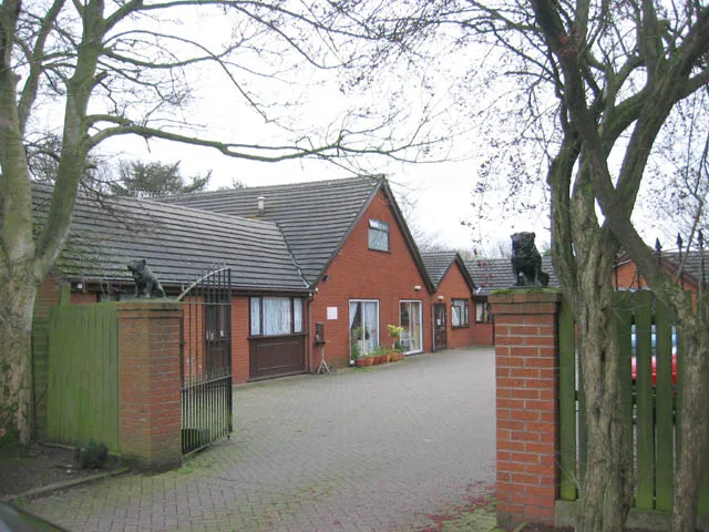
Bus stops
Roads nearby
Brammall Drive150 m
Sping Lodge Avenue200 m
Ridgway Drive250 m
Grindley Roundabout250 m
Pinetree Drive250 m
Portland Close300 m
Meadow Close300 m
Grindley LaneCreda Roundabout, Brammall Drive, Hilltop Crescent, Grange Road, Meir Heath, Rexam Works, Whittle Road
300 m
Villa Meltia300 m
Green Close300 m
Grindley Close350 m
Orchard Rise350 m
Argyll Close400 m
Uttoxeter RoadAdamthwaite Drive, Allan House, Aynsley Sch, Aynsley School, Brammall Drive, Blythe Bridge Nursery, Greenacres Avenue, Blythe Off Licence & Convenience Store, Catchems Corner
400 m
Springfield400 m
Highland Close400 m
Railway TerraceUttoxeter Road Post Office
400 m
Ford Yard400 m
Midway Drive400 m
Highfield Close450 m
Swan Passage450 m
Park View450 m
Fieldway450 m
Calverhay Close500 m
Blythe Close500 m
Pine Court550 m
Adamthwaite Close550 m
Adamthwaite Drive550 m
Rowan Court550 m
Caverswall To Caveleigh FarmCalverleigh Farm Level Crossing
600 m
Willowcroft Rise600 m
Beech Court600 m
Mayfield Drive600 m
Hargreave Close650 m
Buildings nearby
Blythe Bridge Telephone Exchange250 m
Convenience stores nearby
Lloyds Newsagents400 m
Doctor's practice nearby
Trinity Medical Centre350 m
Farmyards nearby
Calverhay Farm450 m
Garage complexes nearby
Adamthwaite Garages550 m
Garages nearby
Ridgeway Drive Garages350 m
Hairdresser's nearby
Mie350 m
Industrial areas nearby
Fords of Blythe Bridge450 m
Plant nurseries nearby
Fernbridge Nurseries350 m
Railway lines nearby
Foxfield Light Railway600 m
Up Goods Loop850 m
Down Goods Loop850 m
Residential areas nearby
Blythe Bridge500 m
Sports pitches nearby
Checkley Parish/Blythe Bridge Crown Green Bowls Club450 m
Streams nearby
River Blythe850 m
Public transport map Fulford Legend
| Railway | |
| Bus | |
| Tram |
Cycling map Fulford Legend
| Cycle path | |
| Cycle lane on road | |
| Cycling on bus lane | |
| Bicycle street | |
| Cyclists allowed | |
| Cyclists allowed, good surface | |
| No cycling | |
| Cobblestones |
| Long-distance cycle route | (depending on scale) | |
| Long-distance cycle route |
Walking map Fulford Legend
| Path |
| Long-distance hiking trail | (depending on scale) | |
| Long-distance hiking trail | ||
| No pedestrians |