
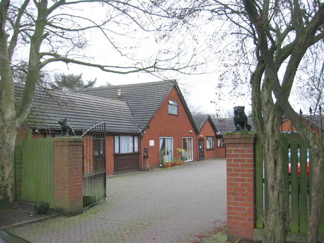
Pilsden Place in Stoke-on-Trent
Pilsden Place in Stoke-on-Trent is a residential street. It crosses Glaisher Drive and ends in a cul-de-sac.
- Road Type
- residential street
Image
Convenience stores
Supermarkets
Social facility
Pet shops
Bus stops
Furniture shops
Butcher's
Kindergarten
Post offices
Fast food restaurants
Hairdressers
Places of worship
Bakeries
Pharmacy
Roads nearby
Faceby Grove100 m
Glaisher Drive150 m
Freckleton Place150 m
Kestrel Avenue200 m
Monyash Close200 m
Farman Close200 m
Tissington Place200 m
Farnborough Drive200 m
Mickleby Way200 m
Halifax Close250 m
Hargreave Close250 m
Blanchard Close250 m
Aldrin Close250 m
Badger Grove300 m
Hermes Close300 m
Bleriot Close300 m
Gosforth Grove300 m
Adamthwaite Close350 m
Willowcroft Rise350 m
Adamthwaite Drive350 m
Greenacres Avenue350 m
Whittle RoadWestbridge Furniture
400 m
Highfield Close400 m
Fieldway450 m
Rowan Court450 m
Blythe Close450 m
Ash Grove450 m
Mayfield Drive450 m
Green Close450 m
Beech Court450 m
Grindley LaneHilltop Crescent, Grange Road, Meir Heath, Creda Roundabout, Brammall Drive, Rexam Works, Whittle Road
500 m
Pine Court500 m
Villa Meltia500 m
Portland Close500 m
Calverhay Close550 m
Grindley Roundabout550 m
Pinetree Drive600 m
Ridgway Drive600 m
William Avenue650 m
Farmyards nearby
Calverhay Farm650 m
Fast food restaurants nearby
McDonald's350 m
Garage complexes nearby
Adamthwaite Garages250 m
Garages nearby
Ridgeway Drive Garages450 m
Hotels nearby
The Weather Vane350 m
Railway lines nearby
Down Goods Loop750 m
Up Goods Loop750 m
Residential areas nearby
Meir Park250 m
Supermarkets nearby
Aldi400 m
Tesco600 m
 Public transport map Stoke-on-Trent Legend
| Railway | |
| Bus | |
| Tram |
 Cycling map Stoke-on-Trent Legend
| Cycle path | |
| Cycle lane on road | |
| Cycling on bus lane | |
| Bicycle street | |
| Cyclists allowed | |
| Cyclists allowed, good surface | |
| No cycling | |
| Cobblestones |
| Long-distance cycle route | (depending on scale) | |
| Long-distance cycle route |
 Walking map Stoke-on-Trent Legend
| Path |
| Long-distance hiking trail | (depending on scale) | |
| Long-distance hiking trail | ||
| No pedestrians |