
Lutterworth Road in Brinklow
Lutterworth Road in Brinklow CP in Rugby is a two-lane, asphalted secondary road. There is no cycle path. It runs in a north-south direction starting from Fosse Way and crosses Main Street and Ell Lane and ends at The Crescent. It connects Stretton under Fosse CP and Brinklow CP. This road is part of the hiking trails ACW Circular Walk 12A (short-cut for C12), ACW Circular Walk 12, ACW Circular Walk 12S and ACW Circular Walk 12B and the long-distance road "Fosse Way". The nearest stop is Cemetery. The bus lines 85 and 85A serve this stop. Lutterworth Road also exists in Burton Hastings CP, Churchover CP, Pailton CP and Wolvey CP.
- Road Type
- secondary road
- Speed Limit
- 30 mph
- Route
- north-south
Image
Bus stops
- bus lines 85, 85A
Roads nearby
The CrescentBrinklow Information and Swap Point
400 m
Town Yard450 m
Hall Grove450 m
Broad StreetWhite Lion, Post Office, Brinklow House, Brinklow Fish Bar, Brinklow Post Office, Brinklow Village Sign
450 m
Barr Lane500 m
Ell Lane550 m
Brinklow Road550 m
Butchers Close700 m
Cathiron Lane800 m
Rugby Road200 Years of Rugby
800 m
Lutterworth RoadWharf
800 m
Coventry RoadGreat Balance, Bulls Head
850 m
Brays Close850 m
Potters Close850 m
Dun Cow Close900 m
Yew Tree HillBrinklow Information and Swap Point
900 m
Rooks Nest950 m
George Birch Close950 m
Colledge Close1000 m
Poppy Close1000 m
Great Balance1,0 km
Skipwith Close1,0 km
Percy Close1,1 km
Green Lane1,1 km
A Coventry Way1,2 km
Pedlar's Bridge1,2 km
Heath Lane1,2 km
Smeaton LanePeter Hall Lane
1,2 km
Colehurst Lane1,6 km
Fosse Way1,6 km
Main StreetHome Farm, Farriers Court
1,6 km
Boatyards nearby
Rose Boatyard850 m
Buildings nearby
Scout Hut600 m
Brinklow Community Hall600 m
Canals nearby
Oxford Canal700 m
Commercial areas nearby
Stretton Stop850 m
Derelict canals nearby
Oxford Canal Brinklow Arm200 m
Doctor's practice nearby
Revel Surgery500 m
Farmyards nearby
The Farm700 m
Brierleys Farm800 m
Goodes Farm1,1 km
Coombe Fields Farm1,6 km
Parks nearby
Brinklow Playing Field650 m
Places of worship nearby
St John the Baptist300 m
Brinklow URC750 m
Pubs nearby
The Raven450 m
The Bulls Head800 m
Railway lines nearby
Trent Valley Line1,1 km
Streams nearby
Smite Brook700 m
Viewpoint nearby
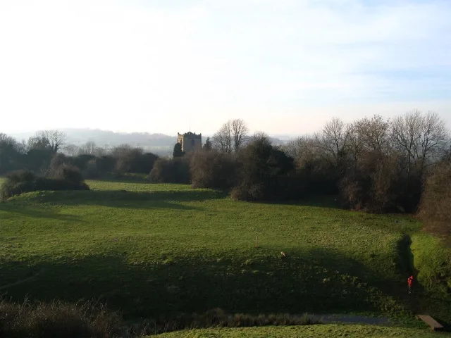
Brinklow Castle300 m
 Public transport map Brinklow CP Legend
| Railway | |
| Bus | |
| Tram |
 Cycling map Brinklow CP Legend
| Cycle path | |
| Cycle lane on road | |
| Cycling on bus lane | |
| Bicycle street | |
| Cyclists allowed | |
| Cyclists allowed, good surface | |
| No cycling | |
| Cobblestones |
| Long-distance cycle route | (depending on scale) | |
| Long-distance cycle route |
 Walking map Brinklow CP Legend
| Path |
| Long-distance hiking trail | (depending on scale) | |
| Long-distance hiking trail | ||
| No pedestrians |