City of Bradford

This page is the City map of Bradford, showing streets, paths and places across the metropolitan borough in West Yorkshire, England. Bradford has city status and covers approximately 366.4 square kilometres. The borough was established in 1974 and had a population of about 537,173 in 2018; population estimates increased from 524,600 in 2012 to 552,644 in 2022. The area includes urban Bradford as well as towns and villages around the Aire, Wharfe and Worth valleys, with 21 mapped subregions.

City map Bradford
BradfordPal1, CC BY-SA 3.0 – Wikimedia Commons
City map Bingley
David Robinson, CC BY-SA 2.0 – Wikimedia Commons

Bingley

Bingley is a market town in the City of Bradford metropolitan borough in West Yorkshire. The town lies in the Aire valley, close to the River Aire and the Leeds and Liverpool Canal.

The Bingley subregion has an administration level of 10 and a recorded population of 23,274. Bingley Five Rise Locks form a notable flight of canal locks on the Leeds and Liverpool Canal.

City map Keighley
Flickr user:Tim Green atouch, CC BY 2.0 – Wikimedia Commons

Keighley

Keighley is a town and civil parish in the City of Bradford, situated in the Aire valley of West Yorkshire. The town is near the confluence of the River Aire and the River Worth.

Keighley has an administration level of 10 and a recorded population of 53,331. The Keighley and Worth Valley Railway connects the town with Haworth, Oakworth and Oxenhope on a preserved standard-gauge railway.

City map Addingham
Tim Green, CC BY 2.0 – Wikimedia Commons

Addingham

Addingham is a village and civil parish in West Yorkshire, on the River Wharfe between Ilkley and Silsden. The settlement lies at the southern edge of the Yorkshire Dales landscape.

The Addingham subregion has an administration level of 10 and a recorded population of 3,784. Its position beside the Wharfe places it within the rural corridor linking Wharfedale with the Bradford metropolitan area.

City map Ilkley
Derek Sains, CC BY-SA 2.0 – Wikimedia Commons

Ilkley

Ilkley is a town and civil parish in West Yorkshire, located on the River Wharfe. Ilkley Moor rises south of the town and is part of the broader Pennine upland landscape.

The subregion has an administration level of 10 and a recorded population of 14,809. Ilkley is known for the Victorian-era Ilkley Old Bridge and for Roman remains associated with the settlement of Olicana.

Burley

Burley is a civil parish in Bradford, West Yorkshire, situated in Wharfedale beside the River Wharfe. The village lies between Ilkley and Menston within the northern part of the City of Bradford.

Burley has an administration level of 10 and a recorded population of 7,257. The local railway station is on the Wharfedale Line, which provides rail connections through the Wharfe valley towards Leeds and Bradford.

City map Menston
Mtaylor848, CC BY-SA 3.0 – Wikimedia Commons

Menston

Menston is a village in Bradford, West Yorkshire, located near the River Wharfe and the northern edge of the metropolitan borough. It lies between Guiseley and Burley in Wharfedale.

The Menston subregion has an administration level of 10 and a recorded population of 4,798. Menston railway station is on the Wharfedale Line, linking the village with Ilkley, Shipley and Leeds.

City map Steeton with Eastburn
Tim Green, CC BY 2.0 – Wikimedia Commons

Steeton with Eastburn

Steeton with Eastburn is a civil parish in West Yorkshire, located in the Aire valley west of Keighley. The parish includes Steeton and Eastburn near the River Aire and the Leeds and Liverpool Canal.

The subregion has an administration level of 10 and a recorded population of 5,209. Steeton and Silsden railway station lies on the Airedale Line, connecting the area with Skipton, Keighley, Shipley and Leeds.

City map Silsden
Betty Longbottom, CC BY-SA 2.0 – Wikimedia Commons

Silsden

Silsden is a town and civil parish in the City of Bradford, West Yorkshire, positioned between Keighley and Ilkley. The town stands near the River Aire and the Leeds and Liverpool Canal.

Silsden has an administration level of 10 and a recorded population of 8,708. Its railway station, shared with Steeton, is on the Airedale Line and serves the transport corridor through the Aire valley.

City map Oxenhope
David Dixon, CC BY-SA 2.0 – Wikimedia Commons

Oxenhope

Oxenhope is a village in West Yorkshire at the head of the Worth valley, south of Keighley. The settlement is surrounded by the Pennine moorland of the South Pennines.

The Oxenhope subregion has an administration level of 10 and a recorded population of 2,575. Oxenhope is the southern terminus of the Keighley and Worth Valley Railway, whose line passes through Haworth and Oakworth.

City map Denholme
Tim Green from Bradford, CC BY 2.0 – Wikimedia Commons

Denholme

Denholme is a town in the Bradford metropolitan borough of West Yorkshire. It lies west of Bradford between the Worth valley and the A629 corridor towards Halifax.

The Denholme subregion has an administration level of 10 and a recorded population of 3,802. Denholme Beck runs through the settlement before joining the wider drainage system of the River Aire catchment.

City map Cullingworth
Decvalts ( talk ), Public domain – Wikimedia Commons

Cullingworth

Cullingworth is a village and civil parish in West Yorkshire, located south of Keighley and west of Bradford. The village stands in the Worth valley near the former route of the Keighley and Worth Valley Railway.

The Cullingworth subregion has an administration level of 10 and a recorded population of 3,513. The surrounding landscape rises towards the South Pennine moors and connects with settlements including Denholme and Oxenhope.

City map Harden
Betty Longbottom, CC BY-SA 2.0 – Wikimedia Commons

Harden

Harden is a village and civil parish in West Yorkshire, situated west of Bingley in the Aire valley. The village is close to the River Aire and the wooded slopes around Harden Moor.

The Harden subregion has an administration level of 10 and a recorded population of 1,850. Harden lies within the northern part of the City of Bradford, between Bingley and Cullingworth.

City map Wilsden
No machine-readable author provided. MGSpiller assumed (based on copyright claims)., CC BY 2.5 – Wikimedia Commons

Wilsden

Wilsden is a village and civil parish in Bradford, West Yorkshire, located between Bradford and Keighley. The settlement stands above the Aire valley and near the historic transport routes linking Bradford with the Worth valley.

The Wilsden subregion has an administration level of 10 and a recorded population of 4,631. Wilsden Moor and the surrounding Pennine slopes form the rural setting west of the Bradford urban area.

City map Baildon
Betty Longbottom, CC BY-SA 2.0 – Wikimedia Commons

Baildon

Baildon is a town and civil parish in Bradford, West Yorkshire, on the northern side of the River Aire. Baildon Moor rises immediately north of the town and forms part of the Pennine landscape.

Baildon has an administration level of 10 and a recorded population of 17,053. The town is located between Shipley and Guiseley, with the River Aire and the Leeds and Liverpool Canal running through the adjoining valley.

City map Clayton
Alan Longbottom, CC BY-SA 2.0 – Wikimedia Commons

Clayton

Clayton is a village and civil parish in the City of Bradford metropolitan borough in West Yorkshire. It lies west of Bradford city centre on elevated ground between the Bradford urban area and Queensbury.

The Clayton subregion has an administration level of 10 and a recorded population of 9,180. Clayton is associated with the high ground and reservoirs of the western Bradford landscape, including the area around Thornton Road.

City map Sandy Lane
Betty Longbottom, CC BY-SA 2.0 – Wikimedia Commons

Sandy Lane

Sandy Lane is a village and civil parish in West Yorkshire, located north-west of Bradford. It lies near the Aire valley settlements of Shipley and Wilsden.

The Sandy Lane subregion has an administration level of 10 and a recorded population of 2,805. Its position places it within the built-up and rural transition zone between Bradford and the northern Pennine foothills.

City map Wrose
David Spencer, CC BY-SA 2.0 – Wikimedia Commons

Wrose

Wrose is a village and civil parish in Bradford, West Yorkshire, situated north of the city and west of Shipley. The settlement lies close to the River Aire corridor and the urban districts around Bradford.

The Wrose subregion has an administration level of 10 and a recorded population of 6,836. Wrose is connected to nearby Shipley and Bradford by the road network across the northern metropolitan borough.

City map Trident
Alan Longbottom, CC BY-SA 2.0 – Wikimedia Commons

Trident

Trident is a civil parish in Bradford, West Yorkshire, with an administration level of 10. The subregion is located within the metropolitan borough surrounding the urban area of Bradford.

Trident has a recorded population of 19,237. Its location belongs to the network of settlements and neighbourhoods in the Bradford district, which extends across approximately 366.4 square kilometres.

City map Shipley
Jon Farman, Public domain – Wikimedia Commons

Shipley

Shipley is a town in the City of Bradford, West Yorkshire, situated where the River Aire and the Bradford Beck valley meet. The Leeds and Liverpool Canal passes through the town alongside the Aire valley transport corridor.

The Shipley subregion has an administration level of 10 and a recorded population of 14,259. Shipley railway station is an important interchange on the Airedale and Wharfedale lines, with routes towards Bradford, Leeds, Ilkley and Skipton.

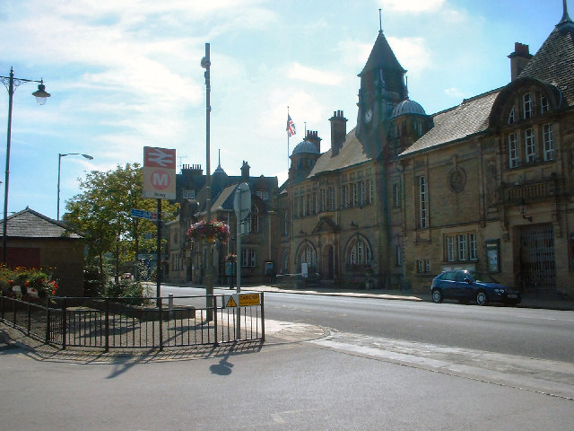
Cross Roads

Cross Roads is a subregion of the City of Bradford in West Yorkshire with an administration level of 10. It lies in the Worth valley area near Keighley and Haworth.

The settlement is located close to the A629 corridor and the South Pennine landscape. Cross Roads is part of the wider network of communities around the River Worth and the preserved Keighley and Worth Valley Railway.

Haworth and Stanbury

Haworth and Stanbury is a subregion in West Yorkshire with an administration level of 10, situated in the Worth valley west of Bradford. Haworth stands on the hills above the River Worth, while Stanbury lies farther along the valley.

The area is closely associated with the Brontë family and the Brontë Parsonage Museum in Haworth, where Charlotte, Emily and Anne Brontë lived and worked. Haworth and Stanbury also lie near the Keighley and Worth Valley Railway, which runs through Oakworth and connects the valley with Keighley and Oxenhope.

Data sources: OpenStreetMap (ODbL), Wikidata (CC0) · Image: Wikimedia Commons

Bradford – Facts

Inhabitants 537173
Area 366.4 km²
Subregions 21
Inception 1974
Located in West Yorkshire
Country United Kingdom
Described by source Encyclopædia Britannica 11th edition
Website https://www.bradford.gov.uk/

Data source: Wikidata (CC0)

Roads in City of Bradford

Roads

Leeds Road
Little Germany W, Leeds Road Carroll Street, Leeds Road Carnegie Drive, Great Northern Junction, Leeds Road Marlborough Road, Leeds Road Fourlands Drive, Leeds Road Mitchell Lane, Leeds Road Ashfield Place, Leeds Road Park Road, Thackley Corner, Salvation Army worship and community hall, Leeds Road Waterloo Pub, Leeds Road Myrtle Street, Leeds Road Walnut Street, Leeds Road Lapage Street, Leeds Road Manse Street, Leeds Road Seymour Street, Leeds Road Allan Street, Leeds Road Cracoe Road, Leeds Road Gladstone Street, Prince of Wales, Wellington Hotel, Undercliffe, Leeds Road Fagley Drive, Leeds Road George Street, Little Germany X, Leeds Road E, Leeds Road Bradford Lane, Leeds Road Thornbury Street, Leeds Road Loxton Lighting, Leeds Road Wensleydale Road, Leeds Road Flexiform, Thornbury, Leeds Road Thornbury Avenue, Leeds Road Marsland Place, Zouk Tea Bar & Grill, Leeds Road, Leeds Road Pianesar Motors, Costcutter, Busy Lane Post Office, Busy Lane Convenience Store, Leeds Road West Royd Avenue, Charlie's Supersave, Thackley Pharmacy, Natural Beauty Studios, Leeds Road Aire Street, Leeds Road Baddeley Gardens, Leeds Road Cyprus Drive, Leeds Road Cyprus Avenue, Leeds Road Cherry Tree Gardens, Leeds Road Overdale Drive, Leeds Road Cote Farm Lane, Leeds Road Glenholme, Leeds Road Dale Grove, Leeds Road Glenside Avenue, Leeds Road Busy Lane, Leeds Road Daleside Road, Leeds Road Wrose Brow Road, Leeds Road Thackley Old Road, S & H Carpets, Banjo's Cafe, Adante, Sweet Tooth Desserts, Pizza Nonna, Hungry Monkey, Beatz and Pointe Dancewear, CUBE Barbers, Leeds Old Road C, Leeds Road Moorside Place
Tong Street
Tong Street Denbrook Avenue, Tong Street Harry Street, Tong Street Melford Street, Tong Street Factory Street, Tong Street Rook Lane, Adult Superstore, Motosave, Tong Street Knowles Street, Speedy Hire, Tong Street Oddy Street, Triumph Fisheries, Bo King, Spice Balti, Tong Street Post Office, Tong Street Parrott Street, Tong Street Edward Street, Tong Street Tennis Avenue, Tong Street Avenue Street, Tong Street Highfield, The Holme Lane, Tong Liberal Club, Selco Builders Warehouse, Reflections Kitchen, Bathroom & Tiles, Plumbase Heating Supplies, Diva Bridal, Beautilicous - Sunbed & Nails, Tasty Snacks, Karen Kutz, Tong Street Convenience Store, Tong Street Fisheries, The Upper Room Church, St Johns, Tong Street (CofE), Lloyds Pharmacy, Tong Plumbing & Electrical Merchants, Carpet Design, Capital Cartridge, Happy Budha Takeaway, ThreeSixy5, Belly Busters, William Hill, Bargain Booze, Mr B's Pizza, Burgers, Kebabs, S.F.C., Curries, Tong Optical Service, Mega-Bites, St Columba's Catholic church, InPost locker, Tong Street Toftshaw Lane, Poundstretcher, Tong Conservative Club, Pet City, Tong Street Prince Street, Betfred, Distinctive Kitchens, Supreme Sandwich Bar, HSBC UK, Step 2, Funnacliffe & Lambert Opticians, De Lacy Hotel, Gentz Hair Studio, Mobile Mart, Tong Motor Spares, Sizzlers Balti House
Great Horton Road
Esso, Great Horton Road Ash Mount, Great Horton Road Union Road, Great Horton Road Derby Street, Great Horton Road Crabtree Place, Great Horton Road Beckside Road, Bharat, Great Horton Road Laisteridge Lane, Great Horton Road Moore Avenue, Great Horton Road Blamires Place, Great Horton Road Southmere Drive, Great Horton Road Bartle Lane, Great Horton Road Bartle Fold, Great Horton Road Ward Street, Great Horton Road Southfield Lane, Great Horton Road Westcroft Road, Norland Guest House, Chowdrey's, Ambala, Mahmood's, Anam's, Great Horton Road St Margarets Road, Great Horton Road Summerville Road, Great Horton Road Old Road, Great Horton Road Hollingwood Lane, Great Horton Road Windermere Terrace, Great Horton Road Windermere Road, The Monkey, Great Horton Road Mannville Terrace, Great Horton Road Grove Terrace, Pepe's Piri Piri, Subway, Omar's, mylahore, Misha Convenience Store, Morrisons Daily, Chicken Curb, Richmond Eatery, Desmond Tutu House, Catholic Chaplaincy, Great Horton Road Ashgrove, Treehouse, Texaco, Boots, Great Horton Road Cooper Lane, Hare And Hounds, Mumtaz, Great Horton Road Noble Street, Great Horton Road Horton Park Avenue
Bolton Road
Cathedral Q, Cathedral R, 450 16554, Eccleshill Library, Bolton Road Lister Lane, Bolton Road Ashbourne Drive, Bolton Road Beaufort Grove, Bolton Road Derwent Road, Bolton Road Grove House Road;450 16559, Bolton Road Grasmere Road, Bolton Junction, Bolton Road Bolton Drive, Bolton Road Undercliffe Road, Bolton Methodist Church, Tesco Express, Nautical Vapes, Bolton Road Lawson Street, Bolton Road North View, Bolton Road Queens Road, Bolton Road Cross Sun Street, Bolton Road Coleman Street, Bolton Road Cranmer Road, Bolton Road Cliffe Road, Bolton Road North View Road
Sunbridge Road
S10 Sunbridge Road, BigImprov - The Bradford Improv Group, Goitside D, Goitside E, S1 Bradford Sunbridge Road, S2 Bradford Sunbridge Road, S3 Bradford Sunbridge Road, S6 Bradford Sunbridge Road, Sunbridge Road S7, S4 Bradford Sunbridge Road, S5 Sunbridge Road Queen Anne Chambers, Sunbridge Road Post Office, The In Plaice, Sunbridge Wells, Tesco Express, Rose & Crown, The Lovefood Deli, Royal Shawarma, SUGI, Empire Barbers, Sunbridge Road Wigan Street, Sunbridge Road Vaughan Street, Sunbridge Road Akam Street, Sunbridge Road Gaynor Street, Sunbridge Road City Road, Sunbridge Road Preston Street, S8 Sunbridge Road, Ambrozja
Barkerend Road
Church Bank Upperpark Gate, Barkerend, The Red House, D Barkerend Road, Barkerend Road Webster Street, Barkerend Health Centre, Barkerend Road Chelmsford Road, Lidl, Barkerend Road Bennie Street, Barkerend Road Harewood Street, Barkerend Road Silkstone Road, Barkerend Road Gilpin Street, Barkerend Road Amberley Street, Barkerend Road Fitzroy Road, Barkerend Road Post Office, Barkerend Pharmacy, Church Bank Upper Park Gate, Barkerend Road Nuttall Road, Barkerend Road Nuttal Road, Barkerend Road Harris Street, Barkerend Road Hill Side Road
Canal Road
Canal Road Hamm Strasse, Cathedral O, Cathedral P, Canal Road North Brook Street, Canal Road Holdsworth Street, Bradford Audi, Canal Road Bolton Lane, Canal Road Midland Terrace, Suzuki, Canal Road Frizinghall Road, Valley Road Frizinghall Road, Canal Road Gaisby Lane, Canal Road Sidings Close, The Flower Pot Restaurant, Bicycle parking, Appleyard, Canal Road Station Road, Volvo, National Tyres and Autocare, Canal Road Kings Gardens, Company Shop
Bridge Street
Stand X Bradford Interchange, Stand Y Bradford Interchange, Bradford Interchange, Bridge Street B1, Birmingham Interchange, The Ginger Goose, Subway, S14 Bridge Street, Moes, Corniche, Stand Z Bradford Interchange, Stand 2 Bradford Interchange, Stand 1 Bradford Interchange, Azuma
Thornton Road
Thornton Road Hollings Road, Thornton Road Brownroyd Street, Thornton Road Fearnside Street, Thornton Road Hockney Road, Thornton Road Rosse Street, Thornton Road Whetley Lane, Terminus Fisheries, Thornton Road Vine Terrace, Thornton Road Ashfield Road, Thornton Road Royd Street, Thornton Road Wensley Bank West, Wensley Bank, Thornton Road Albion Place, Thornton Road New Farm, Thornton Road Close Head Drive, Thornton Cemetery, Thornton Road Keelham, Ashtree House Bed and Breakfast, Ann's Farmhouse, Red Lion, Thornton Road Ingleby Road, Thornton Road Agar Street, Thornton Road Cemetery Road, Thornton Road West Park Terrace, Thornton Road Brighouse Road, Thornton Road Stocks House Farm, Esso, Thornton Road Southlands Grove, Thornton Road Leaventhorpe Lane, Thornton Road Old Road, Thornton Road Thorpe Road, Thornton Road School Green, Thornton Road Chat Hill Road, Thornton Road Churchill Road, Thornton Road Hoyle Ings Road, Thornton Road Coach Lane, Thornton Road Coach Road, Thornton Road Bronte Place, City Park C, Costa, Thornton Road Bell Dean Road, Thornton Road Rhodesway, Thornton Road Oaks Lane, Thornton Road Jesse Street, Thornton Road Lane Ends Close, Thornton Road Olive Grove, Thornton Road Vine Terrace West, Thornton Road Munby Street, Fairweather Green, Four Lane Ends, Thornton, New Inn, The Co-operative Food, Thornton Road Green Lane, Thornton Road Ball Street, Thornton Road Kipping Lane, Great Northern Fisheries, The Blue Boar, Thornton Road City Road, Thornton Road Preston Street, Ivory, Thornton Road Sugden Street, Thornton Road Norcroft Street, Thornton Road Listerhills Road, Thornton Road Listerhills Lane, The Deli
Otley Road
Otley Road Hatfield Road, Otley Road Beldon Place, Otley Road Barmby Road, Otley Road Harrogate Street, Otley Road Wightman Street, Otley Road Chatham Street, Tesco Express, Pizza Hut Delivery, Otley Road Prospect Road, Otley Road Welham Walk, Otley Road Sycamore Close, Otley Road North Wing, Otley Road Rees Way, East Ward Labour Club, Otley Road Heap Lane;450 16830, Otley Road Heap Lane;450 16831, Otley Road Barkerend Road
Valley Road
Next, Valley Road Singleton Street, Valley Road North Home Street, Valley Rd North Holme Street, Greggs, Costa, Subway, tui, Shipley Convenience Store, Valley Road Poplar Road, Valley Road Argyle Street, Valley Road Wallbank Drive, Valley Road Shipley Fields Road, Pit Stop
Killinghall Road
Killinghall Road Higher Intake Road, Killinghall Road Fagley Road, Killinghall Road Fifth Avenue, Killinghall Road Fourth Street, Killinghall Road First Avenue, Killinghall Road Kismet Gardens, Killinghall Road Moor Park Road, A Killinghall Road, Killinghall Road Greenhill Lane, Killinghall Road Folkstone Street, C Killinghall Road, Killinghall Road Harrogate Road, Texaco
Market Street
M3 Bradford Market Street, Market Street M8, Market Street M9, Hotcrazes, A-Star Phones, Barclays, Bradford, Market Street M4, Market Street M5, M6, M6A, M7, M3A Market Street, Pizza Pieces, The Exchange, The Red Shop, Marios
Oak Lane
Freshco, Oak Lane North Park Lane, Oak Lane St Marys Road, Oak Lane Manningham Lane, Eyecare Outlet, Chemist, Lister Park Florist, Charity Shop, Sarahs Interiors, Mahmoods, Marco Polo, Jungle Grill, Mangla Pricecheck, Oak Lane Victor Terrace, Lister Pharmacy
Kings Road
Kings Road Queens Road, Wrose Health Centre Pharmacy, Kings Road Plumpton Close, Kings Road Swain House, Kings Road Bolton, Kings Road Wood Lane, Kings Road Princes Crescent, Kings Road Poplars Park Road, Kings Road Flower Bank, Kings Road Swain House Road, Kings Road Thorndale Rise, Kings Road Brow Wood Crescent
Dick Lane
Dick Lane Lower Rushden Road, Dick Lane Barberry Avenue, Dick Lane Nottingham Street, Gallagher Leisure Park Dick Lane, Lulu the Aagrah Elephant, Dick Lane Arkwright Street, Sandwich Corner, Dick Lane Dudley Street, Sutton House Extra Care home, Dick Lane Sutton Road, Dick Lane Parsonage Road
Rooley Lane
Rooley Lane Wakefield Road, Rooley Lane Bowling Hall Road, Euro Ring Road Service Station (Esso Snack & Shop), Balti Ranch, Rooley Lane Staygate Roundabout, Rooley Lane Bude Road, Rooley Lane Bierley Church, Cross Keys, Ebenezer Methodist Church Centre, Dudley Hill Rooley Lane, McDonald's, Asda, The Red Lion, Rooley Lane Sangster Way, Rooley Lane Bierley Lane, Rooley Lane Croft Leigh Court
Fagley Road
Fagley Road Whitehead Place, Fagley Road Fagley Place, Fagley Road Intake Road, Fagley Pharmacy, Adeel Balti and Pizza Bar, Deli 29, Fagley Road Froisthorpe Mead, Fagley Off Licence, Fagley Road Moorside Road, Fagley Road Falsgrave Avenue, Fagley Road Frodingham Villas, Fagley Road Foston Lane, West Leeds Country Park Green Gateway
Wakefield Road
Wakefield Road Usher Street, Wakefield Road Hartley Street, Wakefield Road Harcourt Street, Wakefield Road Warwick Road, Wakefield Road Lorne Street, Wakefield Road Leicester Street, Wakefield Road Hall Lane, Wolseley, Wakefield Road Lister Avenue, Wakefield Road Sherdian Street, Screwfix, Topps Tiles, Wakefield Road Heaton Street
Manningham Lane
The Bradford Arms, Highfield Cycles, Manningham Lane Spring Bank Place, Manningham Lane Grosvenor Road, Manningham Lane Trafalgar Street, Manningham Lane St Judes Place, Manningham Lane Thurnscoe Road, Manningham Lane Brearton Street, Tesco Express, Cartwright Hotel, Manningham Lane Oak Lane, Manningham Lane Blenheim Road
Huddersfield Road
Odsal Top, Huddersfield Road Abb Scott Lane, Huddersfield Road Woodside Road, Huddersfield Road The Gateways, Huddersfield Road Markfield Drive, Huddersfield Road Carr House Lane, Huddersfield Road Wycoller Road, Huddersfield Road Barraclough Square, Huddersfield Road Back Road, Huddersfield Road Mayfield Avenue, Huddersfield Road / Storr Hill, The Crown, Crown Garage, Huddersfield Road West Croft, Huddersfield Road Hind Street, Huddersfield Road Station Road, Huddersfield Road Green Lane, Huddersfield Road St Marys Crescent, Huddersfield Road Whitehall Road, Huddersfield Road Larch Hill, Huddersfield Road / Lower Wyke Green, Huddersfield Road Bolton Street, Huddersfield Road Lower School Street, Huddersfield Road Netherlands Avenue
Idle Road
The Malt Kiln, Idle Road Bolton Road, Idle Road Myers Lane, Idle Road High House Road, Idle Road Norman Grove, Idle Road Swain House Road, Idle Road Norman Lane, Idle Road Sefton Place;450 16805, Idle Road Pen Close, R Dental Clinic, Khayams, Arny's, jaybee's
Bowling Back Lane
Bowling Back Lane Sticker Lane, Bowling Back Lane Swain Green, Bowling Back Lane Parry Lane, Bowling Back Lane Mount Street, Bowling Back Lane Hammerton Street, Wakefield Road Bowling Back Lane, Bowling Back Lane Bow Beck, Swain Green Tavern, Swain Green
Harrogate Road
Harrogate Road Leeds Road, Harrogate Road Pullan Avenue, Harrogate Road Moorside Road, Harrogate Road Sherwood Place;450 16814, Harrogate Road Sherwood Place, Delights, Harrogate Road Carr Bottom Road, Harrogate Road Fagley Lane, Harrogate Road Park Road, Harrogate Road Ruswarp Crescent, Harrogate Road Cherry Tree Avenue, Harrogate Road Holybrook Avenue, Harrogate Road Tenterfields, Kiplings, Harrogate Road Stockhill Road, Cracker Barrel, Harrogate Road Ravenscliffe Avenue, Harrogate Road Hazlecroft, Studio 38, Harrogate Road Wharncliffe Drive, Harrogate Road Victoria Avenue, Aire Rivers Trust
Cemetery Road
Cemetery Road Glendare Road S, 2nd West, Cemetery Road Glendare Road N, Cemetery Road Necropolis Road SE, Cemetery Road Necropolis Road NW, Cemetery Road Nicholas Close, Let's Grill It, Cemetery Road Mortimer Street S, Cemetery Road Mortimer Street, Cemetery Road Wallis Street, Cemetery Road
Town Gate
Griffe Road Wyke Lane, Town Gate Clare Road, Town Gate Albert Street, Town Gate Oakenshaw Court, Town Gate Worthing Head Road, Wyke Post Office, Lucky Garden, Fratelli, Chi Chini, Kash Kashmiri Indian Takeaway, The Village Fish and Chip Shop, Towngate Kitchen, Top Odd, The Low Odd
Westgate
Westgate D, Westgate E, Mana, Westgate Sedgfield Terrace, Living Islam, Zaffran, High Point A, High Point B, High Point C
St Blaise Way
P3, Boots, Bradford Forster Square, Pets at Home, OneBelow
Broadstone Way
Broadstone Way Tyersal Lane, Broadstone Way Stoneyhurst Square, Broadstone Way Copgrove Road, Broadstone Way Wareham Corner, Broadstone Way Stirling Crescent, Broadstone Way Lymington Drive, Madison Cafe & Takeaway, Holme Church, Morrisons Daily, Adeel's Spice - Pizza & Fisheries
Broadway
Greggs, CeX, German Doner Kebab, PizzaExpress, Wingstop, Specsavers, Popeyes, H12 Broadway, William Hill, Paddy Power
Gain Lane
Shandar, Gain Lane Upper Rushton Road, Gain Lane Fagley Road, Gain Lane Woodhall Road, Gain Lane, Gain Lane Burlington Avenue, Gain Lane Morrisons HQ, Today's Extra
Leeds Old Road
Bradford Moor, Leeds Old Road Upper Rushton Road, Leeds Old Road Thornbury Drive, Leeds Old Road Roydstone Terrace, Leeds Old Road Thornhill Terrace, Leeds Old Road Killinghall Road, Desi Cafe, Leeds Old Road Woodhall Road, Leeds Old Road Melbourne Grove, Leeds Old Road Ruston Avenue
Owlet Road
450 26408, 450 17104, Owlet Road Hollin Road, Owlet Road Pratt Lane, Owlet Road Prospect Avenue, Owlet Road Shipley, Owlet Road Fairbank
Cleckheaton Road
Cleckheaton Road Glenfield Mount, Cleckheaton Road Glenroyd Avenue, Cleckheaton Road Wesley Avenue, Cleckheaton Road Brighouse Road, Cleckheaton Road Tordoff Road, Cleckheaton Road Terry Road, Cleckheaton Road New Works Road, Cleckheaton Road Chapel Road, Cleckheaton Road Hird Road, Cleckheaton Road Taylor Road, JT Hair Design, WK Nails, AJ's Diner, Cleckheaton Road Frogmore Terrace, Cleckheaton Road Oakenshaw, Cleckheaton Road Illingworth Road, Cleckheaton Road Victoria Park, Cleckheaton Road Furnace Road, Oakenshaw Auto & MOT Centre, Low Moor
Bradford Road
Bradford Road Idlecroft Road, Bradford Road Rowantree Drive, Bradford Road Spring Street, Bradford Road Marine Crescent, Bradford Road Cobden Street, Idle Post Office, 450 25574;The Green Hampton Place, Keighley Road Lynthorne Road, Keighley Road Paddock, Biedronka Express, Deli 29, BBQ Bites, Frizinghall Convenience Store, Chunky FC, Frizinghall Pharmacy, B Leeds Road, Bradford Road Five Lane Ends, Bradford Road Sunny Bank Lane
Queen's Road
Queens Road Manningham Lane, Queens Road Midland Road, Queens Road Bolton Lane, Queens Road Station Road, 450 16802;Queens Road Queens Avenue, 450 16803;Queens Road Queens Avenue, Queens Road Harland Close, Low Fold, Queens Road Kings Road
Carr Lane
Carr Lane Hall Lane, Carr Lane Park Road, Carr Lane Oakfield Terrace, Carr Lane Prospect Mount, Carr Lane Hollin Lane
West Royd Road
450 24494, 450 17125, West Royd Road West Royd Mount, West Royd Road West Royd, West Royd Road West Royd Avenue, West Royd
Denby Lane
Allerton, Jerry's Cafe, Age UK, Faizan, Central Fisheries, More Reasons, Paper Works, Pinnacle Hair, Precinct Pharmacy
Spencer Road
Paradise Green, Clayton Pharmacy, Excel, Zain's Cafe and Restaurant, AT Hair Studio, Krahi & Handi Masters, Bila Mini Market, Stitch & Go
Nelson Street
Stand P Bradford Interchange, Stand Q Bradford Interchange, Stand R Bradford Interchange, Stand S Bradford Interchange, Nelson Street N2, Nelson Street N3, Nelson Street N1
Allerton Road
Allerton Road Cote Lane, Allerton Road Ivy Lane, Allerton Road Saffron Drive, Allerton Road Bull Royd Lane, Allerton Road Squire Lane, Four Lane Ends Allerton Road, Allerton Road West Park Road, Allerton Road Pearson Lane, Allerton Road Yew Tree Avenue, Allerton Road Crow Tree Lane, Allerton Road Hedge Close, Allerton Road Hedge Way, Allerton Road Meadowbank Avenue, Allerton Road Denby Lane, Allerton Road Dene Mount, Allerton Road Prospect Terrace, The Hope & Anchor, Alllerton Conservative Club, Ahad's, Allerton Launderette, Allerton Road Chapel Lane, Allerton Road Manscombe Road
Lumb Lane
Lumb Lane Sedgwick Close, Lumb Lane Darfield Street, Lumb Lane Gracechurch Street, Lumb Lane Bowland Street, Lumb Lane Picton Street, Lumb Lane Marlborough Road, Haigys Bar
Inkersley Road
USC, Argos, TK Maxx, Asda Living, ScS, Dreams, Outfit
Ivegate
M2 Bradford Market Street, Wallers Brewery, City Phones, Ivegate Phones, Phone Plus Vapes, Ivegatee Mini Market, The Phone Store
Gaisby Lane
Pharmacy Care Direct, Gaisby Lane Wrose Drive, Gaisby Lane Crimshaw Lane, Gaisby Lane Camellia Court, Gaisby Lane Thornhill Drive, Gaisby Lane Gaisby Mount, Gaisby Lane Powell Road, Gaisby Lane Shipley
New Line
New Line Carr Bottom Road, New Line Sulby Grove, New Line Redcar Road, Greengates Dental, Kebabeesh, Leeds Road Albion Road, The New Line, Boots, Leeds Road Harrogate Road, Costa Coffee, New Line Elder Street, Clarick Pharmacy
Duckworth Lane
Duckworth Lane Daisy Bank, Duckworth Lane Temple Bank School, Duckworth Lane Crow Tree Lane, Bradford Royal Infirmary, Duckworth Lane Prospect Place, Duckworth Lane Duckworth Terrace, Duckworth Lane Little Lane, Duckworth Lane Back Kensington Street, Duckworth Lane Durham Road, Sahara Pharmacy, Oxfam, Deli passion, Cross Roads Opticians, Eco Home Interiors, Cinderella's
Moore Avenue
Moore Avenue Ashtree Grove, Moore Avenue Poplar Grove, Moore Avenue Kenley Avenue, Moore Avenue Kenmore Road, Moore Avenue Enfield Parade, Moore Avenue Enfield Place, Moore Avenue Mount Road
Bolton Lane
Bolton Lane Ashbourne Crescent, Bolton Lane Queens Avenue, Bolton Lane Whiteways
Lilycroft Road
Lilycroft Road Westfield Road, Lilycroft Road Farcliffe Road, Lilycroft Road Police Hq, Westfield Garage, Nafees Bakers, Lilycroft Road Post Office, 1838 Thrift Store, Manningham Mills Community Centre, Lister's Coffee House
Haworth Road
Haworth Road High Park Drive, Haworth Road Brantwood Drive, Haworth Road Lynfield Drive, Haworth Road Thorn Drive, Haworth Road Sowden Road, Haworth Road Heights Lane, Happy Garden, Boots, Pizza Nuovo, Tesco Express, Haworth Road Post Office, Sandwich Bar
Whetley Lane
Whetley Lane Hollings Road, Patson, Whetley Lane Beaumont Road, Chach Valley, Hairbase, Sinchro Motor Co, Whetley Medical Centre, Whetley Lane Weetwood Road
Crag Road
Crag Road Owlet Road, Crag Road Shipley, Crag Road Rochester Street, Crag Road Poplar Road, Crag Road Fair Bank, Crag Road Marion Drive, Crag Road Carr Road, Crag Road Carr Lane
Church Bank
Cathedral S, W E Forster, Cathedral N, Bradford Arts Centre, Cathedral T, Guzelian Cafe/Bar/Gallery
Claremont
Claremont Morley Street, McColl's, Delius, Belgian Fries, Halo Cafe, Masjid Doha
Ashbourne Road
Ashbourne Road Ashbourne Haven, Ashbourne Road Ashbourne Avenue, Ashbourne Road Ashbourne Bank, Ashbourne Road Ashbourne Oval, Ashbourne Road Bolton
Sticker Lane
Sticker Lane Fearnville Drive, Sticker Lane St Marys Road, Sticker Lane Morton Road, Sticker Lane Bowling Back Lane, Sticker Lane Post Office, Mo's Munch Cafe
Cheapside
Cheapside L, Cheapside N9, Fibres, Forster Square K, Forster Square J, Forster Square H
Frizinghall Road
Frizinghall Road Buxton Lane, Frizinghall Road Ferndales Grove, Frizinghall, My Thai, Sultans Restaurant, Frizinghall Road Rydal Avenue, Frizinghall Road Frizley Gardens, Nicholas Noble, Frizzy Stores, Frizinghall Road Keighley Road
Cutler Heights Lane
Sticker Lane Heshbon Street, Cutler Heights Lane Challenge Way, Cutler Heights Lane Pitts Street, R.W. & S. Hall - Newsagents & Convenience Store, West Yorkshire Police Data Centre
Grove House Road
Best-one, Grove House Road Ashbourne Way, Grove House Road Myers Lane, Grove House Road Bolton
Holmewood Road
Holme Wood Road Dulverton Grove, Holme Wood Road Sandmead Close, J J Moores, Holmewood Pharmacy
Fenby Avenue
Fenby Avenue Cutler Heights Lane, Fenby Avenue Bertie Street, Chahal Store
Prince's Way
Cake 'ole, Pictureville Cinema, City Park A, City Park B, The Baby of the North
Charles Street
Zizzi, Pret a Manger, Metro Bank, TSB, Boots
Highfield Road
Balloon & Basket, Idle National Spiritualist Church, Town Lane Idle, Highfield Road Back Lane, Highfield Road Green Lane, Highfield Road Leyton Terrace, Highfield Road Ley Fleaks Road, Highfield Road Santa Monica Road, Highfield Road Wendrow Way, Highfield Road Doctor Hill, Highfield Road The Stray, Highfield Road Woodsley Road, Highfield Road Highfield Grove
High House Road
High House Road Kestral Mount, High House Road Myers Avenue, High House Road Greenwood Drive, High House Road High House Avenue, High House Road Bolton
Hustlergate
Waterstones, Tiffin Coffee, Café W, Regal Salons, Speakers' Corner
Bell Dean Road
Allerton Pharmacy, Bell Dean Road Avocet Close, Bell Dean Road Marmion Avenue, Bell Dean Road Wallingford Mount, Bell Dean Road Greenway Drive, Bell Dean Road Bracewell Avenue, Bell Dean Road Roxburgh Grove, Bell Dean Road Saffron Drive, My:Skyn Clinic, Manor Medical Practice
Skinner Lane
Stylo Cuts, Blitz, Skinner Lane Rosebery Road, Fern Tree Electricals
Wrose Brow Road
Wrose Brow Road West Royd, Wrose Brow Road Raistrick Way, Wrose Brow Road Windhill First School
Bowling Hall Road
Bolling Hall Museum, Bowling Hall Road Flockton Drive, Bowling Hall Road Lister Avenue, Bowling Hall Road Rooley Lane, Bowling Hall Road Burras Road
Hall Ings
H11 Bradford Hall Ings, H7 Hall Ings Bank Street, Hall Ings H9, Foundation Stones Sculpture, Hall Ings H7
Chapel Street
JoJo's, Chair and clock, Thornton Methodist Church, George III, Bradford Playhouse
John Street
J6 John Street, Fulton's Foods, J2 John Street, Rawson Square H
Kenley Parade
Kenley Parade Fairway, Kenley Parade Beldon Park Avenue, Kenley Parade Fairway Drive
Hollybank Road
Hollybank Road Hollingwood Lane, Hollybank Road Hollybank Grove, Hollybank Road Brackenhill Drive
Brighouse Road
Brighouse Road Queensbury Golf Club, Brighouse Road Ridgeway, Brighouse Road / Sandbeds, Brighouse Road High Street, Firths Cyles, Brighouse Road Jackson Hill Lane, Robertshaw's Bakery Cafe
Stony Lane
Eccleshill, Youth & Community Centre, Ukrainian Autocephalic Orthodox Church, The Royal Oak, Eccleshill W.M.C., Stony Lane Institute Road, Stony Lane Post Office Road