
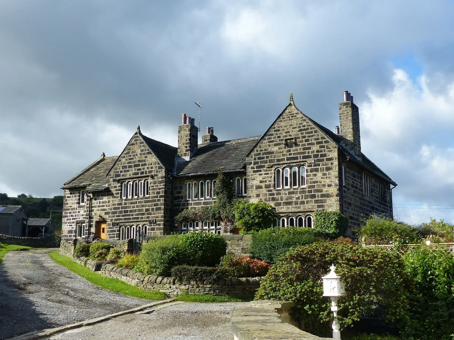
Binn Royd Farmhouse in Calderdale
Binn Royd Farmhouse in Calderdale is a house. Binn Royd Farmhouse is near Hollas Lane.
- Building Type
- house
Image
Roads nearby
Hollas Lane400 m
Donkey Bridge450 m
Goose Pond Lane450 m
Wakefield RoadWakefield Road, Wakefield Road Walker Lane, Donaldson Vets Sowerby Bridge, Wakefield Road / Wood Street, Wakefield Road Knowle Top Road, Wakefield Road St Giles Road, Wakefield Road Roydlands Terrace, Wakefield Road Lightcliffe J & I School, Fryer Tuck Inn, Wakefield Road Cooper Bridge, Wakefield Road / Cooper Bridge, Wakefield Road Coal Pit Lane, Wakefield Road Locksley Road, Wakefield Road Sherwood Road, Bailiff Bridge / Wakefield Road, Bailiff Bridge, Wakefield Road Ripley Street, Wakefield Road Stoney Lane, Wakefield Road / Lightcliffe, Sun Inn, Wakefield Road Stainland Road, Wakefield Road Smith / House Lane, Wakefield Road Copley Grove, Wakefield Road Cow Lane, Wakefield Road Grove Street, Wakefield Road Washer Lane, Wakefield Road Canal Road, Wakefield Road Hollas Lane, Copley, The Volunteer Arms
600 m
Woodhouse LaneWoodhouse Lane
600 m
Hebble Avenue600 m
North Dean Road600 m
Railway Terrace650 m
Dean Court650 m
Lydbrook Park700 m
St. Stephen's Street700 m
Beck Road750 m
Barge Avenue750 m
Copley Valley Road750 m
Milner Royd LaneMilner Royd Junction, Milner Royd
800 m
Birdcage Hill850 m
Birdcage LaneBirdcage Lane Skircoat Moor Road, Albert Promenade
900 m
Gleddings Close900 m
Scarr Bottom RoadScarr Bottom Road Birdcage Hill, Scarr Bottom Road, Scarr Bottom Road Delph Hill Road
950 m
Albert PromenadeEdie the Estafette
950 m
Rocks Road1000 m
Buildings nearby
Spice Cake Barn350 m
The Coach House400 m
Pickwood House Farm400 m
Upper Tinker Hey400 m
Pickwood Grange400 m
Pickwood House400 m
Puntle Hall400 m
Green Head450 m
Tinker Hey450 m
Lower Wat Ing500 m
Upper Wat Ing500 m
Lloyds Banking Group Copley750 m
Canals nearby
Calder & Hebble Navigation Sowerby Cut750 m
Cliffs nearby
Woodhouse Scar950 m
Forests nearby
Long Wood850 m
Industrial areas nearby
Copley Valley Business Park750 m
Industrial buildings nearby
Wm. Hayes550 m
P.L.S.550 m
GWD Convenience Distribution Ltd650 m
Develop DSales (UK) Ltd700 m
Communisis PLC750 m
Nature reserves nearby
Long Wood and Scarr Wood Local Nature Reserve950 m
Pavilions nearby
Copley Cricket Club750 m
Railway lines nearby
Caldervale Line350 m
Residential areas nearby
Calder View700 m
Rivers nearby
River Calder500 m
Streams nearby
Maple Dene Clough200 m
Woodlands nearby
Scarr Wood900 m
| Heritage designation | Grade II listed building |
|---|---|
| Located in | Calderdale |
| Country | United Kingdom |
| Location | Norland Town |
 Public transport map Calderdale Legend
| Railway | |
| Bus | |
| Tram |
 Cycling map Calderdale Legend
| Cycle path | |
| Cycle lane on road | |
| Cycling on bus lane | |
| Bicycle street | |
| Cyclists allowed | |
| Cyclists allowed, good surface | |
| No cycling | |
| Cobblestones |
| Long-distance cycle route | (depending on scale) | |
| Long-distance cycle route |
 Walking map Calderdale Legend
| Path |
| Long-distance hiking trail | (depending on scale) | |
| Long-distance hiking trail | ||
| No pedestrians |