
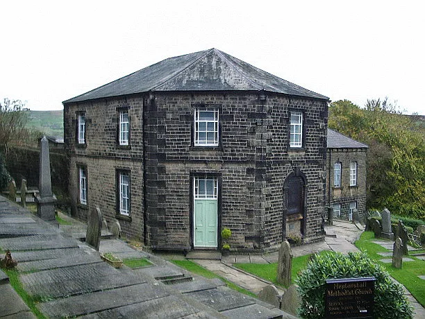
Wesleyan Methodist Chapel in Heptonstall
Wesleyan Methodist Chapel in Heptonstall in Calderdale is a Methodista church, Northgate (HX7 7ND). It is also known as Heptonstall Methodist Church and is a listed building.
- Postal Code
- HX7 7ND
- Street
- Northgate
- Amenity
- place of worship
- Building Type
- building
Image
Hofläden
Campsite
Bus stops
Roads nearby
Townfield View50 m
Northfield Terrace50 m
Northfield50 m
Tinker Bank Lane100 m
Northgate100 m
Wadsworth View100 m
Whitehall Fold100 m
Townfield Lane100 m
Cooperative Terrace100 m
Cliffe Street100 m
Caycroft Nook100 m
Swan Fold100 m
TowngateThe Cross Inn, The White Lion
100 m
Churchyard Bottom150 m
Church LaneHeptonstall
150 m
Church Street150 m
Weavers Square200 m
Hepton DriveHepton Drive Longfield, Hepton Drive
200 m
North Well200 m
Heptonstall RoadHeptonstall Smithwell Lane, Towngate Tearoom, Heptonstall Road
200 m
Silver Street250 m
West Laithe250 m
Back Lane250 m
Valley View Road300 m
Lilly Hall350 m
LongfieldHeptonstall Longfield
350 m
Becketts Close400 m
Lee Wood Road400 m
SouthfieldSouthfield
400 m
Acres Lane400 m
Smithwell LaneSmithwell Lane Heptonstall J&I School, Smithwell Lane Lane Head, Smithwell Lane Green Lane, Heptonstall Smithwell Lane
500 m
Eaves Avenue600 m
Brookside750 m
Eaves Road800 m
Campden Road850 m
Glen View RoadMytholm
850 m
Mytholm Bank850 m
Buildings nearby
Church Hall50 m
Heptonstall Social and Bowling Club500 m
Bank Terrace850 m
Museum nearby
Heptonstall Museum150 m
Picnic site nearby
Pinfold100 m
Places of worship nearby
Saint Thomas's Church250 m
Saint James800 m
Post offices nearby
Heptonstall Post Office150 m
Quarries nearby
Heptonstall Quarry600 m
Rivers nearby
Colden Water700 m
School buildings nearby
Hebden Royd Primary School800 m
Sports pitches nearby
Heptonstall/Mytholmroyd Crown Green Bowls Club550 m
| Heritage designation | Grade II* listed building |
|---|---|
| Located in | Heptonstall |
| Country | United Kingdom |
 Public transport map Heptonstall Legend
| Railway | |
| Bus | |
| Tram |
 Cycling map Heptonstall Legend
| Cycle path | |
| Cycle lane on road | |
| Cycling on bus lane | |
| Bicycle street | |
| Cyclists allowed | |
| Cyclists allowed, good surface | |
| No cycling | |
| Cobblestones |
| Long-distance cycle route | (depending on scale) | |
| Long-distance cycle route |
 Walking map Heptonstall Legend
| Path |
| Long-distance hiking trail | (depending on scale) | |
| Long-distance hiking trail | ||
| No pedestrians |