
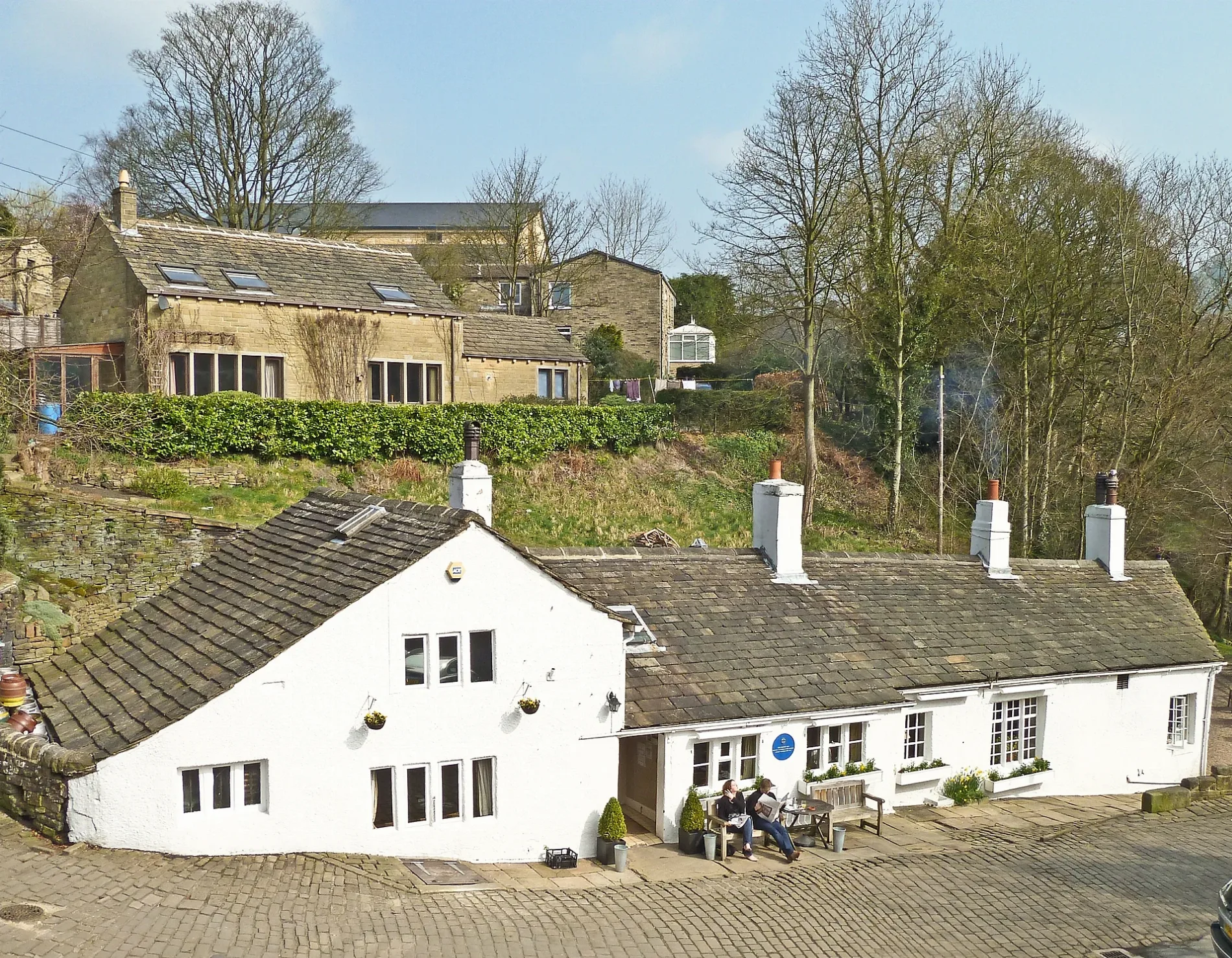
Old Bridge Inn in Ripponden
Old Bridge Inn in Ripponden in Calderdale is a pub, Priest Lane (HX6 4DF) 🌐.
- Postal Code
- HX6 4DF
- Street
- Priest Lane
- Amenity
- pub
- Building Type
- building
- Website
- https://theoldbridgeinn.co.uk/
Image
Bus stops
Roads nearby
Old Bank50 m
Priest Lane50 m
Elland RoadRipponden Elland Road, Elland Road Oldham Road, Ripponden New Bank Bank Hey Bottom Lane, Elland Road School Close
100 m
Mill View100 m
Mill Fold100 m
Hirstwood100 m
Rochdale RoadIndii Brew, Rochdale Road Small Lees Road, Rochdale Road Bird Lane, Rochdale Road, Rochdale Road Stones Drive, Rochdale Rd Stead Lane, Rochdale Road Nursery Lane, Rochdale Road Dowry Lane, Rochdale Road Hollin Lane, Rochdale Road Blue Ball Lane, Turvin Road
150 m
Oldham RoadOldham Road, Oldham Road Holly Crescent, Oldham Road Small Lees Road, The Last Post, Heathfield School, Rishworth, Rishworth School, Oldham Road Rishworth, Oldham Road Rishden, Oldham Road Moselden Lane, Booth Wood
150 m
Back Fold150 m
Upper Brig Royd150 m
Back Lane200 m
Maude Lane200 m
Coach Road200 m
School Close250 m
Mill Fold WayRipponden
250 m
Fountain Street250 m
Royd LaneRoyd Lane Halifax Road, Royd Lane Maude Lane
300 m
Hanging Stones Lane300 m
Brig Royd300 m
Spring Street300 m
Halifax RoadHalifax Road, Halifax Road Ripponden J & I School, Halifax Road Kebroyd, Halifax Road Royd Lane, Ripponden Brig Royd
350 m
Birks Lane400 m
Ripponden New BankElland Road North View, Elland Road, The Fleece, The Fleece Inn, Ripponden New Bank Fiddle Lane, Ripponden New Bank
400 m
Spinners Hollow450 m
Bank Hey Bottom Lane450 m
Meadowcroft Lane450 m
Ripponden Old Bank500 m
Small Lees RoadRochdale Road Small Lees Road
500 m
Stony LaneStony Lane
600 m
Church Lane700 m
Ryburn Lane750 m
Cow Lane800 m
Silk Mill Chase800 m
Highfield Terrace800 m
Soyland Town RoadSoyland Town, Soyland Town Road
850 m
Hob LaneCross Wells Road
900 m
Cross Wells RoadCross Wells Road New Moor, Cross Wells Road, Cross Wells Road Royd Lane
900 m
High Field Lane1000 m
Abandoned railways nearby
Rishworth Branch550 m
Buildings nearby
JLA Limited500 m
Cemeteries nearby
Ebenezer Methodist Chapelyard700 m
Places of worship nearby
St Bartholomew's Parish Church100 m
Public toilets nearby
Ripponden100 m
Pubs nearby
Ripponden Conservative Club150 m
The Lion150 m
The Beehive Inn750 m
Residential buildings nearby
Over The Bridge Restaurant50 m
School buildings nearby
Ripponden Junior & Infant School250 m
Supermarkets nearby
Co-op Food250 m
| Located in | Ripponden |
|---|---|
| Country | United Kingdom |
 Public transport map Ripponden Legend
| Railway | |
| Bus | |
| Tram |
 Cycling map Ripponden Legend
| Cycle path | |
| Cycle lane on road | |
| Cycling on bus lane | |
| Bicycle street | |
| Cyclists allowed | |
| Cyclists allowed, good surface | |
| No cycling | |
| Cobblestones |
| Long-distance cycle route | (depending on scale) | |
| Long-distance cycle route |
 Walking map Ripponden Legend
| Path |
| Long-distance hiking trail | (depending on scale) | |
| Long-distance hiking trail | ||
| No pedestrians |