
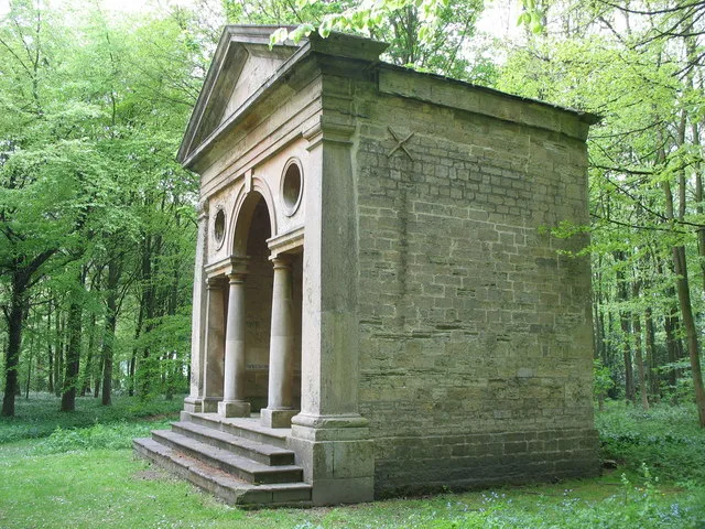
Open Temple in Bramham cum Oglethorpe
Open Temple in Bramham cum Oglethorpe in Leeds ist ein historisches Objekt. Open Temple is near Lord Bingley's Walk.
- Building Type
- building
Image
Post offices
Bus stops
Roads nearby
Lord Bingley's Walk500 m
Broadwalk700 m
South Approach800 m
Mangrill Lane800 m
Bramham RoadChurch Hill Kirkfield Avenue, Church Hill Kirkfield Lane, Bramham Road
1,0 km
Thorner RoadBramham Road
1,1 km
Thorner Lane1,4 km
York RoadRed Bus Lay-By, Kiddal Bridge, York Road Park House farm, York Road, York Road Scholes Lane, York Road Kiddal Hill Farm, Morwick Farm, York Road Thorner Lane, York Road Morwick Farm -
1,6 km
Kiddal Lane Cottages1,7 km
Bramham Lane1,8 km
Ellerker Lane2,0 km
Ellerker Road2,1 km
Kirkfield Lane2,2 km
Body of waters nearby
T-Pond300 m
Obelisk Pond550 m
Wothersome Lake950 m
Buildings nearby
Gothic Temple350 m
Bramham House550 m
Round House1,0 km
Temple Of Lead Lads1,2 km
Hope Hall1,7 km
Bunkers nearby
Starfish2,1 km
Chapels nearby
Bramham Park Chapel600 m
Ditches nearby
Brickpond Runner1,9 km
Farmhouses nearby
Norwood House1,6 km
Farmlands nearby
Kiddal Lane End Farm1,7 km
Farmyards nearby
Terry Lug Farm900 m
Nova Scotia1,0 km
Park House Farm1,5 km
Norwood House Farm1,5 km
Kellfield Grange1,6 km
Whitewell Farm2,0 km
Kiddal Hall Farm2,3 km
Forests nearby
Terry Lug Plantation700 m
Parks nearby
Bramham Park1,7 km
Residential areas nearby
Park House Farm Cottages1,6 km
Bar Farm House2,0 km
Streams nearby
Milner Beck1,0 km
Bramham Beck1,1 km
Openrakes Beck1,7 km
Woodlands nearby
Privet Plantation450 m
Thorner Moor Plantation650 m
Wellhill Plantation1,3 km
Young Pickhill Rash1,4 km
Old Pickhill Rash1,4 km
Dawsonfield Plantation1,5 km
Oldroad Plantation1,5 km
Stubbing Moor Plantation1,7 km
Beccamoor Plantation2,1 km
| Heritage designation | Grade I listed building |
|---|---|
| Located in | Bramham cum Oglethorpe |
| Country | United Kingdom |
 Public transport map Bramham cum Oglethorpe Legend
| Railway | |
| Bus | |
| Tram |
 Cycling map Bramham cum Oglethorpe Legend
| Cycle path | |
| Cycle lane on road | |
| Cycling on bus lane | |
| Bicycle street | |
| Cyclists allowed | |
| Cyclists allowed, good surface | |
| No cycling | |
| Cobblestones |
| Long-distance cycle route | (depending on scale) | |
| Long-distance cycle route |
 Walking map Bramham cum Oglethorpe Legend
| Path |
| Long-distance hiking trail | (depending on scale) | |
| Long-distance hiking trail | ||
| No pedestrians |