
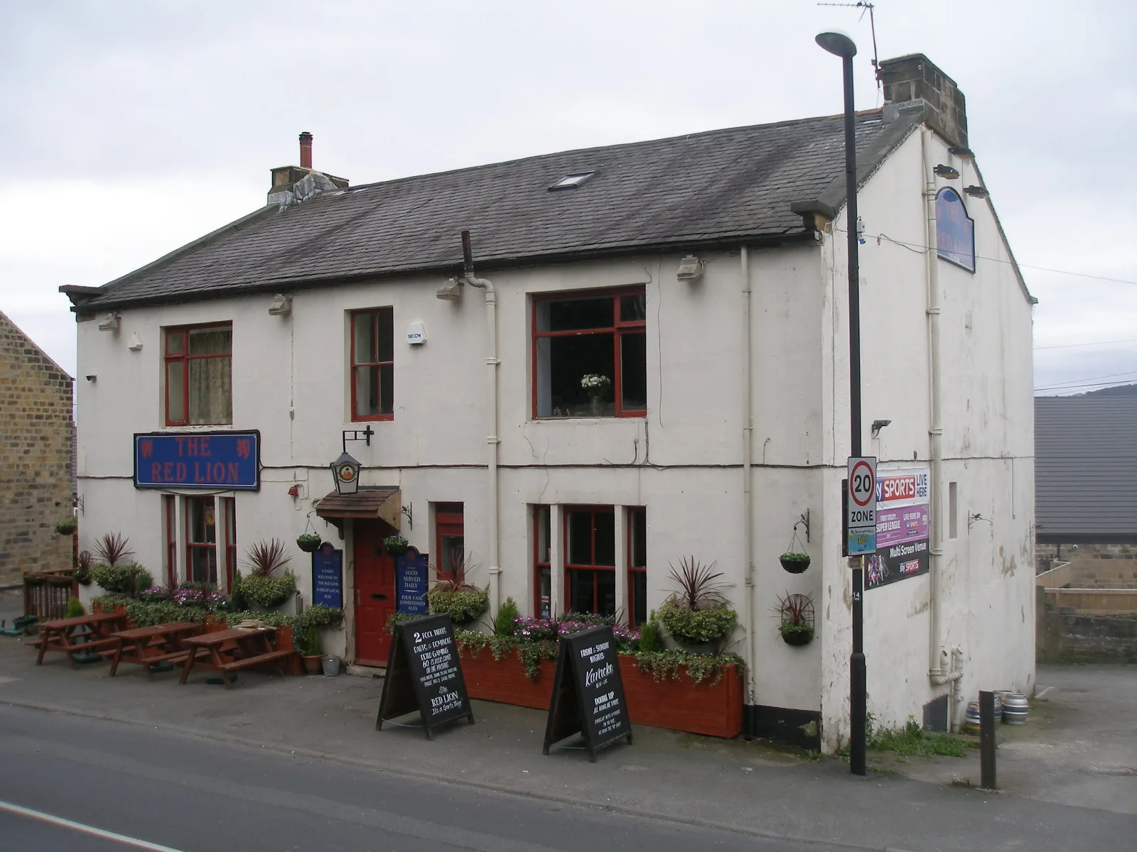
Red Lion in City of Leeds
Red Lion in Leeds is a pub. Red Lion is near Jacquard Gardens. Red Lion also exists in Greater Manchester, Greater London, West Midlands, Cambridgeshire and Peterborough and South Yorkshire.
- Amenity
- pub
- Land Use
- retail area
Image
Roads nearby
Well Lane50 m
Cambridge Street100 m
Heddles Mews100 m
Cartwright Avenue100 m
Tweedales CourtGuiseley
100 m
Town GateTowngate Chapel Street, Towngate Woodhall Road, Towngate, Town Gate Church Street, Denison's
150 m
Butts Terrace150 m
Greencroft Mews150 m
Butts Lane150 m
Lands LaneTK Maxx, Caffè Nero, iMobile, Whittard of Chelsea, Cancer Research UK, Luxury Nails, Abbassi Street Food, Card Factory, Costa, Farmhouse, Cotswold Outdoor
150 m
Jacquard Gardens150 m
Oxford StreetReflections Community Support, Flowers By Karen, The West Yorkshire School of Performing Arts, NJC Hair, Treatment Zone, The Office Saloon, The Mulberry Tree
150 m
Orchard Lane200 m
Well Terrace200 m
Well View200 m
South ViewWood Nook Fish Bar, Beechwood Hair Studio, Cup Nineteen, Sparta Greek Food, Blossoms
200 m
Well StreetOscar's Barber Shop, Jasper's, Aesthetic Angels
200 m
Orchard Way200 m
Spring Bank Terrace200 m
Wells Grove200 m
Springfield Terrace250 m
Jubilee Walk250 m
Wells Mount250 m
Springfield Place300 m
Otley RoadCardfactory, Otley Road Lawnswood, Otley Road Ring Road West Park, Lawnswood School, Otley Road St Chads Drive, Caffeine Addict, Headingley Arndale Centre, British Heart Foundation, Burger King, Boots, 21 Co, Superdrug, Thyme Restaurant, Heavenley Desserts, The Den, Otley Road Welburn Grove, Otley Road Kingsley Drive, Adel, Otley Road Holt Lane, Otley Road The Crescent, Otley Road New Adel Lane, Otley Road Greenfield Court, Woodends Of Adel, The Foundation, Dastaan, Acorns In Adel, Star Anise, Leeds St Helens Lane, Headingley Lane Glen Road, Otley Road St Chads Road, Audio Republic, Flourish, Otley Road Lawnswood Sports Club, Otley Road Lawnswood Crematorium, Welcome to Bingley, Otley Road Lawns Hall Close, Otley Road Guiseley Libaray, Guiseley Morrisons, Sancerre, Tony Woods Family Butchers, Timpson, Morrisons Cafe, My Vision, Guiseley White Cross, Otley Road Ings Lane, Otley Road Back Lane, Otley Road Guiseley Retail Park, Subway, Guiseley's Co-op, Pizza House, Windsor Interiors, Bellissima Exclusive, Guiseley Community Events, Otley Road Otley Old Road, Otley Old Road Lawnswood, Yazz Number One Hair Salon, Yazz Barbers, Onward Brews & Goods, Corner House Cafe, Philip Kirby, Sue Ryder, Juno, Lister's, Summer Nails, Guiseley Pizza And Kebab, Spring Field Mills, St. Gemma's Hospice, Lounge, Morrisons Travel Money, Sainsbury's, Greggs, PizzaExpress, Costa, Santorini Bar & Grill, Olympus, The Gin Room, Magic VAPE, The Cats Pyjamas, Otley Road St Annes Road, LS1 Dental, Guiseley Station Hotel, Otley Road Morton Terrace, Guise & Dolls, Robson Interiors, Morgan Travel, The Hoptimist, Mr Men's, Blue Residential, Leeds Road, Otley Road Kepston Road, Otley Road Ancaster Road, Otley Road Churchwood Avenue
400 m
The GreenMumbai Village, The Green Aireborough Leisure Centre, Flavour, Guiseley Library, The Cutting Crew, Tuana Bar & Restaurant, The Green, Bupa Dental Care, First Floor Club
400 m
Shops nearby
LPS Heating & Plumbing350 m
Bars nearby
Coopers350 m
Buildings nearby
The Parish Room100 m
Alexander House200 m
UGP300 m
Cafés nearby
Costa400 m
Community centres nearby
1st Guiseley Guide Headquarters200 m
15th Airedale St Oswalds Scout Group250 m
Doctor's practice nearby
Park Road Medical Centre400 m
Fast food restaurants nearby
Lotus Chop Suey House350 m
Office buildings nearby
CRS250 m
Parks nearby
Memorial Garden150 m
Springfield Park350 m
Places of worship nearby
Guiseley Methodist Church200 m
Guiseley Baptist Church250 m
Railway lines nearby
Ilkley Branch300 m
Residential areas nearby
St Oswald's Terrace100 m
Laurel Bank Bungalows250 m
Bedford Place300 m
Retail areas nearby
Oxford PlaceAlternatively Vegan
150 m
Social facilities nearby
Orchard Court200 m
Sports centres nearby
Aireborough Leisure Centre200 m
Other nearby
Prospect Buildings200 m
| Located in | Leeds |
|---|---|
| Postal code | LS20 9BB |
| Country | United Kingdom |
 Public transport map Leeds Legend
| Railway | |
| Bus | |
| Tram |
 Cycling map Leeds Legend
| Cycle path | |
| Cycle lane on road | |
| Cycling on bus lane | |
| Bicycle street | |
| Cyclists allowed | |
| Cyclists allowed, good surface | |
| No cycling | |
| Cobblestones |
| Long-distance cycle route | (depending on scale) | |
| Long-distance cycle route |
 Walking map Leeds Legend
| Path |
| Long-distance hiking trail | (depending on scale) | |
| Long-distance hiking trail | ||
| No pedestrians |