
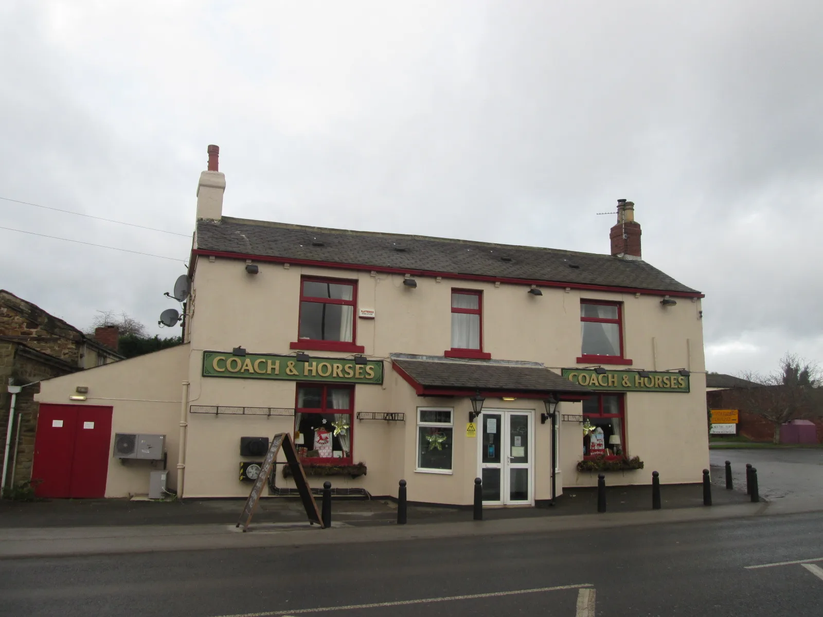
The Coach and Horses in City of Leeds
The Coach and Horses in Leeds is a pub, Wakefield Road 71 (LS26 0SF). The Coach and Horses also exists in Gloucestershire and Staffordshire.
- House Number
- 71
- Postal Code
- LS26 0SF
- Street
- Wakefield Road
- Amenity
- pub
- Building Type
- building
Image
Roads nearby
Glebe Court100 m
Knavesmire150 m
Angel Row150 m
Kingsfield200 m
Castlefields200 m
Fairfield Grove250 m
Middleton Avenue300 m
Middleton LaneMiddleton Lane Lower Thorpe Lane, Middleton Thorpe Hotel Thorpe On The Hill, Middleton Lane, Middleton Lane Towcester Avenue, Middleton Lane Winthorpe Avenue
300 m
Fairfield Close300 m
Linden Court300 m
Fairfield Lane300 m
Fairfield Gardens350 m
Leeds RoadWakefield Road Ashton Terrace, Wakefield Road Sharp Lane, Leeds Road Sharp Lane, Leeds Road Leadwell Lane, Leeds Road Sherwood Industrial Estate, Leeds Road Goldsmith Drive, Leeds Road Valentine Mews, Leeds Road Westgate Lane, Leeds Road, Leeds Road Park Avenue, Park Drive, King Caribbean Kitchen, Star Balti, Leeds Road Wood Row, Methley Lane Fleet Lane, Leeds Road Church Lane, New Road Dibb Lane, Leeds Road Pawson Street, Leeds Road The Green, New Road Nunroyd Avenue, New Road Kirk Lane, Lofthouse Jumbles Lane, Leeds Road Church Farm Close, Leeds Road Carlton Lane, Leeds Road Church, The Lofty Cafe, Leeds Road Temple Court, John O Gaunts, Rothwell Local Store, Leeds Road Rothwell Lane, Leeds Road Haigh Road, Leeds Road Park Lane, Leeds Road Parkways, Leeds Road Holmsley Lane, Welcome Way
350 m
Fairfield Drive350 m
Wakefield RoadWakefield Road, Wakefield Road Glebe Farm, Wakefield Road Middleton Lane, Wakefield Road Queen Street, Wakefield Road Valley Park Estate, Wakefield Road Wood Lane, Jawbones Tattoo, Wakefield Road Glebe Court, Wakefield Road Angel Row, Miller & Carter, Wakefield Road Barleyhill Road, Wakefield Road Cyprus Road, Moorfield House Surgery, Nicholas and Fisher, Aberford Road Pennington Lane, Wakefield Road Pontefract Road, C, B, Wakefield Road Oulton Drive, Garforth Bridge, Wakefield Road Alandale Crescent, Corner Shop
350 m
Matty Lane350 m
Hopefield Close400 m
Hopefield Crescent400 m
Hopefield View400 m
Hopefield Mews400 m
Hopefield Place450 m
Hopefield Green450 m
Hopefield Court450 m
Hopefield Walk500 m
Hopefield Way500 m
Hopefield Drive500 m
Hopefield Grove500 m
Northfield Place550 m
Northfield Avenue600 m
Hopefield Chase600 m
Newton Close600 m
Hopefield Gardens650 m
Copley LaneRobin Hood Post Office
650 m
Ebenezer Street650 m
Leadwell LaneLeadwell Lane, Leadwell Lane Copley Lane, Lee Garden, Leadwell Lane Northfield Avenue
700 m
Westfield RoadWestfield Road, Westfield Road Westfield Court, The Rosebud, Londis, Dewan Cafe Restaurant, Mazzika Lounge
750 m
Abandoned railways nearby
Beeston Colliery Branch300 m
Beeston Colliery Loop500 m
Allotment gardens nearby
Rothwell Copley Lane Allotments350 m
Buildings nearby
Dransfield Roofing200 m
Cafés nearby
The Sorting Office Coffee House650 m
Car parts shops nearby
Dixons Vehicle Recyclers500 m
Commercial areas nearby
Rothwell Trailers200 m
Fast food restaurants nearby
Robin Hood Fisheries550 m
Pizza Max650 m
Hairdresser's nearby
Robin Barber650 m
Industrial buildings nearby
AutoDrain450 m
Pubs nearby
The Angel100 m
Social facilities nearby
Carlton House200 m
| Located in | Leeds |
|---|---|
| Country | United Kingdom |
| Location | Rothwell |
 Public transport map Leeds Legend
| Railway | |
| Bus | |
| Tram |
 Cycling map Leeds Legend
| Cycle path | |
| Cycle lane on road | |
| Cycling on bus lane | |
| Bicycle street | |
| Cyclists allowed | |
| Cyclists allowed, good surface | |
| No cycling | |
| Cobblestones |
| Long-distance cycle route | (depending on scale) | |
| Long-distance cycle route |
 Walking map Leeds Legend
| Path |
| Long-distance hiking trail | (depending on scale) | |
| Long-distance hiking trail | ||
| No pedestrians |