
The Crooked Clock in City of Leeds
The Crooked Clock in Leeds is a pub, Sussex Avenue 2 (LS10 2LF). The Crooked Clock is also known as The Punch Clock.
- House Number
- 2
- Postal Code
- LS10 2LF
- Street
- Sussex Avenue
- Amenity
- pub
- Building Type
- building
Image
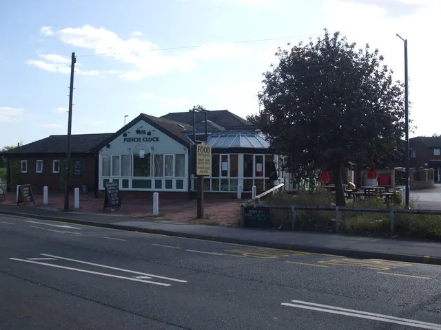
Roads nearby
George Mann Road100 m
Thwaite Gate100 m
Sussex Gardens100 m
George Mann Way100 m
Low RoadLow Road Severn Road, Thwaite Gate, Low Road Balmoral Chase, Low Road Rocheford Gardens
150 m
Sussex Green150 m
Sussex Avenue150 m
Wakefield RoadWakefield Road Queen Street, Wakefield Road, Wakefield Road Valley Park Estate, Wakefield Road Wood Lane, Jawbones Tattoo, Wakefield Road Glebe Court, Wakefield Road Angel Row, Miller & Carter, Wakefield Road Glebe Farm, Wakefield Road Middleton Lane, Wakefield Road Barleyhill Road, Wakefield Road Cyprus Road, Moorfield House Surgery, Nicholas and Fisher, Aberford Road Pennington Lane, Wakefield Road Pontefract Road, C, B, Wakefield Road Oulton Drive, Garforth Bridge, Wakefield Road Alandale Crescent, Corner Shop
250 m
Severn Way300 m
Lockside Road450 m
Definitive Footpath ROTHWELL 1500 m
Queen StreetStarbucks, Carlton Post Office
600 m
Amenities nearby
Citylink400 m
DIY stores nearby
Screwfix100 m
Buildings nearby
Hunslet Gate Centre100 m
Scientific Games200 m
Freshfayre250 m
Siemens300 m
First Direct400 m
Retail Computer Solutions400 m
The Queen550 m
CPM600 m
Cafés nearby
The Pow Wow50 m
Bangers & Baps450 m
Canals nearby
Aire and Calder Navigation300 m
Car repair shops nearby
Stourton Accident Repairs450 m
Stourton Service Station550 m
Indepedent VW Audi Centre550 m
ML Motors600 m
Car washes nearby
Starshine Hand Car Wash50 m
Glossy Hand Car Wash350 m
Commercial buildings nearby
Mayflower House550 m
Mears600 m
Convenience stores nearby
Nisa Local350 m
Fast food restaurants nearby
Land and Sea Fisheries100 m
Industrial buildings nearby
Advanced400 m
Office buildings nearby
Morgan Sindall100 m
RAM Tracking100 m
Covvi150 m
R C S500 m
Petrol stations nearby
BP350 m
Queens Service Station500 m
Railway lines nearby
Hunslet East Branch400 m
Razed railways nearby
Hunslet Branch350 m
Recycling points nearby
European Metal Recycling600 m
Specialist shops nearby
Howdens Joinery100 m
Pemsa200 m
Warehouses nearby
Troy Foods150 m
Dowsing & Reynolds200 m
| Located in | Leeds |
|---|---|
| Country | United Kingdom |
| Location | Hunslet |
 Public transport map Leeds Legend
| Railway | |
| Bus | |
| Tram |
 Cycling map Leeds Legend
| Cycle path | |
| Cycle lane on road | |
| Cycling on bus lane | |
| Bicycle street | |
| Cyclists allowed | |
| Cyclists allowed, good surface | |
| No cycling | |
| Cobblestones |
| Long-distance cycle route | (depending on scale) | |
| Long-distance cycle route |
 Walking map Leeds Legend
| Path |
| Long-distance hiking trail | (depending on scale) | |
| Long-distance hiking trail | ||
| No pedestrians |