
Salisbury Street in Oakland, California
Salisbury Street in Oakland is a residential street and it runs in a southeast-northwest direction starting from 34th Avenue and ends at 35th Avenue. Salisbury Street also exists in Los Angeles County and Riverside County.
- Road Type
- residential street
- Route
- southeast-northwest
Image
Places of worship
Convenience stores
Gas stations
Bus stops
Streets nearby
Orchid Street350 ft
Hyde Street450 ft
34th AvenuePeralta Hacienda Historical
0.1 mi
Davis StreetHeritage Psychiatric Health Facility
0.1 mi
Paxton Avenue0.1 mi
Coolidge AvenuePatten University Library, Patten Academy, Coolidge Avenue & Hopkins Place, Coolidge Avenue & MacArthur Boulevard, Coolidge Avenue & Madeline Street (Bret Harte Middle School), Coolidge Avenue & Carmel Street, Coolidge Avenue & Alida Street, 4024 Coolidge Avenue, Coolidge Avenue & Morgan Avenue
0.1 mi
Custer Street0.1 mi
Galindo StreetFood Mart, La Familia
0.2 mi
Gray Street0.2 mi
Baxter Street0.2 mi
Harper Street0.2 mi
Logan StreetChristian Temple Church
0.2 mi
Henrietta Street0.2 mi
Hughes Avenue0.2 mi
Meadow Street0.2 mi
Alexander Court0.2 mi
Prentiss Street0.2 mi
East 27th StreetEast 27th Street & Fruitvale Avenue, East 27th Street & 26th Avenue, East 27th Street & 25th Avenue
0.2 mi
Prentiss Place0.2 mi
East 23rd Street0.2 mi
Lynde StreetLittle Free Library
0.2 mi
Eden Lane0.3 mi
East 22nd Street0.3 mi
Sunset Avenue0.3 mi
Harrington AvenuePillar of Fire Church
0.3 mi
Atwell Avenue0.3 mi
Deering Street0.3 mi
Carrington Way0.3 mi
Deering Court0.3 mi
35th Avenue35th Avenue & Foothill Boulevard, 35th Avenue & Victor Avenue, Delicias Bakery, 35th Avenue & International Boulevard, 35th Avenue & Suter Street, QuickStop, BlackBox Studios, Maria’s Mexican Kitchen, 35th Avenue & Redding Street, United for Success Academy, 35th Avenue & Custer Street, 35th Avenue & Davis Street, Calvin Simmons Middle School, 35th Avenue & Lynde Street, 35th Avenue & Deering Street, 35th Avenue & Quigley Street, Chevron Food Mart, Chevron, Chevron Auto Service, 35th Avenue & MacArthur Boulevard, Pilgrim Lutheran Church, 35th Avenue & Wisconsin Street, 35th Avenue & Arizona Street, 35th Avenue & California Street, 35th Avenue & Jordan Road, 35th Avenue & Libby Court, Friends Market, 35th Avenue & East 16th Street, 35th Avenue & East 17th Street, 35th Avenue & School Street, 35th Avenue & Brookdale Avenue, 35th Avenue & Allendale Avenue, 35th Avenue & Penniman Avenue
0.3 mi
Foothill BoulevardEastmont Transit Center, Foothill Boulevard & Eastmont Transit Center, Foothill Boulevard & 106th Avenue, Mong Hoang Cafe, Foothill Boulevard & 18th Avenue, Foothill Boulevard & 19th Avenue, Foothill Boulevard & 16th Avenue, Paramount Liquors, Foothill Market, Foothill Boulevard & 68th Avenue, Rockin Crawfish, Foothill Boulevard & 2nd Avenue, Foothill Boulevard & 8th Avenue, Jax Liquor, Foothill Boulevard & 23rd Avenue, Foothill Boulevard & 11th Avenue, Foothill Boulevard & 13th Avenue, East Bay Auto Repair & Towing Complete Auto Services, Foothill Boulevard & 35th Avenue, Fremont High School, V & J's Body Works, Foothill Boulevard & 61st Avenue, Foothill Boulevard & 64th Avenue, Foothill Boulevard & Seminary Avenue, Foothill Boulevard & Cole Street, Foothill Boulevard & Avenal Avenue, Foothill Boulevard & Vicksburg Avenue, Fairfax Liquor, Foothill Boulevard & High Street, Metro by T-Mobile, Subway, Fairfax Lighthouse Community Church, Foothill Boulevard & Laverne Avenue, Foothill Boulevard & Trask Street, Foothill Boulevard & 55th Avenue, Foothill Boulevard & 48th Avenue, Foothill Boulevard & 50th Avenue, Penny Saver Market, Chevron, Exxon, Bay Wheels, Foothill Boulevard & 38th Avenue, Foothill Boulevard & 41st Avenue, Cafe Cordoba, Foothill Boulevard & 42nd Avenue, Los Olivos Restaurant, Foothill Boulevard & 27th Avenue, Community Auto Center, Latin American Branch Oakland Public Library, Foothill Boulevard & Fruitvale Avenue, Evergreen 99 Cent Plus, Rancho Market and Produce, Foothill Boulevard & 28th Avenue, Foothill Boulevard & 25th Avenue, Taqueria El Grullo, China Gourmet Express, Mi Carnal Market, Boost Mobile, Foothill Boulevard & 26th Avenue, Mi Ranchito Market & Produce, Cricket Wireless, Peña's Bakery, Los Arcos, Foothill Boulevard & 24th Avenue, Gold Coin Car Wash, Foothill Discount Grocery, Portal, San Antonio, Foothill Boulevard & 5th Avenue, Foothill Boulevard & Church Street, Minute Muffler & Service Center, All Bout Cars, Grace Temple Baptist Church, Foothill Boulevard & Havenscourt Boulevard, Golden Gasoline, Foothill Boulevard & 108th Avenue, Foothill Boulevard & 21st Avenue, Foothill Boulevard & 22nd Avenue
0.3 mi
Crosby Avenue0.3 mi
Santa Rita Street0.3 mi
Ransom Avenue0.4 mi
38th AvenueLaurel, Laurel Lounge, Allendale Community Pentecostal Holiness Church, donut savant, Vientian Cafe, MoneyGram
0.4 mi
36th AvenueFood Mart, Fruitvale
0.4 mi
39th AvenueCafe Santana Roasting Company, Chatham Preschool 39th Campus
0.4 mi
Auto repair shops nearby
Midas Total Car Care0.3 mi
VN. Auto Service Center0.3 mi
Allstar Autobody0.4 mi
El Torito Auto Body0.4 mi
Brownfields nearby
Jungle Hill0.3 mi
Buildings nearby
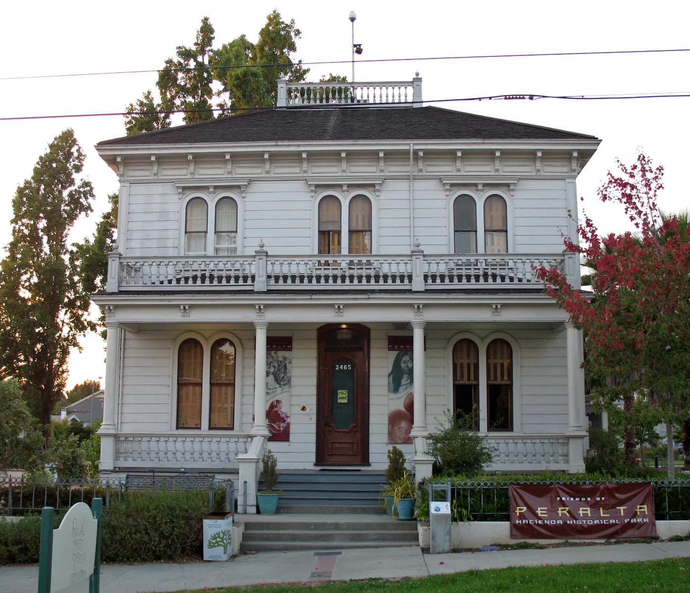
Antonio Maria Peralta House400 ft
Mercy Retirement & Care Center0.3 mi
Fast food restaurants nearby
KFC0.3 mi
Parks nearby
Peralta Hacienda Park0.1 mi
Places of worship nearby
True Buddha Vijaya Temple0.3 mi
Streams nearby
Peralta Creek0.2 mi
Peralta Creek Harrington Avenue Branch0.3 mi
Public transit map Oakland Legend
| Railway | |
| Bus | |
| Streetcar |
Bicycle map Oakland Legend
| Bike path | |
| Bike lane on roadway | |
| Cycling allowed on bus lane | |
| Bicycle street | |
| Open to cyclists | |
| Open to cyclists, good path | |
| Cycling prohibited | |
| Cobblestone |
| Long-distance bike route | (depending on scale) | |
| Long-distance bike route |
Pedestrian map Oakland Legend
| Path |
| Long-distance hiking trail | (depending on scale) | |
| Long-distance hiking trail | ||
| Pedestrians prohibited |