
California Avenue in Glendale, California
California Avenue in Glendale is a two-lane, asphalted residential street. It runs in an east-west direction starting from West California Avenue and crosses North Brand Boulevard and ends at East California Avenue. California Avenue also exists in Long Beach, Los Angeles, Montebello, Santa Monica and Signal Hill.
- Road Type
- residential street
- Lanes
- 2
- Route
- east-west
Image
Fast food restaurants
Cell phone stores
Pawn shops
Hair salons
Restaurants
Florists
Galleries
Cafes
Clothing stores
Bus stops
Computer stores
Bakeries
Streets nearby
West California AvenueIdeology Coffee, Starbucks, Sprint, Buzzy Bee Flowers, Computers, Rudy's of Glendale - Barber shop, Roslin Art Gallery, Yifang Taiwan Tea, Poke House, Mix & Match Burger, Regent Coffee
0.1 mi
Wilson Avenue0.1 mi
Lexington Drive0.1 mi
West Wilson AvenueThe San Fernando, Teriyaki Me!, Tep Thai, CVS Pharmacy, Big 5 Sporting Goods, Elevate Health Group, 85°C
0.1 mi
North Maryland AvenueLaemmle Glendale
0.1 mi
North Orange Street500 N Central/501 N Orange Parking, 520 N Central Parking
0.1 mi
East California AvenuePanera Bread, Royal Oaks Convalescent Hospital, Glendale & California, Rubio's, World Market, Petco, Ross, TJ Maxx
0.1 mi
East Wilson AvenueGlendale Park and Ride, Bank of America, The Church of Jesus Christ of Latter-day Saints, Wells Fargo, Staples, Ralphs, Civic Center Visitors Parking
0.1 mi
North Artsakh AvenuePierre Garden, Greek Bistro, Octopus, Five Star Cinema, Prestige Salon, Friar Tux Shop, Gen Korean BBQ House
0.1 mi
East Lexington DrivePanini Kabob Grill, Salt and Olive, Union Bank
0.2 mi
West Lexington DrivePhoenicia, Bank of America, Corner Market
0.2 mi
North Central AvenueCentral & California, Central & Doran, Central & Milford, East West Bank, Citibank, Central & Lexington, Central & Arden, Ralphs, Starbucks, Golden Market, Central & Stocker, Central & Dryden, Central & Glenoaks
0.2 mi
Milford Street0.2 mi
East Milford Street0.2 mi
West Milford StreetCitibank, McDonald's, Riley's, LaserMD Pain Relief, Macular & Retina Institute
0.2 mi
North Kenwood Street0.3 mi
Doran Street0.3 mi
East Doran Street0.3 mi
North Louise Street0.4 mi
Apartment buildings nearby
Lex On Orange550 ft
Onyx Glendale0.2 mi
Banks nearby
U.S. Bank0.3 mi
Bookstores nearby
Legacy Comics and Cards0.1 mi
Buildings nearby
Glendale Masonic Center0.1 mi
Clinics nearby
Kaiser Permanente Glendale Orange Street Medical Offices0.3 mi
Commercial buildings nearby
330 North Brand500 ft
Sears0.1 mi
Hollywood Production Center0.2 mi
Wells Fargo0.3 mi
Fast food restaurants nearby
The Great White Hut400 ft
Fitness centers nearby
total woman gym and spa0.3 mi
Furniture stores nearby
Cort Furniture Outlet0.2 mi
Hotels nearby
Brandwood Hotel0.1 mi
Nightclubs nearby
Stars on Brand0.2 mi
Parking lots nearby
Orange Street Public Parking Structure400 ft
employee parking0.1 mi
330 North Brand Parking0.1 mi
400 & 450 North Brand (Monthly Parking Only)0.2 mi
400 & 450 North Brand Parking0.2 mi
505 North Brand Parking0.2 mi
500 North Brand Blvd Parking0.3 mi
500/501/520 Parking0.3 mi
Wells Fargo Customer Parking0.3 mi
Residential areas nearby
Kenwood Village0.2 mi
Next on Lex0.2 mi
Retail buildings nearby
Chess Park Tavern350 ft
Theaters nearby
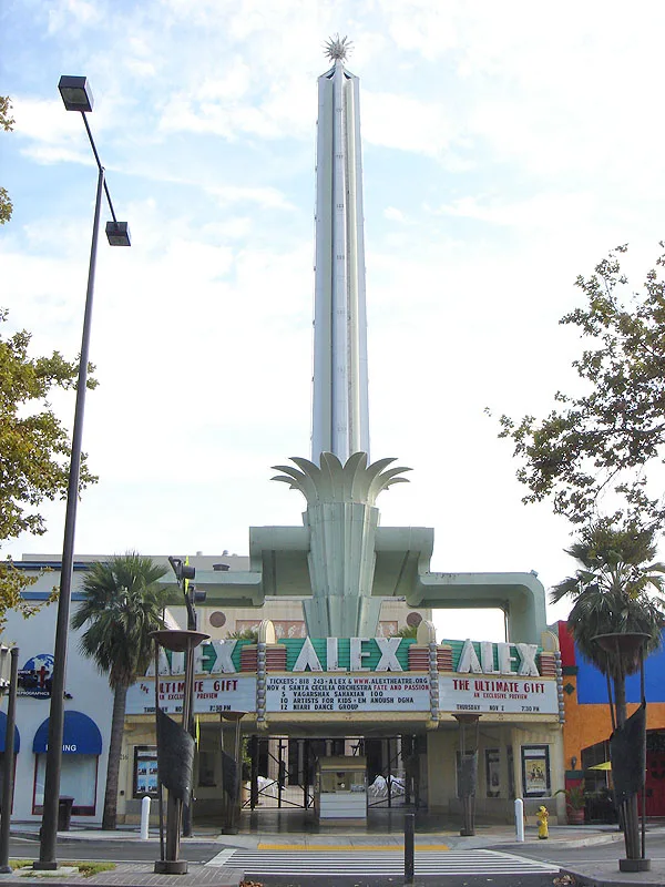
Alex Theatre500 ft
Glendale Center Theater500 ft
Thrift stores nearby
Goodwill350 ft
Public transit map Glendale Legend
| Railway | |
| Bus | |
| Streetcar |
Bicycle map Glendale Legend
| Bike path | |
| Bike lane on roadway | |
| Cycling allowed on bus lane | |
| Bicycle street | |
| Open to cyclists | |
| Open to cyclists, good path | |
| Cycling prohibited | |
| Cobblestone |
| Long-distance bike route | (depending on scale) | |
| Long-distance bike route |
Pedestrian map Glendale Legend
| Path |
| Long-distance hiking trail | (depending on scale) | |
| Long-distance hiking trail | ||
| Pedestrians prohibited |