
Milford Street in Glendale, California
Milford Street in Glendale is an asphalted residential street. It runs in a East direction starting from West Milford Street and crosses North Brand Boulevard and continues as East Milford Street.
- Road Type
- residential street
- Route
- east-west
Image
Bus stops
ATMs
Massage therapy clinics
Banks
Parking entrances
Copy shops
Restaurants
Fast food restaurants
Bars
Pharmacies
Streets nearby
East Milford Street100 ft
Lexington Drive450 ft
West Lexington DriveBank of America, Acai Grill, Phoenicia, Corner Market
450 ft
North Brand BoulevardBrand & Doran, Wells Fargo, Comerica Bank, The Little Goat Pizza House, Church of the Incarnation, First Church of Christ Scientist, Brand & Glenoaks, Brand & Fairview, Muffin Can Stop Us, Casa Verdugo Branch Glendale Public Library, Brand & Dryden, Trader Joe's, The Coffee Bean & Tea Leaf, Brand & Monterey, Chase, Brand & Milford, Glendale City Center, Brand & Lexington, Brand & Wilson, Men's Wearhouse, Royal Vanak, Starbucks, Subway, Poké Cafe, Kopan Ramen, Gam Tu Bop, Integrated Digital Technologies - Vocational, Brand & Broadway, Nails By Us, Alegro, Grillers Mediterranean Kitchen, Tender Greens, Fish Time, Sapporo, All India Cafe, Hope specialty pharmacy, Brand & California, Carousel Restaurant Glendale, Oishi Sushi, Jincook, Hot Wings Cafe, FedEx Office, Crazy Rock' Sushi Glendale, Glendale Career College, North-West College, Giggles, Cocina Cilantro, Iness, El Morfi Grill, Chess Park Tavern, California Pizza Kitchen, Olive Garden, Damon's Steak House, Porto's Bakery and Cafe, Massage Envy, Cosiani, JAX Bar & Grill, Gracie Barra, BJ's Printing Emporium, Porto's Bakery, Porto's Cafe, City National Bank, Da Juice Bar, Glendale Pawn Shop, AT&T, The Halal Guys, Citibank
500 ft
North Orange Street500 N Central/501 N Orange Parking, 520 N Central Parking
0.1 mi
Doran Street0.1 mi
East Doran Street0.1 mi
West Milford StreetCitibank, McDonald's, Riley's, LaserMD Pain Relief, Macular & Retina Institute
0.1 mi
East Lexington DrivePanini Kabob Grill, Salt and Olive, Union Bank
0.1 mi
North Central AvenueCort Furniture Outlet, Central & California, Central & Doran, Central & Milford, East West Bank, Citibank, Central & Lexington, Central & Arden, Ralphs, Starbucks, Golden Market, Central & Stocker, Central & Dryden, Central & Glenoaks
0.2 mi
North Louise Street0.2 mi
California Avenue0.2 mi
North Kenwood Street0.2 mi
West California AvenueIdeology Coffee, Starbucks, Buzzy Bee Flowers, Computers, Rudy's of Glendale - Barber shop, Roslin Art Gallery, Yifang Taiwan Tea, Big Mama's & Papa's Pizzeria - Glendale, California Poke House, Regent Coffee
0.2 mi
East California AvenuePanera Bread, Royal Oaks Convalescent Hospital, Glendale & California, Rubio's, World Market, Petco, Ross, TJ Maxx
0.3 mi
Wilson Avenue0.3 mi
North Maryland AvenueLaemmle Glendale
0.3 mi
East Wilson AvenueGlendale Park and Ride, Bank of America, The Church of Jesus Christ of Latter-day Saints, Wells Fargo, Staples, Ralphs, Civic Center Visitors Parking
0.3 mi
North Artsakh AvenuePierre Garden, Greek Bistro, Octopus, Five Star Cinema, Prestige Salon, Friar Tux Shop, Gen Korean BBQ
0.3 mi
Apartment buildings nearby
Lex On Orange0.2 mi
Onyx Glendale0.2 mi
Banks nearby
U.S. Bank0.1 mi
Bookstores nearby
Legacy Comics and Cards0.3 mi
Buildings nearby
Glendale Masonic Center0.3 mi
Clinics nearby
Kaiser Permanente Glendale Orange Street Medical Offices0.1 mi
Commercial buildings nearby
Hollywood Production Center400 ft
Wells Fargo0.1 mi
330 North Brand0.1 mi
Sears0.3 mi
Fast food restaurants nearby
The Great White Hut0.2 mi
Fitness centers nearby
total woman gym and spa0.1 mi
Hotels nearby
Brandwood Hotel0.1 mi
Nightclubs nearby
Stars on Brand250 ft
Parking lots nearby
505 North Brand Parking250 ft
400 & 450 North Brand Parking300 ft
400 & 450 North Brand (Monthly Parking Only)350 ft
500 North Brand Blvd Parking450 ft
330 North Brand Parking0.1 mi
500/501/520 Parking0.1 mi
Wells Fargo Customer Parking0.1 mi
Orange Street Public Parking Structure0.3 mi
employee parking0.3 mi
Residential areas nearby
TENTEN Campus400 ft
Next on Lex0.2 mi
Kenwood Village0.3 mi
Retail buildings nearby
Chess Park Tavern0.3 mi
Theaters nearby
Glendale Center Theater0.1 mi
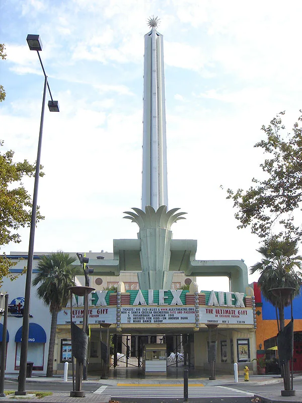
Alex Theatre0.3 mi
Thrift stores nearby
Goodwill0.2 mi
Public transit map Glendale Legend
| Railway | |
| Bus | |
| Streetcar |
Bicycle map Glendale Legend
| Bike path | |
| Bike lane on roadway | |
| Cycling allowed on bus lane | |
| Bicycle street | |
| Open to cyclists | |
| Open to cyclists, good path | |
| Cycling prohibited | |
| Cobblestone |
| Long-distance bike route | (depending on scale) | |
| Long-distance bike route |
Pedestrian map Glendale Legend
| Path |
| Long-distance hiking trail | (depending on scale) | |
| Long-distance hiking trail | ||
| Pedestrians prohibited |