
Lime Avenue in Orlando, Florida
Lime Avenue in Orlando is an asphalted residential street. The street has sidewalks. It runs in a north-south direction starting from West Church Street and crosses West Jackson Street and ends at West South Street. Lime Avenue also exists in Brevard County, Indian River County, Pinellas County, Sarasota County and Monroe County.
- Road Type
- residential street
- Route
- north-south
Image
Auto parts stores
Bus stops
Streets nearby
South Parramore AvenueParramore, South Parramore Avenue and West Anderson Street, South Parramore Avenue and West South Street
350 ft
Hicks Avenue0.1 mi
West Jackson Street0.1 mi
West South StreetWest South Street and South Orange Blossom Trail, Los Carnales Tires, West South Street and South Lee Avenue, West South Street and McFall Avenue, West South Street and Albany Avenue, West South Street and Woods Avenue, West South Street and Lime Avenue, South Division Avenue and South Hughey Avenue
0.1 mi
South Terry AvenueSouth Terry Avenue and West Church Street, South Terry Avenue and West Central Boulevard
0.2 mi
Glenn Lane0.2 mi
McFall Avenue0.2 mi
McDevitt Street0.2 mi
Pharr Avenue0.2 mi
North Parramore AvenueNoth Parramore Avenue and Ossie Street, North Parramore Avenue and West Washington Street, Advance Auto Parts
0.2 mi
Chapman Court0.2 mi
Grove Park Drive0.2 mi
Division Avenue0.2 mi
Buck Alley0.2 mi
Ossie Street0.2 mi
North Terry AvenueTerry Avenue and Livingston Street, Dunkin'
0.3 mi
West Central BoulevardCentral Business District, West Central Boulevard and South Orange Blossom Trail, West Central Boulevard and Fred L. Maxwell Boulevard, West Central Boulevard and Maryland Avenue, Westfield, West Central Boulevard and South Tampa Avenue, West Central Boulevard and Halbe Avenue, West Central Boulevard and Wilbe Avenue, West Central Boulevard and North Westmoreland Drive, West Central Boulevard and North Division Avenue, West Central Boulevard and North Parramore Avenue, West Central Boulevard and Pershing Place
0.3 mi
North Division Avenue0.3 mi
Hughey AvenueNORTH ORLANDO
0.3 mi
South Hughey Avenue0.3 mi
West Pine StreetLove Fellowship Christian Church, Downtown CREDO, Mercantile Bank, Downtown Pour House
0.3 mi
Chatham Avenue0.3 mi
West Jefferson Street0.3 mi
South Division AvenueSouth Division Avenue and West Anderson Street, South Division Avenue and South Street, South Division Avenue and West Central Boulevard, South Division Avenue and West Pine Street, S.outhDivision Avenue and West Church Street, South Division Avenue and Callahan Drive, South Division Avenue and Carter Street
0.4 mi
West Anderson StreetWest Anderson Street and Jernigan Avenue, West Anderson Street and Buck Alley, West Anderson Street and Glenn Alley, West Anderson Street and Woods Avenue, West Anderson Street and South Orange Blossom Trail, United States Post Office, West Anderson Street and South Terry Avenue
0.4 mi
I-4 Express0.4 mi
North Hughey AvenueNorth Hughey Avenue and West Washington Street, North Hughey Avenue and West Robinson Street
0.4 mi
South Garland Avenue0.4 mi
Artworks nearby
Artifact0.4 mi
Bars nearby
Cheyenne Saloon0.4 mi
Construction sites nearby
Westcourt Orlando0.3 mi
Convenience stores nearby
Jr Food Store0.2 mi
Courthouses nearby
United States Court House0.3 mi
George C. Young United States Federal Building and Courthouse0.3 mi
Hospitals nearby
Medical Training Center0.2 mi
Museums nearby
Well's Built Museum of African American History & Culture0.2 mi
Parking lots nearby
Geico Garage0.2 mi
Places of worship nearby
Faith Deliverance Temple250 ft
Greater Refuge Memorial Church400 ft
Shiloh Baptist Church of Orlando500 ft
Masjid Al-Quddus0.1 mi
Power Praise and Deliverance Church0.1 mi
Masjid Al-Haqq0.2 mi
Bethel Baptist Church0.3 mi
Recreation grounds nearby
Callahan Basketball Courts0.3 mi
Residential areas nearby
Jackson Court Apartments0.1 mi
Restaurants nearby
Mojo Bar and Grill0.4 mi
Ceviche Tapas Bar & Restaurant0.4 mi
Stadiums nearby
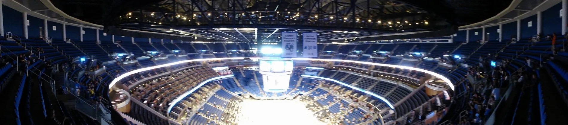
Kia Center0.2 mi
 Public transit map Orlando Legend
| Railway | |
| Bus | |
| Streetcar |
 Bicycle map Orlando Legend
| Bike path | |
| Bike lane on roadway | |
| Cycling allowed on bus lane | |
| Bicycle street | |
| Open to cyclists | |
| Open to cyclists, good path | |
| Cycling prohibited | |
| Cobblestone |
| Long-distance bike route | (depending on scale) | |
| Long-distance bike route |
 Pedestrian map Orlando Legend
| Path |
| Long-distance hiking trail | (depending on scale) | |
| Long-distance hiking trail | ||
| Pedestrians prohibited |