
Melissa Segars Way in Fayetteville, Georgia
Melissa Segars Way in Fayetteville is an asphalted residential street. It runs in a north-south direction starting from Church Street and crosses East Lanier Avenue and ends at Stonewall Avenue East.
- Road Type
- residential street
- Speed Limit
- 25 mph
- Route
- north-south
Image
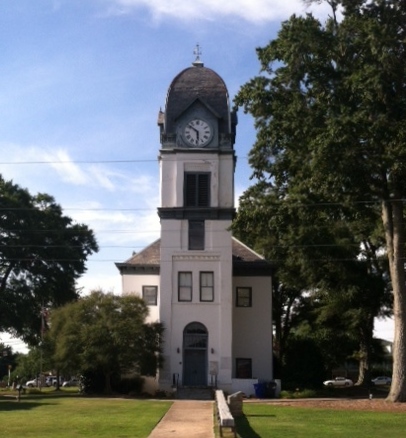
Pubs
Community centers
Places of worship
Auto parts stores
Beauty salons
Schools
Restaurants
Fire stations
Dentist offices
Fish markets
Social facilities
Courthouses
Public clocks
Clothing stores
Pastry shops
Town halls
Ice cream shops
Streets nearby
Jack D. Dettmering Way450 ft
Lee Street550 ft
East Lanier AvenueFayetteville, Fayette County Courthouse, First UM Preschool, Rising Star Montessori Academy, Rising Star Preschool
0.1 mi
Jeff Davis DriveDental One Associates
0.1 mi
Glynn Street SouthTribal Chick, City Café and Bakery, Kroger, Courthouse Tavern
0.1 mi
Glynn Street NorthJohnny's, Tesla Supercharger, Chipotle, Tropical Smoothie Cafe, BP, CVS Pharmacy, Kiddie Kottage
0.2 mi
sidewalk0.2 mi
Johnson AvenueFayetteville Fire Department Station 91, American Legion
0.2 mi
Stonewall Avenue WestTwisted Taco, Leslie's Pool Supplies, Your Hair Spa, Fayetteville City Hall Government, Fayette Floor and Wall
0.2 mi
Jeff Davis Drive NorthJeff Davis Dental & Orthodontics
0.2 mi
Bennett Street0.2 mi
West Lanier AvenueGremlin Growlers, Best Seafood Direct Market;Seafood Market, Just Nails, South OMS, Fayette County Chamber of Commerce, Truett's Luau - Chick-fil-A, Great Expressions Dental Center
0.2 mi
Stephens Street0.2 mi
Washington Street0.3 mi
Church StreetEdgefield Baptist Church
0.3 mi
Heritage Park Way0.3 mi
Carver Street0.3 mi
City Center Pkwy0.4 mi
Lafayette AvenueFayette Center of Innovation, Ferrol A Sams Auditorium, Trash Compactor, Call box for gate access
0.4 mi
Georgia Avenue EastOpen Arms Outreach
0.4 mi
Georgia AvenueFayetteville Post Office, Fayette Orthodontics
0.4 mi
Tiger Trail0.5 mi
Georgia Avenue West0.5 mi
Auto repair shops nearby
Merlin Complete Auto Care0.4 mi
Top Quality Car Care0.4 mi
Jiffy Lube Oil Change0.5 mi
Bars nearby
Revival Wines and Dessert Bar0.2 mi
Commercial buildings nearby
Fayetteville Ford0.3 mi
Fast food restaurants nearby
Arby's0.2 mi
Funeral homes nearby
Mowell's and Son Funeral Home0.2 mi
Gardens nearby
Fayette County Master Garden0.3 mi
Hotels nearby
Quality Inn Fayetteville Near Historic Downtown Square0.1 mi
Parks nearby
Church Street Park0.1 mi
Heritage Park0.2 mi
Jack Day Park0.2 mi
City Center Park0.3 mi
Pastry shops nearby
Dunkin'0.2 mi
Places of worship nearby
First United Methodist Church200 ft
First Baptist Church of Fayetteville450 ft
Destiny Christian Center International0.3 mi
Middle Fayette Church of Christ0.5 mi
Public buildings nearby
Fayette County Administration Building0.2 mi
Restaurants nearby
City Café and Bakery0.2 mi
Capt'n D's0.3 mi
Frozen Rooster0.3 mi
Sports fields nearby
Church Street Park basketball court0.1 mi
FCHS baseball field0.4 mi
FCHS Football Field0.5 mi
Town halls nearby
Fayetteville City Hall0.2 mi
Public transit map Fayetteville Legend
| Railway | |
| Bus | |
| Streetcar |
Bicycle map Fayetteville Legend
| Bike path | |
| Bike lane on roadway | |
| Cycling allowed on bus lane | |
| Bicycle street | |
| Open to cyclists | |
| Open to cyclists, good path | |
| Cycling prohibited | |
| Cobblestone |
| Long-distance bike route | (depending on scale) | |
| Long-distance bike route |
Pedestrian map Fayetteville Legend
| Path |
| Long-distance hiking trail | (depending on scale) | |
| Long-distance hiking trail | ||
| Pedestrians prohibited |