
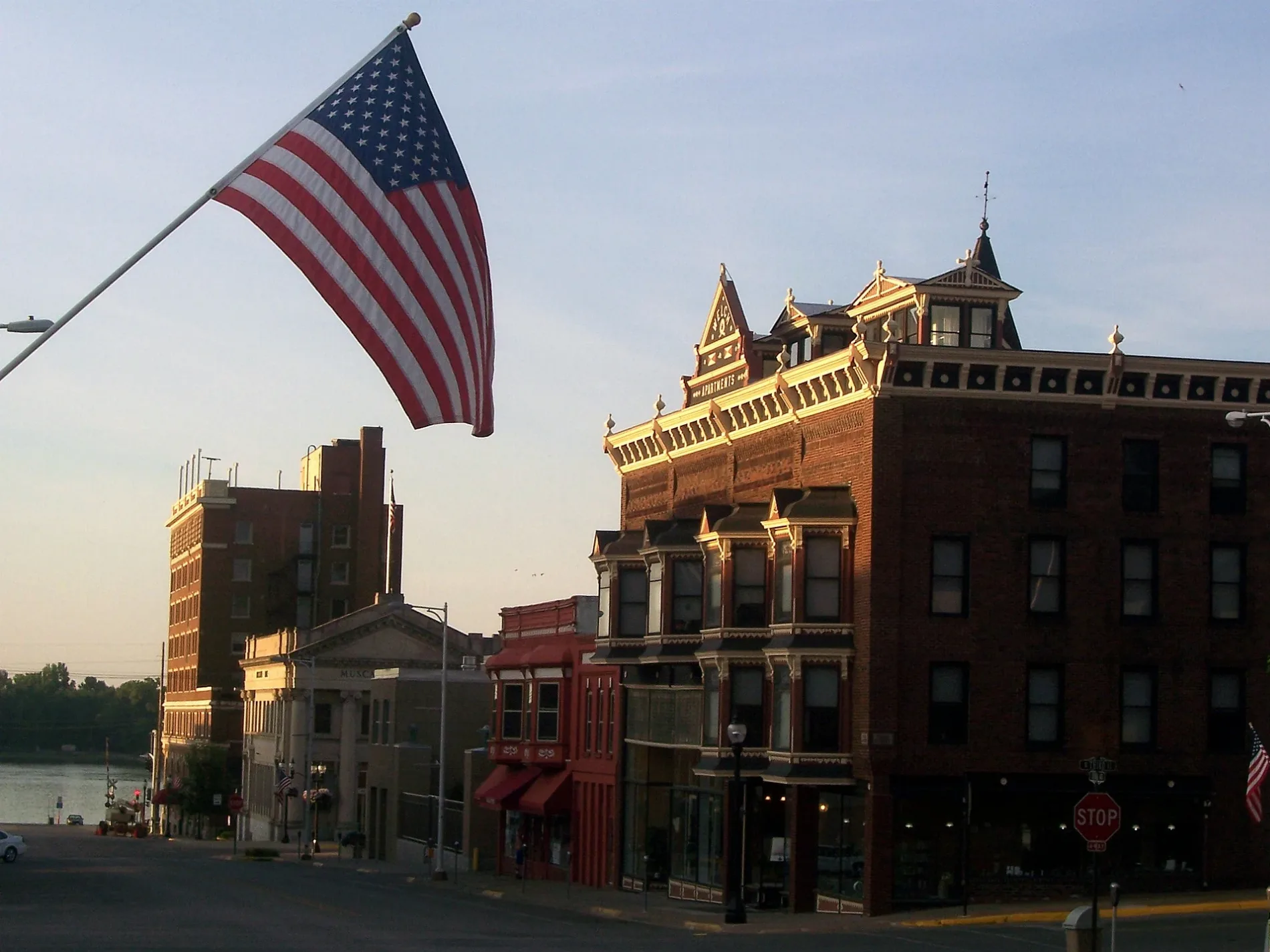
West 6th Street in Muscatine, Iowa
West 6th Street in Muscatine is a residential street. It runs in a Southwest direction starting from East 6th Street and crosses Iowa Avenue, Chestnut Street, Pine Street, Linn Street, Spruce Street and Locust Street. It ends in a cul-de-sac. West 6th Street also exists in Dubuque County, Woodbury County, Harrison County, Mills County and O'Brien County.
- Road Type
- residential street
- Route
- northeast-southwest
Image
Museums
- Pearl Bottom Museum (Web) at West 2nd Street 117 (52761) – approx. 0.3 mi.
Coffee shops
Police stations
Cafes
Supermarkets
Arts centers
Convenience stores
Places of worship
Charging stations
Shelters
Bars
Schools
Fire stations
Prisons
Pharmacies
Auto repair shops
- Clark's Muffler & Service (opening hours: Sat–Sun closed, Mo-Th 8–17; Fri 8–15) at Grandview Avenue 103 (52761). Clark's Muffler & Service is a premier auto repair shop in Muscatine, IA, that serves the greater surrounding area. Specializing in muffler services, our expert team also offers a wide range of automotive solutions including exhaust work & much more. – approx. 0.7 mi.
Viewpoints
Streets nearby
West 7th StreetFirst Assembly of God Church
400 ft
Linn Street400 ft
Spruce Street450 ft
West 5th Street0.1 mi
Locust Street0.2 mi
Broadway Street0.2 mi
Chestnut Street0.2 mi
Cherry Lane0.2 mi
Fuller Street0.2 mi
Van Horne Street0.3 mi
Valley Street0.3 mi
West 4th Street0.3 mi
West 9th Street0.3 mi
Pine Street0.3 mi
West 3rd Street0.3 mi
Cherry Street0.3 mi
Whicher Street0.3 mi
West 2nd StreetPearl Bottom Museum
0.3 mi
West 10th Street0.3 mi
East 9th StreetMount Zion Charismatic Church
0.3 mi
East 4th Street0.3 mi
West 11th Street0.4 mi
East Mississippi Drive0.4 mi
East 10th Street0.4 mi
East 3rd Street0.4 mi
Harbor Drive0.4 mi
Sycamore Street0.4 mi
Iowa AvenueBig Cat's Cafe, Boonie's On the Avenue
0.4 mi
Cedar StreetMuscatine Care Center, Muscatine Post Office, Fareway, Dairy Queen, DQ Grill & Chill, Muscatine Fire Department
0.5 mi
East 8th Street0.5 mi
East 2nd StreetThe Bagel Shop at Black Pearl Café, BTCPower Charging Station, Musser Public Library
0.5 mi
Walnut StreetMuscatine
0.5 mi
East 6th StreetBnai Moses Synagogue, Christian Science Church
0.5 mi
Apartment buildings nearby
Clark House Apartments0.3 mi
Welch Apartments0.3 mi
Hotels nearby
The Merrill Hotel, Muscatine, a Tribute Portfolio Hotel0.4 mi
Houses nearby
Alexander Clark house0.2 mi
Stone-Richman-Musser House0.3 mi
Winn-Stein House0.3 mi
Pliny and Adelia Fay House0.3 mi
Old Muscatine Iowa Jail0.5 mi
Parks nearby
4th Street Park0.2 mi
Places of worship nearby
Saint Mary & Saint Mathias Catholic Church0.2 mi
Wesley United Methodist Church0.3 mi
First Presbyterian Church0.3 mi
Zion Lutheran Church0.3 mi
Vineyard Christian Fellowship Church0.4 mi
Railways nearby
Ottumwa Subdivision0.4 mi
Town halls nearby
Muscatine City Hall0.4 mi
Public transit map Muscatine Legend
| Railway | |
| Bus | |
| Streetcar |
Bicycle map Muscatine Legend
| Bike path | |
| Bike lane on roadway | |
| Cycling allowed on bus lane | |
| Bicycle street | |
| Open to cyclists | |
| Open to cyclists, good path | |
| Cycling prohibited | |
| Cobblestone |
| Long-distance bike route | (depending on scale) | |
| Long-distance bike route |
Pedestrian map Muscatine Legend
| Path |
| Long-distance hiking trail | (depending on scale) | |
| Long-distance hiking trail | ||
| Pedestrians prohibited |