
Madisonville Street in Princeton, Kentucky
Madisonville Street in Princeton is an unclassified road. It runs in a northeast-southwest direction starting from East Young Street and crosses Grace Street and McGoodwin Avenue and ends at East Green Street. This street is part of the highway "62".
- Road Type
- unclassified road
- Route
- northeast-southwest
Image
Museums
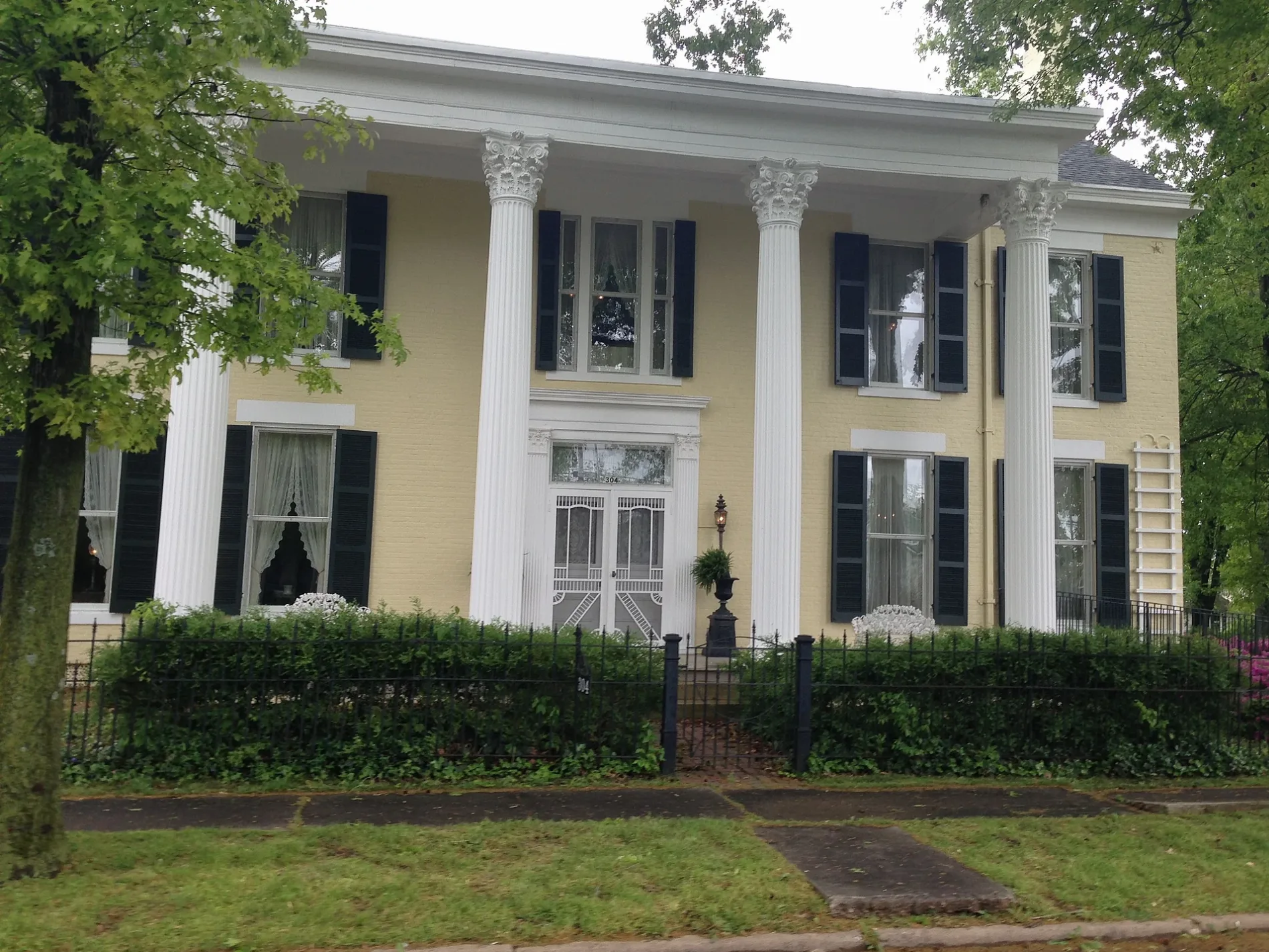
- Adsmore Museum (opening hours: Thu–Sat 11–16, Web) at North Jefferson Street 304 (42445) – approx. 0.2 mi.
Charging stations
Pubs
Beauty salons
Police stations
Drugstores
Florists
Tourist information centers
- Cedar Hill Cemetery (Marker Number: 2623). EDAR HILL CEMETERY - Cedar Hill Cemetery, known as City Cemetery until 1918, was founded in 1809. The first known burial was Capt. William Prince, founder of Princeton. The cemetery includes 32 box-tombs, some made before 1835 by Scottish stone mason Jo – approx. 0.1 mi.
- William Prince, 1752-1810 (Marker Number: 2330). Born in Virginia, his family moved to Spartanburg Co., S.C. in 1768. During the Revolutionary War, he served as captain in Col. Benjamin Roebuck’s S.C. Spartan regiment. After completing his military duty, he led a party of family & friends through – approx. 0.3 mi.
- County Named, 1809 (Marker Number: 834). For General John Caldwell. Born Va.; came Ky., 1781. Maj. Gen. in militia; Indian campaigns. With George Rogers Clark, 1786. Member Danville Conventions, 1787, 1788, which adopted petition "demanding admission into the Union." State Senator, 1 – approx. 0.3 mi.
- Courthouse Burned (Marker Number: 579). Gen. Hylan B. Lyon with 800 men invaded Ky., Dec. 1864, to enforce CSA draft law and divert USA from Nashville. In 23 days he burned seven courthouses used by Union forces. (See map on reverse side.) US troops fled Princeton as Lyon came from Eddyville. – approx. 0.3 mi.
Copy shops
Clothing stores
Restaurants
Town halls
Cafes
Dentist offices
Courthouses
Gun stores
Interior decorators
Streets nearby
Phillips Street350 ft
East Green StreetCedar Hill Cemetery (Marker Number: 2623)
400 ft
East Shephardson Street0.1 mi
McGoodwin Avenue0.1 mi
Stone Street0.1 mi
Cedar Hill Cemetery St 70.1 mi
McGoodwin Court0.1 mi
Alley 170.1 mi
Grace Court0.2 mi
Cs-1206-700.2 mi
Cs-12060.2 mi
East Locust Street0.2 mi
Alley 160.2 mi
North Jefferson StreetAdsmore Museum
0.2 mi
Cedar Hill Cemetery St 60.2 mi
Cs-12270.2 mi
North Franklin StreetPrinceton Tourist Welcome Center
0.2 mi
Cs-12250.2 mi
Cs-12200.2 mi
Grace Street0.2 mi
Cedar Hill Cemetery St 80.2 mi
Cs-12180.2 mi
Cs-12210.3 mi
Cedar Hill Cemetery St 20.3 mi
Grove Drive0.3 mi
Alley 140.3 mi
Cs-12190.3 mi
East Main StreetChargepoint, Dr. David Lee Oliver, DMD, The Globe Tavern
0.3 mi
North Eagle Street0.3 mi
North Chestnut Street0.3 mi
Holeman Street0.3 mi
North Mitchell Street0.3 mi
Apartment buildings nearby
Franklin Place Senior Appartments0.2 mi
Auto repair shops nearby
Kendall AutoCare Center - Fast Lube & Oil Service0.3 mi
Banks nearby
Planters Bank0.2 mi
Buildings nearby
The Eyecare Center0.1 mi
Edward Jones0.2 mi
Princeton Water and Wastewater0.3 mi
Princeton Tourist Welcome Center0.3 mi
Cemeteries nearby
Cedar Hill Cemetery0.2 mi
Community centers nearby
PACS Human Services0.3 mi
VFW Post 55590.3 mi
Dry cleaners nearby
Farmers Cleaners0.3 mi
General stores nearby
Newsom's Old Mill Country Ham & General Store0.3 mi
Gift shops nearby
Littlebita Heather0.3 mi
The Tin Roof0.3 mi
Houses nearby
Adsmore0.2 mi
Police stations nearby
Princeton Police Dept0.2 mi
Restaurants nearby
Ms Piggy Pigs BBQ300 ft
Public transit map Princeton Legend
| Railway | |
| Bus | |
| Streetcar |
Bicycle map Princeton Legend
| Bike path | |
| Bike lane on roadway | |
| Cycling allowed on bus lane | |
| Bicycle street | |
| Open to cyclists | |
| Open to cyclists, good path | |
| Cycling prohibited | |
| Cobblestone |
| Long-distance bike route | (depending on scale) | |
| Long-distance bike route |
Pedestrian map Princeton Legend
| Path |
| Long-distance hiking trail | (depending on scale) | |
| Long-distance hiking trail | ||
| Pedestrians prohibited |