
Riverside (Inbound) in Newton, Massachusetts
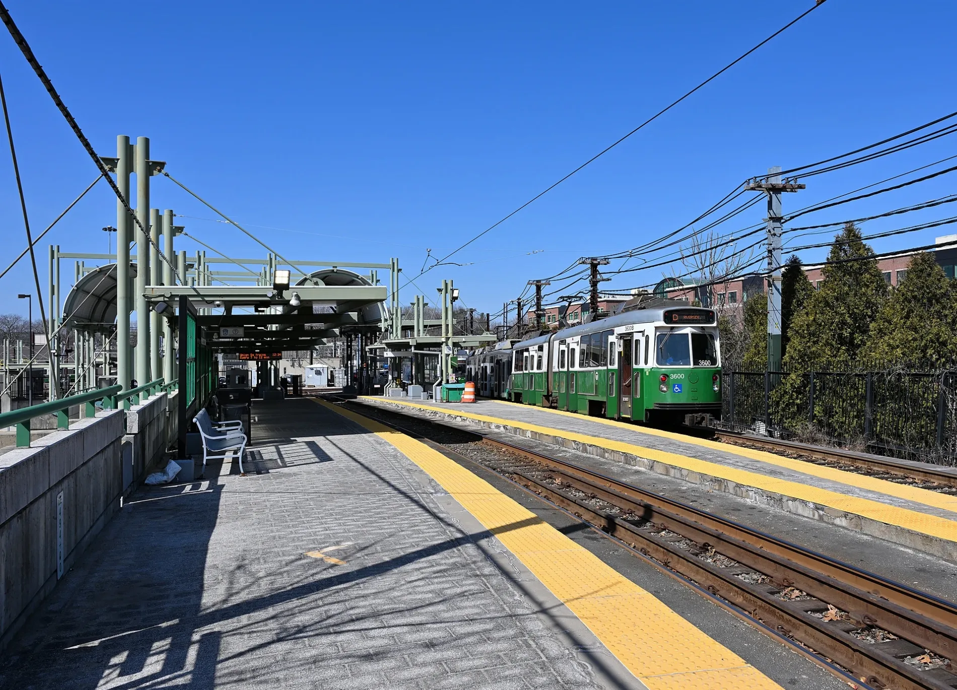
Riverside (Inbound) in Newton is a light rail stop (Massachusetts Bay Transportation Authority, MBTA, wheelchair accessible, Bench, Trash bin, Tactile guidance system, lit). Riverside (Inbound) is located near Woodland Park Road. Ⓦ.
- Bicycle
- no
- Operator
- Massachusetts Bay Transportation Authority
- Wheelchair Access
- yes
Image
Convenience stores
Guest houses
Fast food restaurants
Police stations
Gas stations
Bus stops
Nursing homes
Platforms
- light rail lines Green-D
Light rail stops
- light rail lines Green-D
Stations
- light rail lines Green-D
Restaurants
Cafes
Betting shops
Stops
- light rail lines Green-D
Streets nearby
Woodland Park Road450 ft
Norumbega Court0.2 mi
Robin Dell Street0.2 mi
Seminary AvenueLasell Village
0.2 mi
Williston Road0.3 mi
Grove StreetRiverside, Hotel Indigo, BOKX 109 American Prime
0.3 mi
Hancock StreetWalker Center
0.3 mi
Hawthorne Avenue0.3 mi
Aspen Avenue0.4 mi
Myrtle Avenue0.4 mi
Unity Street0.4 mi
Lake Avenue0.4 mi
Vista Avenue0.4 mi
Washington StreetWashington St @ Cherry St, Lower Falls Wine Co., Washington St @ Greenough St, 1600 Washington St, West Newton, Washington St @ Shaw St, Washington St @ Bacon St, The Paper Mouse, Washington St @ Armory St, Washington St @ Cross St, Washington St @ Eddy St, Ascend Newton, Newton History Museum Library, Jackson Homestead Document Collection Archives, Jackson Homestead and Museum, Washington St @ Church St, Washington St @ Hovey St, Washington St @ Jewett St, Walgreens, Washington St @ Lewis Terr, Honda Village, Washington St @ Walnut St, Learning Prep School, Washington St @ Auburn St, Washington St @ Prospect St, Adams St @ Washington St, Washington St @ Adams St, Washington St @ Highland St, New York Bagel Factory, Clover, The Cookie Monstah, Starbucks, Blue Ribbon Bar-B-Q, Newton Bridge Club, Woodland MBTA Train Station, Washington St @ Lowell St, Newton-Wellesley Hospital, Washington St @ Commonwealth Ave, Washington St @ Chestnut St, Brezniak Rodman Funeral Directors, Washington St @ Harvard St, Washington St opp Armory St, Washington St opp Cross St, Washington St opp Eddy St, Washington St opp Walker St, Washington St @ Walker St, Washington St @ Craft St, Washington St @ Crafts St, Santander, 7-Eleven, Garden Remedies Newton
0.4 mi
Studio Road0.5 mi
Forest Avenue0.5 mi
Walsingham Street0.5 mi
Belmore Park0.5 mi
Beacon StreetCarney Dining Room, Waban, Stone L’Oven Pizza Co., Waban Hardware, Newton Centre Branch Library, Sandwich Works, Mobil, Sycamore, Coconut Newton, Newton Centre Post Office, Eagle's Nest, CareOne at Newton, Dunkin' Donuts, IQ Kitchen, FedEx Drop Box, Waban Dental Group, 4 Corners Pizza, Citizens Bank, Tous les Jours, Bank of America, Four Spoons, Bubbles, Salt, Newton Smilecentre, Suzuki Preschool of Newton, Santander, Chase
0.5 mi
Neshobe Road0.5 mi
Longfellow RoadWoodland, Woodland MBTA Station
0.5 mi
Samoset Road0.6 mi
Abandoned railways nearby
Newton Lower Falls Branch0.2 mi
Buildings nearby
Woodland Golf Club0.3 mi
Holt Hall0.3 mi
Eager House0.4 mi
Donahue Center for Creative and Applied Arts0.4 mi
Blue Building0.5 mi
Green Building0.5 mi
White Building0.5 mi
Allen-Riddle Hall0.5 mi
Ellison Hall0.6 mi
Children's Corner0.6 mi
Hotels nearby
Hotel Indigo - Newton Riverside0.3 mi
Industrial areas nearby
Riverside Carhouse0.1 mi
Light rail lines nearby
Green Line (D)100 ft
Light rail stops nearby
Riverside (Inbound/Outbound)50 ft
Woodland (Inbound)0.5 mi
Woodland (Outbound)0.5 mi
Parking lots nearby
Visitor Parking0.5 mi
Employee Parking0.6 mi
Railway areas nearby
MBTA Riverside Yard0.1 mi
Residential areas nearby
Woodland Park Apartments0.2 mi
Woodland Station0.5 mi
Resorts nearby
Walker Center0.3 mi
School buildings nearby
Holway Child Care Center at Rockwell Nursery School0.4 mi
Stations nearby
Riverside Bus Station0.1 mi
Train stations nearby
Riverside200 ft
Waters nearby
Lasell Pond0.3 mi
| Official opening | 1959 |
|---|---|
| Located in | Newton |
| Country | United States |
| Transport network | MBTA subway |
| Connecting line | Green Line |
| Connecting service | Green Line D branch |
 Public transit map Newton Legend
| Railway | |
| Bus | |
| Streetcar |
 Bicycle map Newton Legend
| Bike path | |
| Bike lane on roadway | |
| Cycling allowed on bus lane | |
| Bicycle street | |
| Open to cyclists | |
| Open to cyclists, good path | |
| Cycling prohibited | |
| Cobblestone |
| Long-distance bike route | (depending on scale) | |
| Long-distance bike route |
 Pedestrian map Newton Legend
| Path |
| Long-distance hiking trail | (depending on scale) | |
| Long-distance hiking trail | ||
| Pedestrians prohibited |