
West Hillsdale Street in Lansing, Michigan
West Hillsdale Street in Lansing is an asphalted residential street. No bike lane available. It runs in an east-west direction starting from South Sycamore Street and crosses South Pine Street, South Chestnut Street, South Walnut Street, Townsend Street, South Capitol Avenue and South Washington Avenue and ends at East Hillsdale Street. Nearby there is a pet store. The nearest bus stop is #3005 (about 350 m away). West Hillsdale Street also exists in Lansing Charter Township.
- Road Type
- residential street
- Route
- east-west
Image
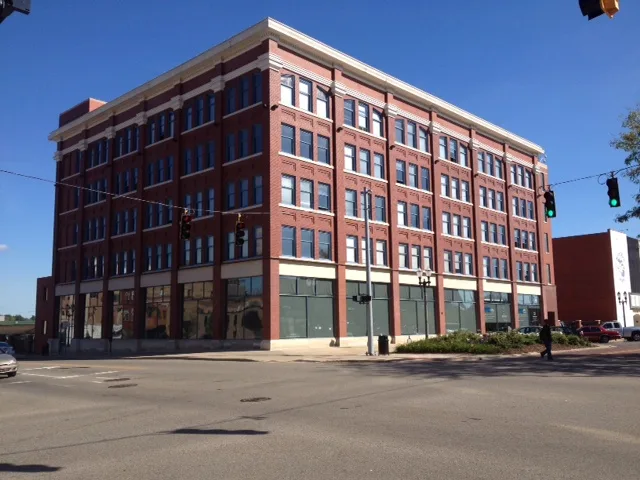
Pet stores
Streets nearby
Savoy Court300 ft
South Walnut StreetChargePoint
450 ft
South Chestnut Street0.1 mi
South Capitol AvenueThomas McIntyre Cooley
0.2 mi
West Saint Joseph StreetLake Trust Credit Union
0.2 mi
West Kalamazoo StreetBlink, Thai Village, Fudge & Frosting, Strange Matter Coffee Co.
0.2 mi
South Pine Street0.2 mi
William Street0.2 mi
West Malcolm X StreetMain Street School, Motown Mini Mart
0.2 mi
West Lenawee Street0.2 mi
Townsend Street0.2 mi
East Lenawee StreetElection Drop Box
0.2 mi
South Sycamore Street0.3 mi
South Washington AvenueSunoco, The Shop, Thiftique, Cutting Up Barber Shop, 1813, Rusty Mug Bar & Grill, Ellison Brewery + Spirits, FLO, 1623 S Washington Ave, Louie's Party Store, Election Drop Box, Saint Vincent de Paul Thrift Store, Builders Hardware Company, Ornamaloo, Anquanettas Treasure, Sapo de Solis, Sweetheart Essentials, Maddie's Place, Little Free Library, Soulful Earth Herbals, Vintage Junkies, #3005
0.3 mi
Washington Square SouthMidtown Brewing Company, Downtown Smoking Club, Barberrettes, Salus Center, Weston's Kewpee Restaurant, The Peanut Shop, Sahara Delight, Tops Bail Bonds, Fifth Third Bank, Nelson Gallery, Insty-Prints, Market on the Square², Envie, Kelly's Irish Pub & Restaurant, Grewal Hall at 224, Summit Comics and Games, Studio 109, Brennan Law Library, Jalapeños, New Daily Bagel, Sylvia's Sudsery, LLC., Subway, Cottage Inn Pizza, Firehouse Subs, A Novel Concept, Veg Head, Bike parking, Element Massage, Great Harvest Bakery & Cafe, Downtown
0.3 mi
Lansing River TrailPluto, Museum District, Sun, Venus, Mars, Mercury, Earth, Neptune, MP Social, Inspiration, Biscuit Bar, The Board Room, Uranus, Lansing River Trail - Brenke Fish Ladder, Lansing River Trail Map, Jupiter, Saturn
0.3 mi
East Malcolm X StreetREO Town Sign
0.3 mi
South Grand AvenueNBD Grand Ave before E Allegan St, CATA Transportation Center (CTC)
0.3 mi
Ransom E Olds Freeway0.3 mi
Oldsmobile PlantOlds Avenue Gate
0.3 mi
West Washtenaw StreetSweet Encounter, Domino's, Lansing Art Gallery, Westside, Estes-Leadley Funeral Home
0.3 mi
West Hazel StreetLittle Free Library
0.4 mi
West Elm StreetREO Town, Elm Street Gate
0.4 mi
Allotment gardens nearby
Pine and St Joe Community Garden0.2 mi
Apartment buildings nearby
Midtown Apartments0.2 mi
Buildings nearby
Elliott-Larsen Building0.2 mi
Commercial buildings nearby
Thomas M Cooley Law School Center for Research and Study0.2 mi
Blue Cross Blue Shield Blue Care Network of Michigan0.3 mi
Knapp's Center0.3 mi
Courthouses nearby
Veteran's Memorial Courthouse0.1 mi
Gardens nearby
Scott Sunken Garden0.2 mi
Government buildings nearby
Grady Porter Building0.2 mi
Industrial areas nearby
Lansing Grand River Assembly0.1 mi
Libraries nearby
Capital Area District Library - Downtown Lansing0.2 mi
Office buildings nearby
Michigan Manufacturing Association550 ft
Michigan Corrections Officers0.2 mi
Centinial - Pricipal Financial Group0.2 mi
Capitol Commons Center0.2 mi
Michigan Lottery0.3 mi
General Motors Administration Building0.3 mi
The Arbaugh0.3 mi
Parking lots nearby
South Capitol Ramp0.3 mi
Townsend Ramp0.3 mi
Parks nearby
Reutter Park0.2 mi
Scott Park0.3 mi
The Darryl J. Parsell Memorial Garden0.3 mi
Post offices nearby
Downtown Lansing Post Office0.3 mi
School buildings nearby
West Junior High School0.2 mi
University buildings nearby
Cooley Law School0.3 mi
 Public transit map Lansing Legend
| Railway | |
| Bus | |
| Streetcar |
 Bicycle map Lansing Legend
| Bike path | |
| Bike lane on roadway | |
| Cycling allowed on bus lane | |
| Bicycle street | |
| Open to cyclists | |
| Open to cyclists, good path | |
| Cycling prohibited | |
| Cobblestone |
| Long-distance bike route | (depending on scale) | |
| Long-distance bike route |
 Pedestrian map Lansing Legend
| Path |
| Long-distance hiking trail | (depending on scale) | |
| Long-distance hiking trail | ||
| Pedestrians prohibited |