
West Kalamazoo Street in Lansing, Michigan
West Kalamazoo Street in Lansing is an asphalted local road. No bike lane available. It runs in an east-west direction starting from Everett Drive and crosses West Street, South Jenison Avenue, McPherson Avenue, West Kalamazoo Avenue, East Kalamazoo Street, Washington Square South, South Capitol Avenue, Townsend Street, South Walnut Street, South Chestnut Street and South Pine Street. Nearby you can find a charging station, a restaurant, a candy store and a cafe. The nearest bus stop is 3033 (about 550 m away). West Kalamazoo Street also exists in Lansing Charter Township.
- Road Type
- local road
- Speed Limit
- 25 mph
- Route
- east-west
Image
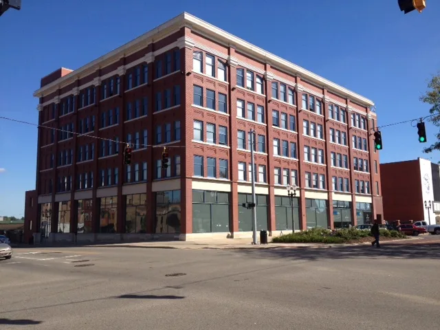
Charging stations
Candy stores
Restaurants
Cafes
Streets nearby
Townsend Street350 ft
South Capitol AvenueThomas McIntyre Cooley
550 ft
South Walnut StreetChargePoint
0.1 mi
Savoy Court0.2 mi
West Washtenaw StreetSweet Encounter, Domino's, Lansing Art Gallery, Westside, Estes-Leadley Funeral Home
0.2 mi
West Allegan StreetChargePoint, Michigan History Museum, Jimmy John's, Nubian
0.2 mi
South Chestnut Street0.2 mi
West Hillsdale StreetAnna Belle's
0.2 mi
West Michigan AvenueSundance, Michigan State University Federal Credit Union
0.3 mi
North Capitol AvenueLansing, Austin Blair, War Governor of Michigan, Lansing City Hall, Election Drop Box, 3012, 2390, #1610, Bird in the Hand, Harmony, Construction #150, Pages, Geometry
0.3 mi
North Walnut StreetChargePoint, 1618, Walnut Street School
0.3 mi
SkywalkLet Me In, Bike Rack
0.3 mi
West Ottawa StreetThe Hob Nob, 3033, Mary Sabina Memorial Chapel, White Capitol House
0.3 mi
South Pine Street0.3 mi
Apartment buildings nearby
Midtown Apartments200 ft
Attractions nearby
Michigan State Capitol0.2 mi
Buildings nearby
Elliott-Larsen Building0.1 mi
Deborah A. Stabenow State Office Building0.2 mi
Joint Operations Center0.3 mi
Diocesan Center0.4 mi
Churches nearby
Central United Methodist Church0.4 mi
Commercial buildings nearby
Thomas M Cooley Law School Center for Research and Study500 ft
Blue Cross Blue Shield Blue Care Network of Michigan0.1 mi
Knapp's Center0.2 mi
Masonic Temple0.2 mi
Billie S. Farnum Building0.2 mi
Courthouses nearby
Veteran's Memorial Courthouse350 ft
Government buildings nearby
Grady Porter Building150 ft
Richard H. Austin State Office Building0.2 mi
Romney Building0.3 mi
Stevens T. Mason State Office Building0.3 mi
John A. Hannah State Office Building0.3 mi
Murray Van Wagner Transportation Building0.3 mi
G. Mennen Williams State Office Building0.3 mi
Libraries nearby
Capital Area District Library - Downtown Lansing0.1 mi
Office buildings nearby
Michigan Corrections Officers0.1 mi
Michigan Senate Binsfeld Office Building0.2 mi
Boji Tower0.2 mi
Hollister Building0.2 mi
Parking lots nearby
South Capitol Ramp500 ft
Townsend Ramp0.1 mi
Parks nearby
Reutter Park0.1 mi
The Darryl J. Parsell Memorial Garden0.1 mi
Places of worship nearby
St. Paul's Episcopal Church0.3 mi
Saint Mary Cathedral0.4 mi
Post offices nearby
Downtown Lansing Post Office0.1 mi
Religious areas nearby
Catholic Diocese of Lansing0.4 mi
School buildings nearby
West Junior High School0.2 mi
University buildings nearby
Cooley Law School500 ft
 Public transit map Lansing Legend
| Railway | |
| Bus | |
| Streetcar |
 Bicycle map Lansing Legend
| Bike path | |
| Bike lane on roadway | |
| Cycling allowed on bus lane | |
| Bicycle street | |
| Open to cyclists | |
| Open to cyclists, good path | |
| Cycling prohibited | |
| Cobblestone |
| Long-distance bike route | (depending on scale) | |
| Long-distance bike route |
 Pedestrian map Lansing Legend
| Path |
| Long-distance hiking trail | (depending on scale) | |
| Long-distance hiking trail | ||
| Pedestrians prohibited |