
Mississippi River in Macalester - Groveland, Saint Paul, Minnesota
Mississippi River in Saint Paul is a river. Mississippi River is also known as The Mississippi. Mississippi River also exists in Dayton's Bluff, West Side, Downtown, West Seventh - Fort Road and Highland. Ⓦ.
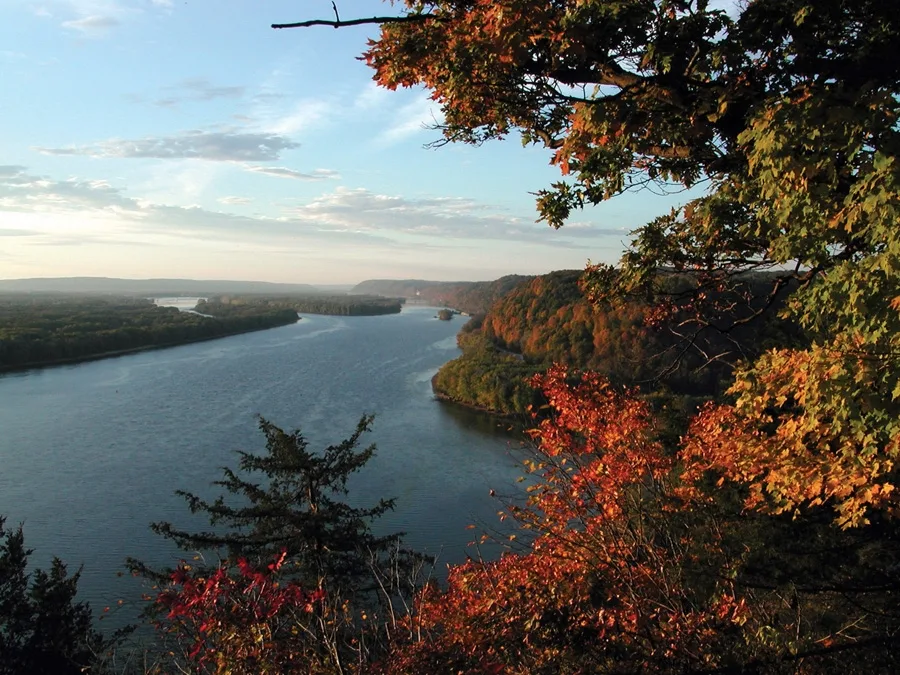
- Waterway Type
- river
Bus stops
Restaurants
Candy stores
Streets nearby
Winchell TrailDrs. Dorothy & Irving Bernstein Scenic Rest Area
0.1 mi
South Mississippi River Boulevard0.1 mi
West River Parkway Trail0.2 mi
East 33rd Street0.2 mi
Otis LaneShadow Falls
0.2 mi
48th Avenue South0.2 mi
West River Parkway0.3 mi
West Goodrich Avenue0.3 mi
Riverwood Place0.3 mi
North Mississippi River Boulevard0.4 mi
Dayton Avenue0.4 mi
Cretin Avenue SouthSummit Av, Randolph Av, Stanford Av, Jefferson Av, Palace Av, St Clair Av
0.4 mi
Exeter Place0.4 mi
Grand AvenueCretin Av, Dunn Brothers, Albert St, Pascal St, Hamline Av, Bar Cart, The Squire, St. Paul Cheese Shop, Jamba, Breadsmith, Nothing Bundt Cakes, My Burger, D'Vine Massage Health & Wellness, Cambridge St, Pad Thai Restaurant, Shish, French Meadow Bakery, Italian Pie Shoppe, Frattallone's Ace Hardware, Against the Current, Zimmerman's Dry Goods, Snelling Av, Cleveland Av, Finn St, Prior Av, Howell St, Footprints Art Studio, Heart Life Massage, Fairview Av, Wheeler St, Twin Cities Friends Meeting, IndoChin Vietnamese Restaurant, Sencha Tea Bar, Lakeside Orthodontics, Baking Betty's, Wet Paint, Dog Days Daycare & Boarding, CVS Pharmacy, bb.q Chicken, Treadle Yard Goods, #2003, #2002, Syndicate St, Everest on Grand, Starbucks, The Wine Store at Kowalski's, Allen L Salon, Than's Tailor, Fein Violins, Lady Fingers
0.4 mi
Montrose Place0.4 mi
Summit AvenueFinn St / Cretin Av, Snelling Avenue & Summit Avenue, Finn St
0.5 mi
Marshall AvenueMarshall & Cretin Station, Los Ocampo, The Wicker Shop, Black Coffee and Waffle Bar, Otis Av, Marshall & Otis Station, Exeter Place, Montrose Place
0.5 mi
Otis Avenue0.5 mi
Apartment buildings nearby
Cretin Court0.4 mi
Beaches nearby
Longfellow Beach550 ft
Buildings nearby
Byrne Residence0.2 mi
Danish American Center0.4 mi
Dormitories nearby
St. Paul Seminary0.2 mi
Grace Hall0.3 mi
Morrison Hall0.5 mi
Brady Hall0.5 mi
Flynn Hall0.6 mi
Hotels nearby
Montrose Moderne0.5 mi
Houses nearby
Eastcliff0.4 mi
Libraries nearby
Archbishop Ireland Memorial Library0.2 mi
Parking lots nearby
Anderson Parking Facility0.4 mi
Parks nearby
Seven Oaks Oval0.2 mi
Places of worship nearby
St. Mary's Chapel0.2 mi
Sports centers nearby
Lee and Penny Anderson Arena0.3 mi
Anderson Athletic and Recreation Center0.5 mi
Sports fields nearby
South Athletic Fields0.4 mi
Palmer Field0.5 mi
North Athletic Fields0.5 mi
Stadiums nearby
O’Shaughnessy Stadium0.5 mi
Streams nearby
Shadow Falls Creek0.2 mi
University buildings nearby
School of Divinity0.2 mi
Schoenecker Center0.2 mi
O'Shaughnessy Science Hall0.3 mi
Brady Education Center0.3 mi
Facilities and Design Center0.3 mi
Binz Refectory0.3 mi
Owens Science Hall0.4 mi
Anderson Student Center0.5 mi
Facilities Management0.5 mi
| Length | 3766 |
|---|---|
| Located in | United States |
| Country | United States |
| Source | Lake Itasca |
| Mouth | Gulf of Mexico |
| Tributary | Black River, Arkansas River, Ohio River, Saint Croix River, Wisconsin River, Rock River, Illinois River, Kaskaskia River, Minnesota River, Des Moines River, White River, Apple River, Big Muddy River, St. Francis River, Yazoo River, Big Black River, Maquoketa River, Wolf River, Rice Creek, Iowa River, Turkey River, Loosahatchie River, Meramec River, Wapsipinicon River, Chippewa River, River des Peres, Bayou Pierre, Catfish Creek, Crow River, Duck Creek, Hatchie River, Henderson Creek, Little Maquoketa River, Marys River, Obion River, Prairie River, Rum River, Rush River, Salt River, Schoolcraft River, Skunk River, Swan River, Trempealeau River, Turtle River, Upper Iowa River, Vermillion River, Wind River, Yellow River, Village Creek, Brazeau Creek, Cinque Hommes Creek, Nokasippi River, Apple Creek, Coles Creek, River aux Vases, Minnehaha Creek, Fox River, Bassett Creek, Sucker Creek, Missouri River |
| Native name | Mississippi River |
| Described by | Sytin Military Encyclopedia, Small Brockhaus and Efron Encyclopedic Dictionary, Brockhaus and Efron Encyclopedic Dictionary, Jewish Encyclopedia of Brockhaus and Efron, The Nuttall Encyclopædia, Great Soviet Encyclopedia (1926–1947), The Encyclopedia Americana, The American Cyclopædia, Encyclopædia Britannica 11th edition, Collier's New Encyclopedia, 1921, The New Student's Reference Work, New International Encyclopedia, Meyer’s Universum, Fünfzehnter Band, Meyer’s Universum, Siebzehnter Band, Meyer’s Universum, Achtzehnter Band, Granat Encyclopedic Dictionary |
Public transit map Macalester - Groveland Legend
| Railway | |
| Bus | |
| Streetcar |
Bicycle map Macalester - Groveland Legend
| Bike path | |
| Bike lane on roadway | |
| Cycling allowed on bus lane | |
| Bicycle street | |
| Open to cyclists | |
| Open to cyclists, good path | |
| Cycling prohibited | |
| Cobblestone |
| Long-distance bike route | (depending on scale) | |
| Long-distance bike route |
Pedestrian map Macalester - Groveland Legend
| Path |
| Long-distance hiking trail | (depending on scale) | |
| Long-distance hiking trail | ||
| Pedestrians prohibited |