
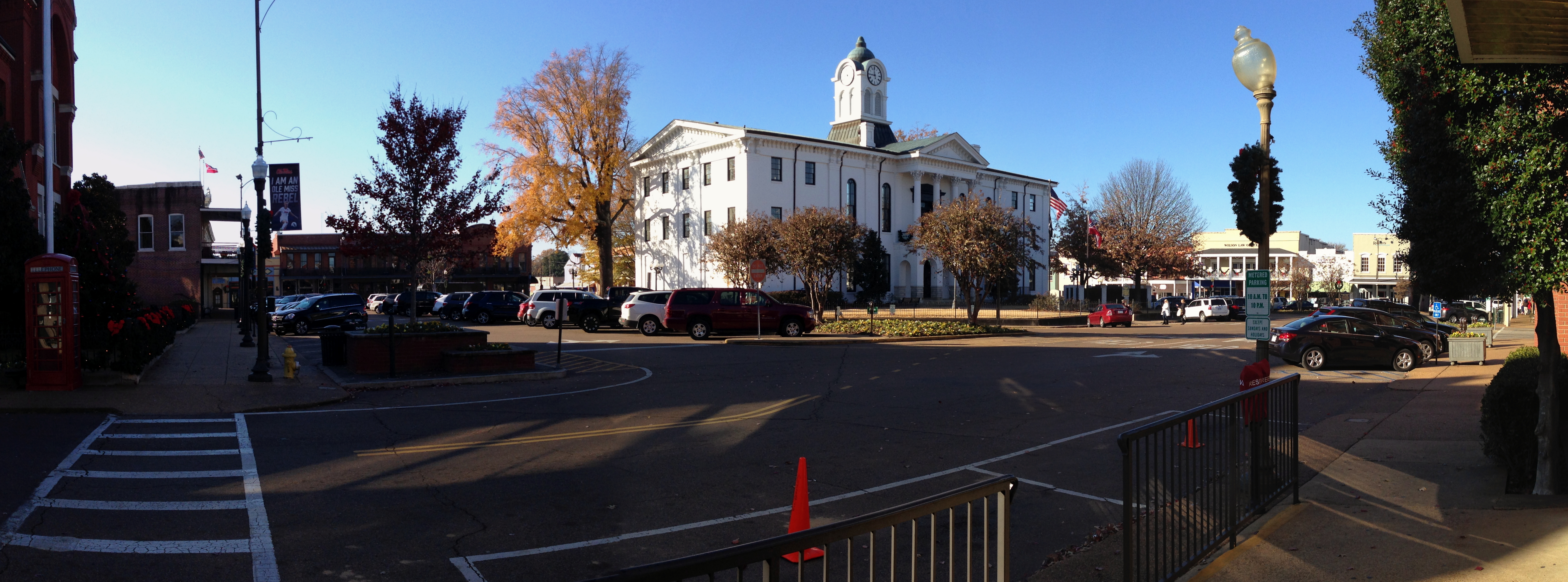
South 10th Street in Oxford, Mississippi
South 10th Street in Oxford is a single-lane, asphalted residential street. It runs as a one-way street in a north-south direction starting from East Jackson Avenue and crosses Van Buren Avenue, Harrison Avenue and Tyler Avenue and ends at University Avenue. Nearby you can find 2 bars and a restaurant. South 10th Street also exists in Lamar County, Covington County, Lowndes County and Monroe County.
- Road Type
- residential street
- Lanes
- 1
- Speed Limit
- 20 mph
- Route
- north-south
Image
Streets nearby
South 11th StreetBlue Delta Jeans Co, Funky's Pizza & Daiquiri Bar
250 ft
Tyler AvenueFirst Presbyterian Church, SoLa, Moe's Original BBQ, RockHouse Live Oxford
500 ft
East Jackson AvenueBoure, End of All Music, University Sporting Goods, Gingersnaps, Renasant Bank, Uno Mas Tacos y Tequila, Mesquite Chop House, Jones at Home, Oxford Visitor Center, Tango's Patio and Kitchen, Oxford Grillehouse, Oxford Burger Company, Saint Leo, Donut Distillery
500 ft
Harrison AvenueAmy Head Cosmetics, Landry's, Cat Daddy's, Stella at Oxford, Harrison's 1810
500 ft
Courthouse SquareOxford, Quack's, Ajax Diner, Van Atkins Jewelers, Round Table, Katherine Beck, Lily Pad, Pink & Proper, Trustmark, Hinton & Hinton, Neilson's, Square Books Jr, Regions Bank
0.1 mi
South Lamar BoulevardDovetail Home, Safari Wines & Spirits, Cicada Boutique, Olive Juice Gifts, Insomnia COokies, Square Books, Village Tailor, Magnolia Wine & Spirits, Amara Salon, U-Haul, Oxford Family Pharmacy, Bickert's Orthotics and Prosthetics, Dr. Robert M. Abraham, DDS, Super Kuts, Roundabouts, Booth's Barbeque, University Baptist Church, Paragon Bank
0.1 mi
North 9th Street0.1 mi
South 9th StreetSaint Peters Episcopal Church
0.1 mi
University AvenueWalgreens, Oxford-University United Methodist Church, Washboard Coin Laundry, Pitner Office Supply, Oxford Climate Safe Storage, Oxford Bridal, Trophy Shop, Luxe, Origin Bank, Headquarters, Dunkin', Nightbird, Subway, China Royal
0.2 mi
South 8th Street0.2 mi
South 6th Street0.2 mi
Jackson Avenue EastSecond Baptist Church, Burns-Belfry Museum and Multicultural Center, USPS, BP, Green Roof Lounge, Frutta Bowls
0.2 mi
West Adams AvenueChurch of Christ
0.3 mi
Van Buren AvenueFirst Baptist Church, Off Square Books, The Frame Up-Basement Gallery, A C's Bed & Bath Co, Tallahatchie Gourmet, Bottletree Bakery, Southside Gallery, Old Venice Pizza, McEwen's, Hemline, South Depot Taco Shop, CVM Salon, Belles & Beaus, The Library, Square Pizza, My Favorite Shoes, CVM, Bar Muse, City Grocery
0.3 mi
South 5th Street0.3 mi
Jefferson AvenueLa Rousse
0.3 mi
North 5th StreetRent-A-Wreck, Hertz
0.3 mi
North 11th Street0.3 mi
Dell Drive0.3 mi
Martin Luther King Jr Drive0.4 mi
Depot StreetVogue
0.4 mi
Oxford Depot Trail0.4 mi
North 6th StreetJames Food Center
0.4 mi
Washington Avenue0.5 mi
Banks nearby
FNB Oxford0.1 mi
Bars nearby
The Velvet Ditch-Sports Bar & Seafood0.1 mi
Bookstores nearby
Rebel Bookstore500 ft
Buildings nearby
Lafayette County Chancery Building0.1 mi
Oxford Insurance0.2 mi
Dunbar Davis, PLLC0.3 mi
University-Oxford Depot0.4 mi
Boys and Girls Club0.5 mi
Churches nearby
Christ Temple CME0.3 mi
Courthouses nearby
United States District Court500 ft
Lafayette County Courthouse0.1 mi
Florists nearby
Oxford Floral0.2 mi
Gas stations nearby
Chevron0.2 mi
Hair salons nearby
Goolsby's Hair World0.1 mi
Hotels nearby
Courtyard by Marriott0.4 mi
Liquor stores nearby
Star Package Store0.4 mi
Museums nearby
University of Mississippi Museum0.3 mi
Nature reserves nearby
Bailey Woods0.3 mi
Places of worship nearby
Saint John Catholic Church0.4 mi
Prisons nearby
Lafayette County Jail0.1 mi
Restaurants nearby
Proud Larry's0.1 mi
School buildings nearby
Central Elementary School0.4 mi
Schools nearby
Oxford Intermediate School0.3 mi
Theaters nearby
The Lyric Oxford250 ft
University buildings nearby
Walton-Young House0.3 mi
Public transit map Oxford Legend
| Railway | |
| Bus | |
| Streetcar |
Bicycle map Oxford Legend
| Bike path | |
| Bike lane on roadway | |
| Cycling allowed on bus lane | |
| Bicycle street | |
| Open to cyclists | |
| Open to cyclists, good path | |
| Cycling prohibited | |
| Cobblestone |
| Long-distance bike route | (depending on scale) | |
| Long-distance bike route |
Pedestrian map Oxford Legend
| Path |
| Long-distance hiking trail | (depending on scale) | |
| Long-distance hiking trail | ||
| Pedestrians prohibited |