
Cultural Corridor Trail in Las Vegas
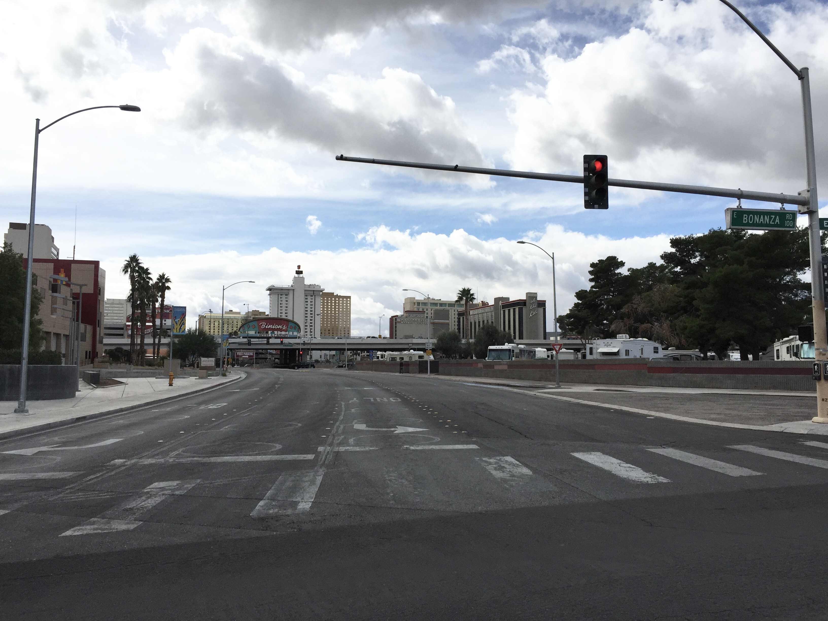
Cultural Corridor Trail in Las Vegas is a concrete footpath. It crosses Veterans Memorial Drive and East Bonanza Road and ends at North 4th Street, while the other end is a cul-de-sac.
- Road Type
- footpath
Image
Schools
Bike rentals
Bars
Artworks
Bus stops
Streets nearby
Veterans Memorial DriveBiltmore Special School
100 ft
North Casino Center BoulevardSouthbound Casino Center before Fremont
300 ft
North 1st Street1st & Ogden, Circa
550 ft
Verdy Lane550 ft
Bonanza Way0.1 mi
Tiffany Lane0.1 mi
North 4th StreetNorthbound 4th after Stewart
0.1 mi
Biltmore Drive0.1 mi
Bell Drive0.2 mi
Purple Heart HighwayCharleston Curve
0.2 mi
West Bonanza RoadWestbound Bonanza after D, Eastbound Bonanza after City Parkway, Dotty's Gaming & Spirit's, Eastbound Bonanza after Rancho, Eastbound Bonanza before H, Eastbound Bonanza at 919 West Bonanza, Eastbound Bonanza after Martin Luther King, Eastbound Bonanza before Martin Luther King, Eastbound Bonanza after Tonopah, Westbound Bonanza before Dike, Westbound Bonanza after Main, Westbound Bonanza after Tonopah
0.2 mi
East Bonanza RoadPoe 61 Post Office, Walgreens, Popeyes, Domino's, T-Mobile, Eastbound Bonanza after Page, Eastbound Bonanza after Lamb, Westbound Bonanza after Page, Eastbound Bonanza after Bruce, Eastbound Bonanza after Sandhill, Westbound Bonanza after Triest, Equipo Academy, Smith's Fuel Center, McDonald's, Carl's Jr., Thai Cuisine, The Blue Skillet, Westbound Bonanza after Lillian, Westbound Bonanza after Nellis, Eastbound Bonanza before Lillian, Eastbound Bonanza after Eastern, Westbound Bonanza after McKnight, Tropical Smoothie Cafe, Eastbound Bonanza after Honolulu, Eastbound Bonanza after Pecos, Eastbound Bonanza after Mojave, Westbound Bonanza after Wardelle, Eastbound Bonanza after 28th, Eastbound Bonanza after 9th, Eastbound Bonanza after Las Vegas, Eastbound Bonanza after Maryland, Westbound Bonanza after Maryland, Westbound Bonanza after Eastern, Westbound Bonanza before Marion, Eastbound Bonanza after Marion, Eastbound Bonanza after Casino Center, Westbound Bonanza before Las Vegas, Westbound Bonanza after Pecos, Westbound Bonanza after Mojave, East Las Vegas, Arco, Circle K, ampm, Eastbound Bonanza after Triest, Westbound Bonanza after Legion, Westbound Bonanza after Lamb, Westbound Bonanza after Bruce, Las Vegas Post Office Station Number 4, Eastbound Bonanza after 23rd
0.2 mi
North Las Vegas BoulevardNormandie Motel Neon Sign, Northbound Las Vegas after Stewart, Society Cleaners Neon Sign, Lucky Cuss Motel Neon Sign, Northbound Las Vegas after Washington, Rachel's Kitchen, Pabst Blue Ribbon Neon Sign, Northbound Las Vegas after Foremaster, Southbound Las Vegas before Foremaster, Northbound Las Vegas after Bonanza, Silver Slipper Neon Sign, Bow & Arrow Motel Neon Sign, Southbound Las Vegas Boulevard at Fremont Street Experience
0.2 mi
Palm Lane0.2 mi
North Main StreetSouthbound Main after Bonanza, Northbound Main after Bonanza, Southbound Main before Fremont Street, Main at Ogden (North), Southbound Main after Washington
0.2 mi
Casino Center Boulevard Alley0.3 mi
East Mesquite Avenue0.3 mi
Sycamore Lane0.3 mi
East McWilliams AvenueCesars Palace Sign, La Concha Motel Sign, Tropicana Sign, Ugly Duckling Sign
0.3 mi
East Wilson AvenueWalgreens, Halle Hewetson Elementary School
0.3 mi
North 3rd StreetDowntown Grand - 3rd & Stewart, Mob Museum
0.3 mi
Pioneer TrailNorthbound Las Vegas at Cashman Field, The True Vine Missionary Baptist Church, Southbound D after Monroe, McDonald's, Eastbound Washington before Robin, Eastbound Washington after Rancho, Eastbound Washington at Lorenzi Park, Westbound Bonanza after Sunny, Westbound Bonanza across from 901 West Bonanza, Westbound Bonanza after H, Southbound H after McWilliams, Southbound H after Washington, Northbound Valley View after Meadows, Northbound Valley View before U.S. 95, Southbound Las Vegas before Foremaster, Eastbound Owens before Las Vegas, Neon Museum Sign, Eastbound Washington after Twin Lakes, Southbound Las Vegas before Washington
0.3 mi
Scenic Byway TrailSouthbound Las Vegas before Cashman, Top of The World, Fellini’s Ristorante Italiano, CBar, Big Shot, X-Scream, Southbound Las Vegas at the Strat, Las Vegas Showgirl Sign, Southbound Las Vegas before Clark, Las Vegas Boulevard at 4th Street, Las Vegas Blvd @ Hoover, Pawn Plaza, Charleston, Aztec Inn Casino, First Christian Church Child Development Center, Southbound Las Vegas before Bonanza, Southbound Las Vegas after Mesquite, Southbound Las Vegas Boulevard at Fremont Street Experience, Axehole Vegas, The Nerd, Southbound Las Vegas before Carson
0.3 mi
Encanto DriveSahara Sign, Jerry Sign, Stardust Sign, Aladdin's Lamp, Treasure Island Skull, Frontier Sign, Golden Nuget Sign, Moulin Rouge Sign, Steiner Cleaners Sign, Riviera Sign, Liberace Sign, Sassy Sally's Sign, Binion's Horseshoe Sign, Tam O'Shanter Sign, Yucca Motel Sign, Algiers Sign, Desert Rose Motel
0.3 mi
North 6th StreetFremont East Entertainment District
0.3 mi
North 7th Street0.4 mi
Las Vegas Boulevard Alley0.4 mi
Auto repair shops nearby
Middleton's Auto Lab0.4 mi
Bars nearby
The Underground Speakeasy and Distillery0.2 mi
Buildings nearby
Department of Human Resources - City of Las Vegas0.3 mi
Commercial buildings nearby
300 N.0.3 mi
Community centers nearby
American Legion Hall0.2 mi
Convenience stores nearby
Pump N Snack0.3 mi
7-Eleven0.3 mi
Fitness centers nearby
Dula Gym0.1 mi
Gift shops nearby
Neon Museum Gift Shop0.3 mi
Hotels nearby
Downtown Grand0.3 mi
Oasis at Gold Spike0.3 mi
El Cortez Hotel and Casino0.4 mi
Motels nearby
Regency Motel0.2 mi
Museums nearby
The Mob Museum0.2 mi
Neon Museum0.3 mi
Parking lots nearby
Zappos Self Parking0.3 mi
Police stations nearby
Nevada Parole and Probation50 ft
Las Vegas Metropolitan Police Department Downtown Substation0.3 mi
Rv parks nearby
Main Street Station RV Park0.1 mi
Sports centers nearby
Municipal Pool0.1 mi
Streams nearby
Vegas Creek250 ft
Transportation buildings nearby
Regional Transportation Commission of Southern Nevada0.2 mi
Public transit map Las Vegas Legend
| Railway | |
| Bus | |
| Streetcar |
Bicycle map Las Vegas Legend
| Bike path | |
| Bike lane on roadway | |
| Cycling allowed on bus lane | |
| Bicycle street | |
| Open to cyclists | |
| Open to cyclists, good path | |
| Cycling prohibited | |
| Cobblestone |
| Long-distance bike route | (depending on scale) | |
| Long-distance bike route |
Pedestrian map Las Vegas Legend
| Path |
| Long-distance hiking trail | (depending on scale) | |
| Long-distance hiking trail | ||
| Pedestrians prohibited |