
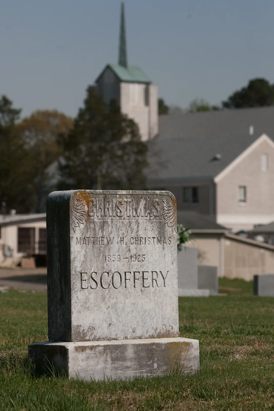
Beechwood Cemetery in Durham, North Carolina
Beechwood Cemetery in Durham is a cemetery (Elevation 101 m). Ⓦ.
- Land Use
- cemetery
Image
Streets nearby
Fayetteville RoadSunTrust, Bocci, Duke Urgent Care South, Fayetteville Rd at Sutton Station, Fayetteville Rd at Geneva Dr (SB), Fayetteville Rd at Woodcroft Pkwy (SB), Bua Thai, Dulce Cafe, Berea Church, Fayetteville Rd at Obie Dr (SB), Fayetteville Rd at Cook Rd (SB), Fayetteville Rd at Obie Dr (NB), Fayetteville Rd at Cook Rd (NB), Fayetteville Rd at Juliette Dr (SB), Fayetteville Rd at Juliette Dr (NB), Fayetteville Rd at Pearson Dr, Fayetteville Rd at Wortley Dr, Fayetteville Rd at Brian Center (NB), Fayetteville Rd at Laurel Springs Dr, T-Mobile, First Watch, Saint Josephs African Methodist Episcopal Church, Fayetteville St at Cecil St (NB), Fayetteville St at Cecil St (SB), Fayetteville St at Red Oak Ave (SB), Fayetteville St at Burlington Ave (SB), Fayetteville St at Red Oak Ave (NB), Fayetteville St at Burlington Ave (NB), Checkers, Let’s Eat Soul Food, Fayetteville St at Piedmont Ave (SB), KFC, Fayetteville Rd at United Dr, Fayetteville Rd at Turmeric Ln, Fayetteville Rd at Crooked Creek Pkwy, Walgreens, Fayetteville Rd at Woodcroft Pkwy (NB), Fayetteville Rd at MLK Pkwy (SB), Keene, Fayetteville Rd at Renaissance Pkwy, Fayetteville St at Pekoe St, Fayetteville St at Brant St (NB), Fayetteville St at Lawson St (NCCU), Fayetteville St at Lawson St (SB), Fayetteville St at Dunstan St, Fayetteville St at Price Ave, Fayetteville St at Simmons St, Fayetteville St at Linwood Ave, Fayetteville St at Dunbar St, Fayetteville St at Umsted St, Fayetteville St at Tralea Dr (SB), Fayetteville Rd at Timothy Ave (WG Pearson Elementary), Fayetteville Rd at Tralea Dr (Mt Zion Church), Fayetteville St at Timothy Ave (SB), Fayetteville Rd at Hillside High School, Fayetteville St at Cook Rd (Hillside HS), Fayetteville St at Piedmont Ave (NB), Southpoint Children's Campus, Fayetteville Rd at Herndon Rd, Fayetteville St at Riddle Rd (NB), Fayetteville Rd at MLK Pkwy (NB), Fayetteville St at Eagle Campus Dr, Fayetteville Rd at Brian Center (SB), Fayetteville Rd at Southpoint Crossing Dr (SB), Fayetteville Rd at Geneva Dr (Southpoint Glen Apts), Fayetteville Rd at Geneva Dr (NB), Fayetteville Rd at Torrey Pine Ln, Fayetteville St at Cornwallis Rd (NB), Fayetteville St at Cornwallis Rd (SB), Fayetteville St at Cook Rd (SB), Durham College, Fayetteville St at Pilot St (NB), Fayetteville St at Utah Ave, Fayetteville St at Pilot St (SB), Fayetteville St at Elmira Ave (Fayetteville Street Elementary), Fayetteville St at Homeland Ave (SB), Fayetteville St at Homeland Ave (NB), Fayetteville St at Riddle Rd (SB), Fayetteville St at Brant St (NCCU)
350 ft
East Cornwallis RoadCornwallis Rd at Spring Ridge Apt, Cornwallis Rd at Bainbridge Dr (NB), Cornwallis Rd at Century Oaks Dr (SB), Cornwallis Rd at Yorktown Ave (SB), Cornwallis Rd at Industry Ln, Cornwallis Rd at Bainbridge Dr (SB), Cornwallis Rd at Campus Crossings (NB), Cornwallis Rd at Campus Crossings (SB), Bell Yeager Freewill Baptist Church, Cornwallis Rd at Roxboro Rd, Kangaroo Express, Cornwallis Rd at Jan Ct, Cornwallis Rd at Weaver St, Cornwallis Rd at Beechwood Ave, Cornwallis Rd at Laurel Oaks Dr (SB), Cornwallis Rd at Fayetteville Rd, Cornwallis Rd at Laurel Oaks (NB), Cornwallis Rd at Yorktown Ave (NB)
550 ft
Timothy Avenue0.1 mi
Facade Street0.2 mi
Cornwallis Court0.2 mi
Mutual Drive0.2 mi
Mirando Place0.2 mi
Homeland Avenue0.2 mi
Trident Place0.2 mi
Arlington Street0.2 mi
Jan Court0.2 mi
Barton Street0.2 mi
Atlantic Street0.2 mi
Dauphine Place0.2 mi
Bonsell Place0.3 mi
Four Seasons Drive0.3 mi
Driftwood Drive0.3 mi
Tralea Drive0.3 mi
Dark Circle0.3 mi
Willowdale Drive0.4 mi
Tripoli Drive0.4 mi
Jamaica Place0.4 mi
West Weaver StreetWeaver St at Weaver St Park, E Weaver St at Cornwallis Rd
0.4 mi
Beechwood Drive0.4 mi
Kanewood Drive0.4 mi
Halsey Place0.5 mi
Springdale Drive0.5 mi
Habitat Lane0.5 mi
Cedarwood Drive0.5 mi
East Pilot Street0.5 mi
American Tobacco TrailWoodcroft Pkwy at Fayetteville Rd (EB), Roses, Highgate Dr at NC 54, State Employees Credit Union, Southpoint Pharmacy, The Melting Pot
0.5 mi
Jesmond Street0.5 mi
Puller Court0.5 mi
Degaulle Place0.5 mi
Wyeth Avenue0.5 mi
East Weaver StreetE Weaver St at Pilot St, E Weaver St at Jesmond St
0.6 mi
Sprucewood Drive0.6 mi
Barnhill Street0.6 mi
South Roxboro StreetShell, Banu Vegan, S Roxboro St at Cornwallis Rd, S Roxboro St at Chestnut St (NB), S Roxboro St at Chestnut St (SB), S Roxboro St at Dillard St, S Roxboro St at Normandy St, S Roxboro St at Masondale Ave, S Roxboro St at Erie St (CC Spaulding Elementary), S Roxboro St at Bond St, S Roxboro St at Dunstan Ave, S Roxboro St at Lodge St (Hillside Park), S Roxboro St at Lawson St (NB), S Roxboro St at Umstead St (NB), S Roxboro St at Umstead St (SB), S Roxboro St at Kroger, S Roxboro St at Summit St, Youth Life Foundation of the Triangle, S Roxboro St at The Life Center of Durham, S Roxboro St at Charles St
0.7 mi
Buildings nearby
Weaver Street Recreation Center0.5 mi
Clothing stores nearby
BullCity Apparel & Customs0.3 mi
Convenience stores nearby
Taj Food Shop0.6 mi
Parks nearby
Cook Road Park0.4 mi
Weaver Street Park0.5 mi
Places of worship nearby
Jamaat Ibad Ar-Rahman0.3 mi
Grace Church of Durham0.7 mi
Residential areas nearby
Cornwallis Road0.6 mi
Restaurants nearby
The Chicken Hut0.4 mi
Streams nearby
Third Fork Creek0.3 mi
| Year built | 1924 |
|---|---|
| Located in | Durham |
| Country | United States |
| Website | http://www.ci.durham.nc.us/departments/general/cemeteries.cfm |
 Public transit map Durham Legend
| Railway | |
| Bus | |
| Streetcar |
 Bicycle map Durham Legend
| Bike path | |
| Bike lane on roadway | |
| Cycling allowed on bus lane | |
| Bicycle street | |
| Open to cyclists | |
| Open to cyclists, good path | |
| Cycling prohibited | |
| Cobblestone |
| Long-distance bike route | (depending on scale) | |
| Long-distance bike route |
 Pedestrian map Durham Legend
| Path |
| Long-distance hiking trail | (depending on scale) | |
| Long-distance hiking trail | ||
| Pedestrians prohibited |