
East Villard Street in Dickinson, North Dakota
East Villard Street in Dickinson is a three-lane, asphalted main road (Road number I 94 Business). It runs in an east-west direction starting from West Villard Street and crosses Sims Street, 1st Avenue East, 2nd Avenue East, 3rd Avenue East, 4th Avenue East, 5th Avenue East, A Avenue East, 6th Avenue East, 9th Avenue Southeast, B Avenue East and 7th Avenue East. It ends in a cul-de-sac. This street is part of the highway "94". Nearby you can find a fast food restaurant and a restaurant.
- Road Type
- main road
- Lanes
- 3
- Route
- east-west
Image
Streets nearby
2nd Street EastGate City Bank
0.1 mi
2nd Avenue East0.2 mi
East Broadway Street0.2 mi
1st Avenue EastAffinity on First
0.2 mi
Sims StreetRedeemer Lutheran Church, Holiday Inn Express, Candlewood Suites
0.2 mi
4th Avenue Southeast0.2 mi
East 3rd Street0.2 mi
West Villard StreetDickinson, Hardee's, Dakota Community Bank and Trust, Brickhouse Grill, JP FrameShop & Western Edge Gallery, A2Z Crafts & Antiques, The Sweet Melange, Paw & Claw Pet Palace, ESP Computer & Software, Just Kuts, Salt of the Earth, Blue 42 Sports Grille & Bar, BMO, Battle Bunker, Woody's Feed & Grain, Subway, Custom Endodontics, Domino's, Serene Therapy Massage, Pop's Soda Shack, M & H, Bank of Dacotah, Thrifty White Pharmacy, Able Thrift Center, Spur Bar, 1026 Oasis Inn, On the Run
0.2 mi
5th Avenue Southeast0.2 mi
4th Avenue East0.2 mi
3rd Avenue Southeast0.2 mi
1st Avenue WestLemongrass, Kirkwood Bank and Trust, Bravera Bank
0.2 mi
1st Street WestKinderkitz, The Hive, Ichiban Ramen, Stevenson Funeral Home, Doller General, Charbonneau Chrysler Center, Charbonneau Car Center, Academy of Dance, Bible Baptist Chuch of Dickinson, Heiser Motors
0.2 mi
3rd Avenue East0.2 mi
Southeast 1st Street0.3 mi
2nd Avenue Southeast0.3 mi
1st Street East0.3 mi
West 3rd StreetMiracle-Ear, TS Therapeutic Massage, Dickinson Area Public Library
0.3 mi
5th Avenue East0.3 mi
East 4th Street0.3 mi
2nd Avenue Westde Porres House of Barbering, Dickinson Fire Station 1, Kinderkidz Learning Center
0.3 mi
South 3rd Avenue West0.3 mi
West 2nd StreetU.S. Bank, Saint Patricks Roman Catholic Church
0.3 mi
3rd Avenue WestSimonson Station Stores
0.3 mi
A Avenue East0.3 mi
Main Avenue0.3 mi
Belmont Street0.3 mi
Colfax Street0.3 mi
9th Avenue Southeast0.3 mi
2nd Street Southeast0.4 mi
1st Avenue Southeast0.4 mi
Apartment buildings nearby
Lily Pad Apartments0.1 mi
Park Place0.3 mi
Buildings nearby
Kubik Bogner Ridl & Selinger Law Office0.1 mi
Schwartz Offices0.2 mi
Saint Wenceslaus Parish Office0.3 mi
Commercial buildings nearby
Sax Customs0.3 mi
Convenience stores nearby
The Hub0.3 mi
Courthouses nearby
Stark County Courthouse0.2 mi
Dams nearby
East Broadway Dam0.2 mi
Gas stations nearby
Mobil0.2 mi
Office buildings nearby
Life Building0.3 mi
Parks nearby
Jaycee Park0.3 mi
Places of worship nearby
Saint Johns Episcopal Church0.2 mi
Saint Josephs Roman Catholic Church0.2 mi
Post offices nearby
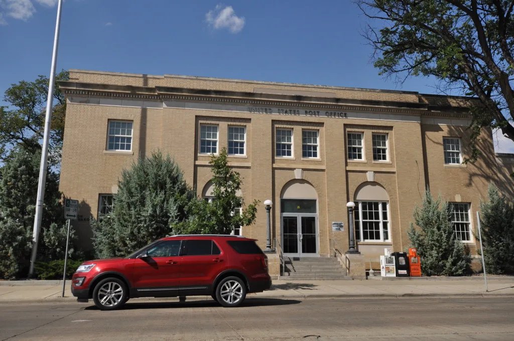
Dickinson Post Office0.1 mi
Railways nearby
BNSF Dickinson Subdivision0.2 mi
Stadiums nearby
Dakota Community Bank & Trust Ballpark0.4 mi
Other nearby
Broadway Substation0.2 mi
Public transit map Dickinson Legend
| Railway | |
| Bus | |
| Streetcar |
Bicycle map Dickinson Legend
| Bike path | |
| Bike lane on roadway | |
| Cycling allowed on bus lane | |
| Bicycle street | |
| Open to cyclists | |
| Open to cyclists, good path | |
| Cycling prohibited | |
| Cobblestone |
| Long-distance bike route | (depending on scale) | |
| Long-distance bike route |
Pedestrian map Dickinson Legend
| Path |
| Long-distance hiking trail | (depending on scale) | |
| Long-distance hiking trail | ||
| Pedestrians prohibited |