
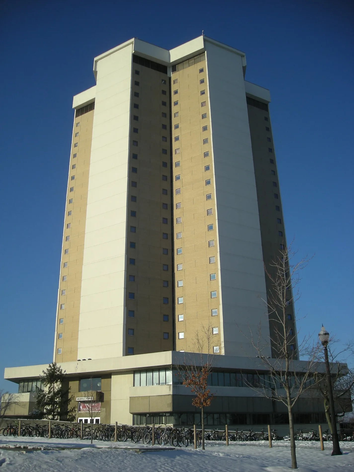
Lincoln Tower in Columbus, Ohio
Lincoln Tower in Columbus is a dormitory, Cannon Drive 1800 (43210). Ⓦ.
- House Number
- 1800
- Postal Code
- 43210
- Street
- Cannon Drive
- Building Type
- dormitory
Image
Cafes
Libraries
ATMs
Pharmacies
Dentist offices
Bus stops
Places of worship
Music schools
Artworks
Convenience stores
Restaurants
Bike shops
Fast food restaurants
Veterinary clinics
Streets nearby
Olentangy River RoadMount Air, 2200 Olentangy River Rd, Olentangy River Rd & W Lane Ave, Olentangy River Rd & Riverview Rd, Olentangy River Rd & Olde Towne Ave, Olentangy River Rd & Bethel Rd, 3420 Olentangy River Rd, 3368 Olentangy River Rd, 2825 Olentangy River Rd, Olentangy River Rd & Dodridge St, Olentangy River Rd & Argyll St, 3440 Olentangy River Rd, Olentangy River Rd & Union Cemetery, Olentangy River Rd & Ackerman Rd, 315 North, Olentangy River Rd & Harley Dr, Cap City Fine Diner & Bar, Olentangy Medical Center, Riverview Health & Rehabilitation Center, Friendship Community Church, Havener Eye and Ear Clinic, Olentangy River Rd & Burnbrae Ave, Woody Hayes Athletic Center
0.2 mi
Cannon DriveTraditions at Morrill, Morrill C-Store, Mid Towers (Northbound), Mid Towers (Southbound)
0.2 mi
West 12th AvenueOhio Union Reliefs, W 12th Ave & N High St, 12th Avenue Bread Company, Traditions at Kennedy, Alpha Phi Alpha Obelisk, Alpha Kappa Alpha Obelisk, Doan Hall, Harding Hospital, The Campus Grind - Drinko, Ohio State University Greyhound Stop, Celebration of Arts, Pathways of Courage, Gnomon, W 12th Ave & College Rd S, Ohio State Dental Clinics, Dr. Willoughby Dayton Miller, FlixBus Columbus (Ohio State University)
0.2 mi
Upham DriveDr. Samuel Mitchel Smith and Sons Memorial Fountain
0.3 mi
Kinnear Road1218 Kinnear Rd, 1197 Kinnear Rd
0.3 mi
Coffey Road0.3 mi
John H Herrick DrivePenultimate Curving Pavilion, Brenen’s Cafe, Biological Sciences and Pharmacy Library, Herrick Drive Transit Hub
0.3 mi
West 10th AvenueMarketplace on Neil, Marketplace C-Store, Marketplace Coffee Shop, 10th Avenue & Meiling Hall, The James Cancer Hospital, First Watch
0.3 mi
Olentangy TrailCoyle Memorial Bench
0.3 mi
Vernon L Tharp Street0.3 mi
Olentangy Freeway0.4 mi
Globe Street0.4 mi
Shops nearby
Sally Beauty0.4 mi
Bookstores nearby
Barnes & Noble0.4 mi
Buildings nearby
Women's Field House350 ft
South Campus Central Chiller Plant0.1 mi
Coffey Rd Recreation Complex0.3 mi
Goss Laboratory0.3 mi
Buildings under construction nearby
University Hospital0.3 mi
Clothing stores nearby
Men's Wearhouse0.3 mi
Old Navy0.4 mi
Cosmetics stores nearby
Sephora0.3 mi
Bath & Body Works0.3 mi
Department stores nearby
Target0.4 mi
Dormitories nearby
Morrill Tower0.1 mi
Hospitals nearby
Harding Hospital0.2 mi
James Cancer Hospital and Solove Research Institute0.3 mi
Movie theaters nearby
Phoenix Theatres0.3 mi
Parks nearby
Buckeye Grove400 ft
Railways nearby
CSX Columbus Subdivision0.4 mi
Restaurants nearby
Bravo0.2 mi
The Capital Grille0.3 mi
Retail areas nearby
Lennox Town Center0.3 mi
Rivers nearby
Olentangy River0.3 mi
Sports fields nearby
Lincoln Tower Park0.1 mi
Lincoln Turf Field0.2 mi
Stationery stores nearby
Staples0.4 mi
Streams nearby
Neil Run0.2 mi
University buildings nearby
Riffe Building0.2 mi
Parks Hall0.2 mi
Sisson Hall0.2 mi
Biological Science Building0.2 mi
Biomedical Research Tower0.2 mi
Davis Heart and Lung Research Institute0.2 mi
Tzagournis Medical Research Facility0.2 mi
Veterinary Medicine Academic Building0.3 mi
McCampbell Hall0.3 mi
Veterinary clinics nearby
Frank Stanton Veterinary Spectrum of Care Clinic0.3 mi
OSU Veterinary Medical Center0.3 mi
| Year built | 1967 |
|---|---|
| Commissioned by | Ohio State University |
| Owned by | Ohio State University |
| Located in | Ohio |
| Country | United States |
| Website | http://www.osu.edu/map/building.php?building=271 |
 Public transit map Columbus Legend
| Railway | |
| Bus | |
| Streetcar |
 Bicycle map Columbus Legend
| Bike path | |
| Bike lane on roadway | |
| Cycling allowed on bus lane | |
| Bicycle street | |
| Open to cyclists | |
| Open to cyclists, good path | |
| Cycling prohibited | |
| Cobblestone |
| Long-distance bike route | (depending on scale) | |
| Long-distance bike route |
 Pedestrian map Columbus Legend
| Path |
| Long-distance hiking trail | (depending on scale) | |
| Long-distance hiking trail | ||
| Pedestrians prohibited |